|
|
Post by OnlyMark on May 6, 2021 13:33:01 GMT 2
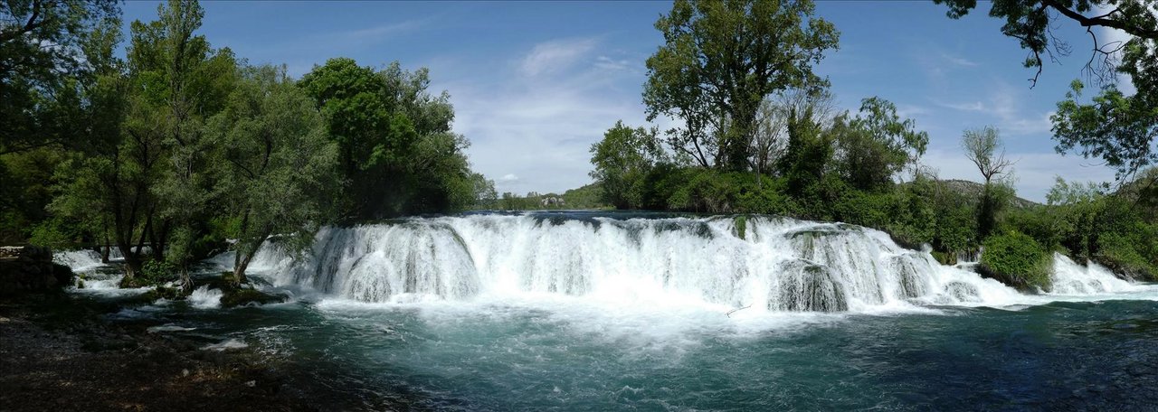
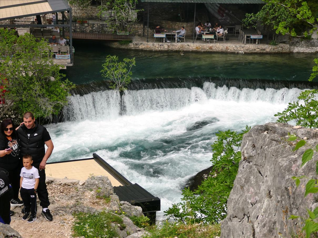
The weather was forecast to be good, more or less, so we decided to slip out of the capital for a couple of days. You can see in the title there is just one lunch, for the two days. But we had a picnic for the first one. As it was just one trip I’ll start at the beginning but then add on in order the places we visited. So you’ll have to wait for the next part to come up, but it will as soon as I’ve done it. The area we drove to was the south of Mostar, which is to the south of Sarajevo and not too far from the Croatia border. We stayed three nights at a self-catering chalet in Medugorje, the town being a pilgrimage site and thus had plenty of accommodation – though it was all 90% empty anyway. But we wanted to do our own food so we weren’t beholden to restaurant eating. The first day we drove down sort of after work, had two days exploring and on the fourth day drove early back so I could get a covid test to fly to Germany with. Our first stop was at – “Kravica Waterfall (Serbo-Croatian: Slap Kravica or Vodopad Kravica / Слап Кравица or Водопад Кравица)” This is on the Trebižat River – in technical terms it’s called a Tufa Cascade in a large karst area of Herzogovina. It’s about 25m high with a 120m circular lake at its base. Very, very popular in the summer and has swimming, camping and a couple of restaurants. We parked above it and walked down. There is a long set of steps, which we came back up, but also a small road/track we walked down initially to get sights of the waterfall. It started coming in to view – 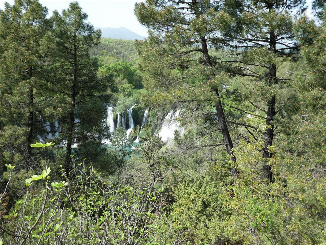 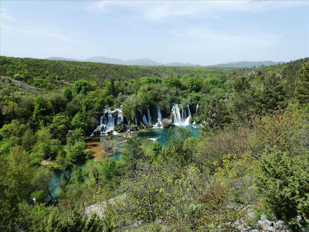 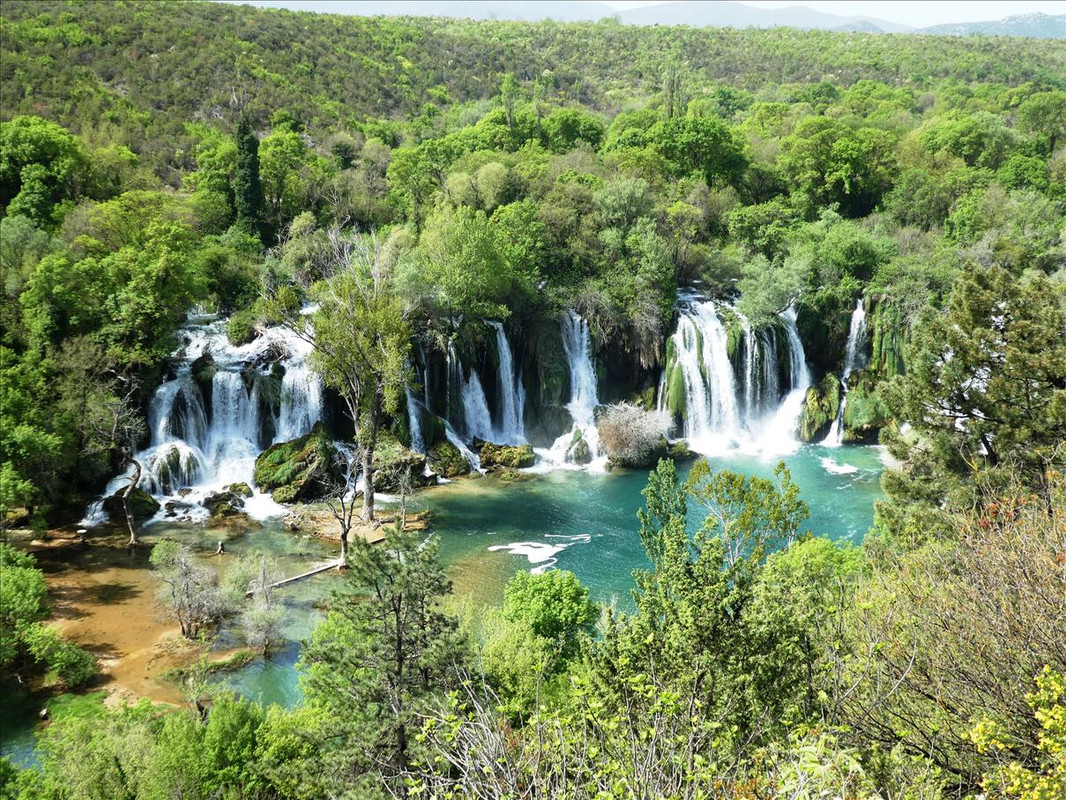 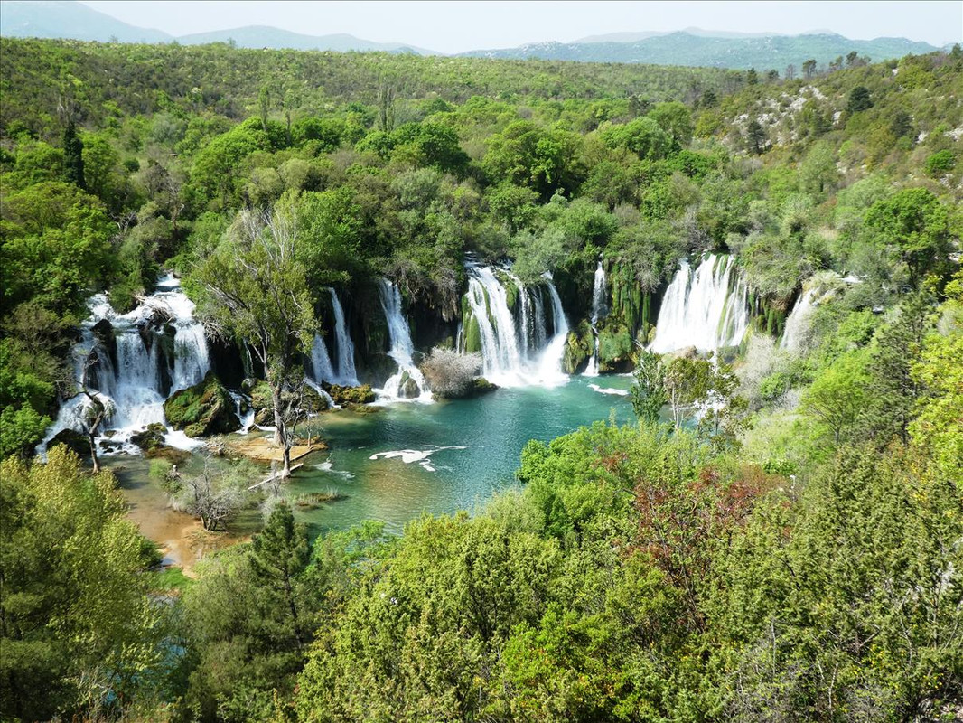 Nice walk through the woods to get to it – 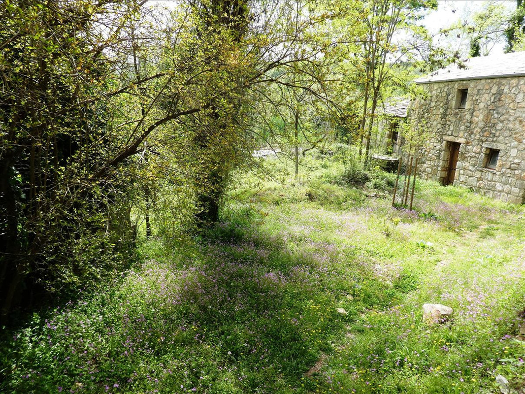 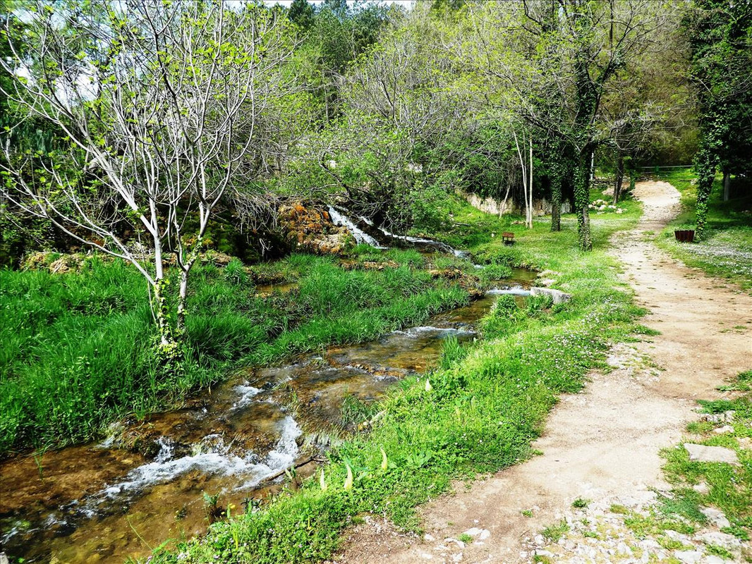 Closer – 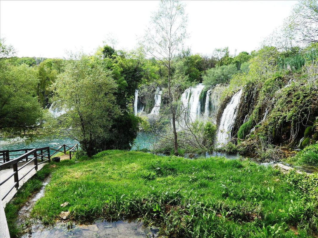 And then there – 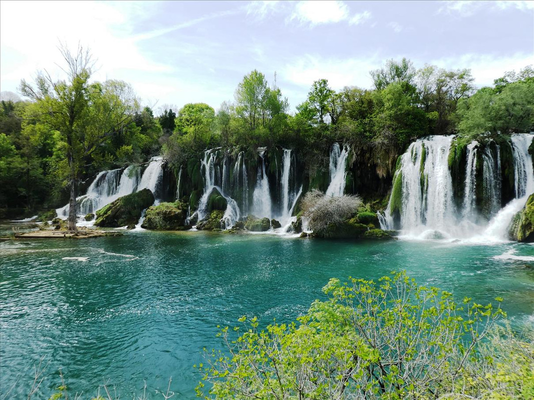 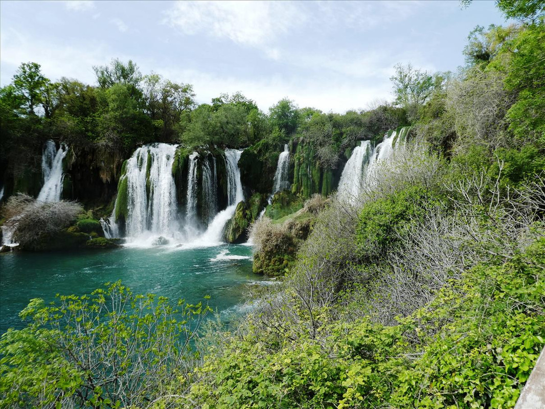 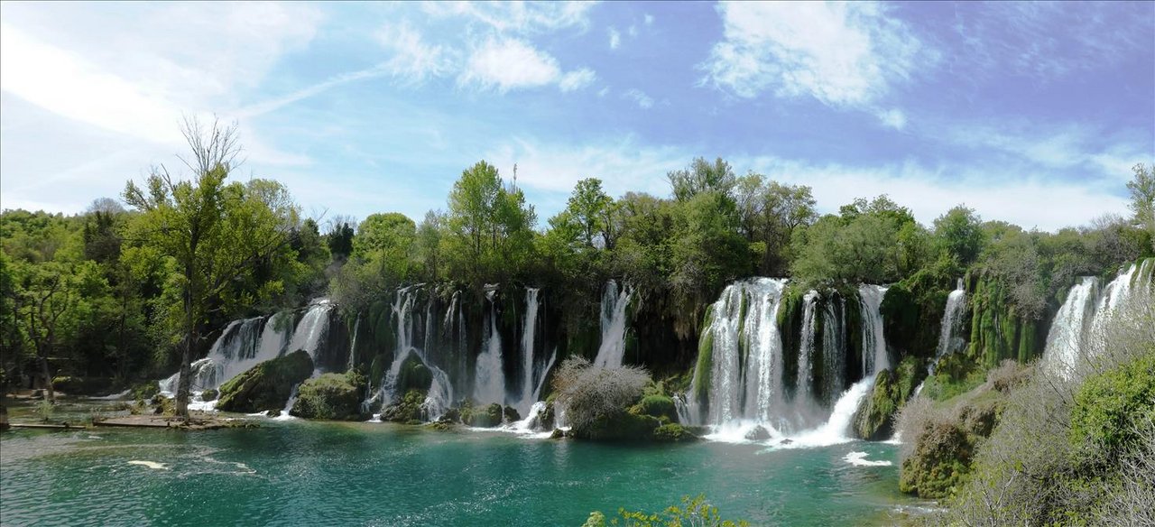   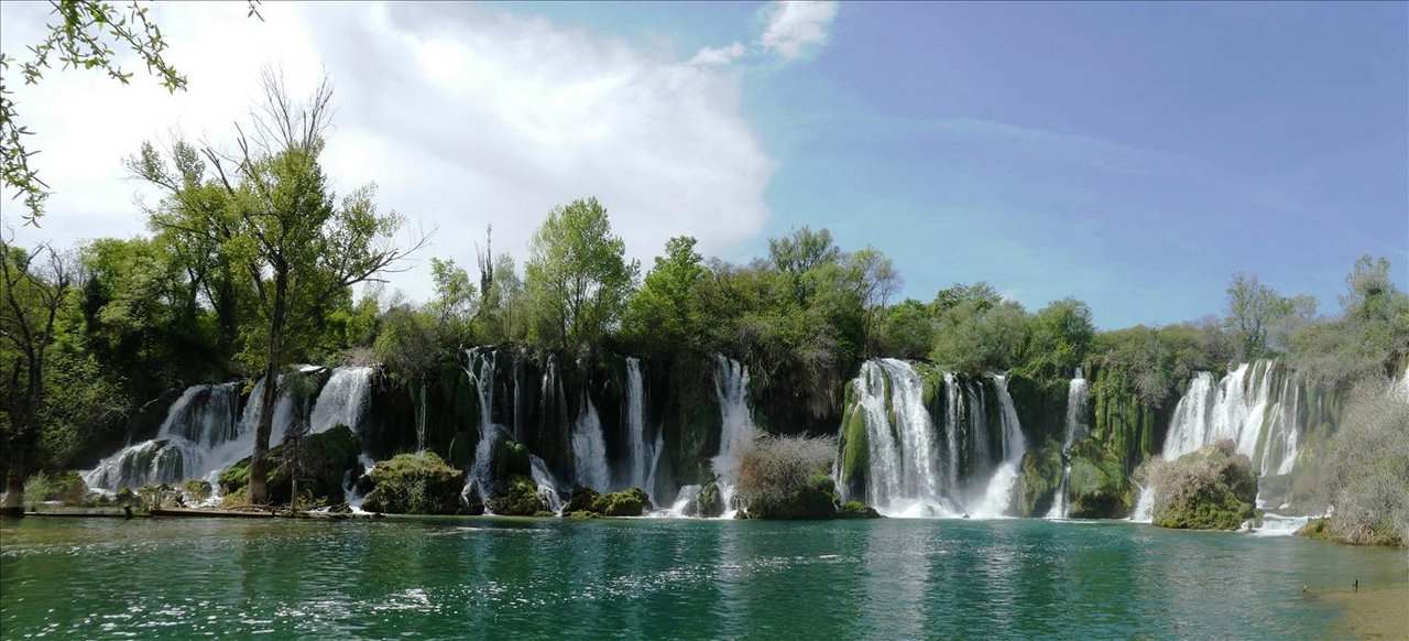  We sat at the cafe and had a drink then moved further down river as there was a little track. We knew that 10km or so further down was another but smaller cascade, but we weren’t planning on walking all the way there and then back again, so we went a km or so and returned – 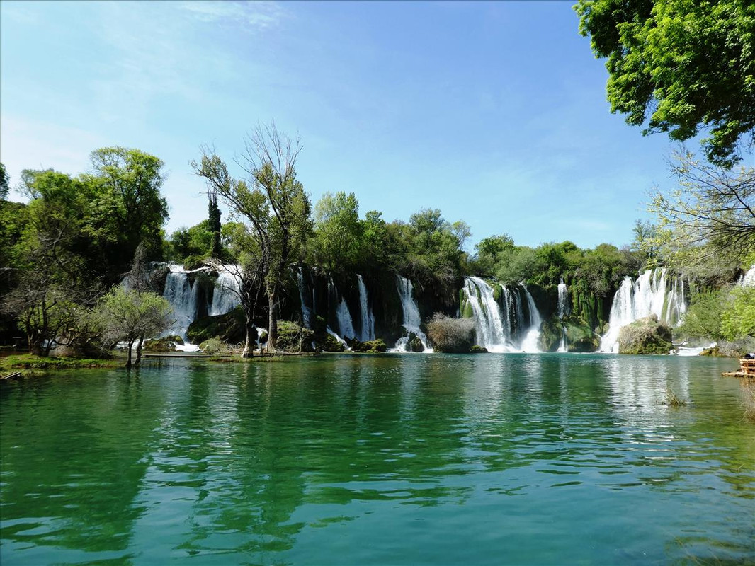   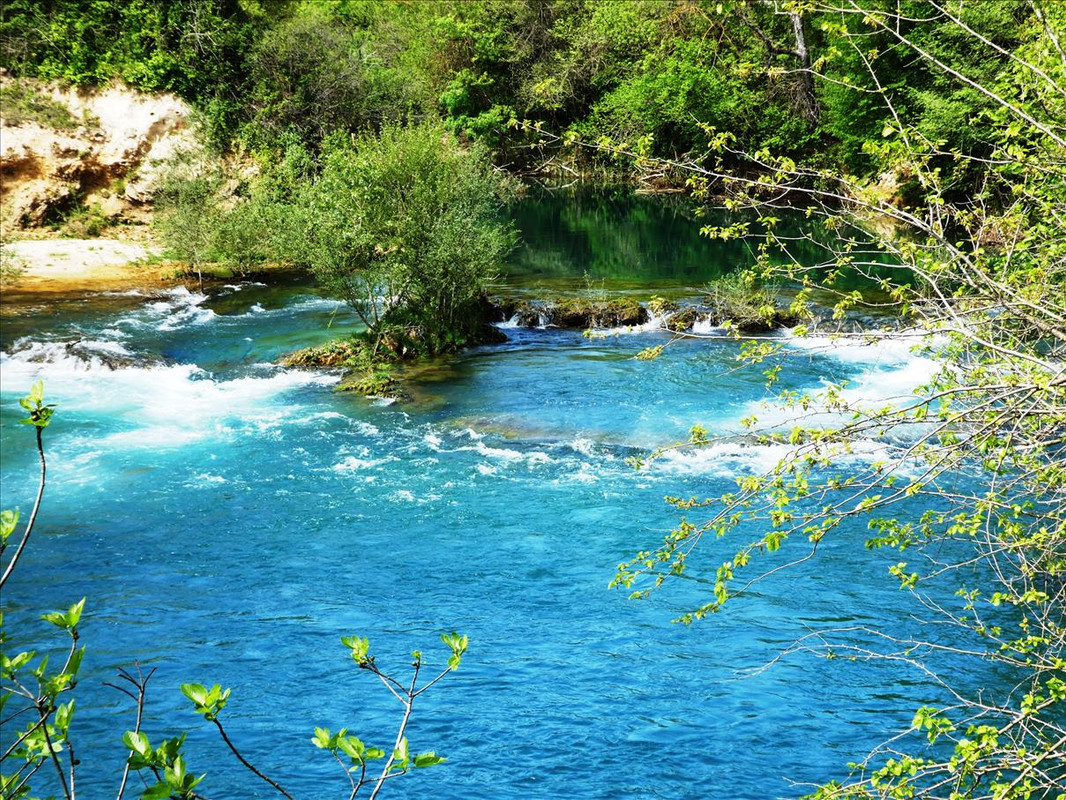 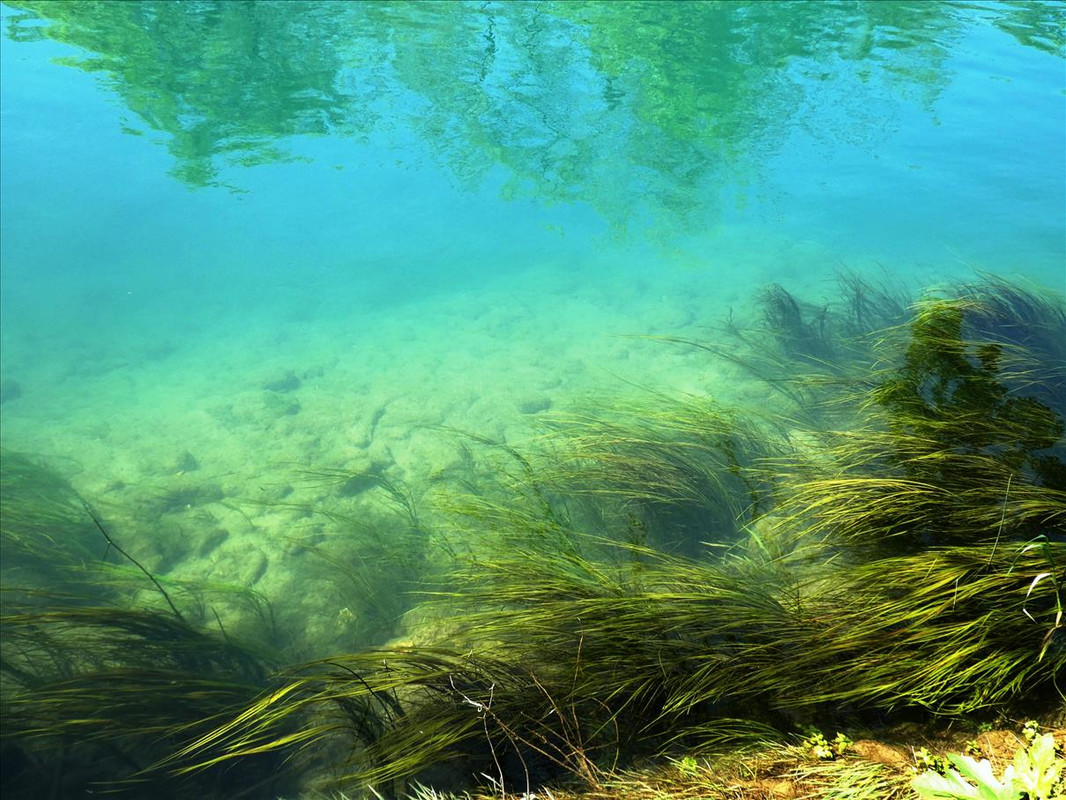  A good start to the morning, sun shining, warm and agreeably deserted. |
|
|
|
Post by auntieannie on May 6, 2021 14:29:52 GMT 2
paradise-like. I feel my cells rejuvenating just looking at the pictures.
|
|
|
|
Post by sophie on May 6, 2021 14:50:50 GMT 2
Gorgeous! Makes me want to go for a swim..
|
|
|
|
Post by OnlyMark on May 6, 2021 15:07:37 GMT 2
Freezing cold sophie. But go ahead.
|
|
|
|
Post by kuskiwi on May 7, 2021 6:30:54 GMT 2
There's something special about waterfalls that makes the heart sing and the ears ring. It's such a pretty area. Looking forward to "joining" you on more adventures. So pleased you are both fit and able to do all these things and report on them for an armchair traveller.
|
|
|
|
Post by OnlyMark on May 7, 2021 7:08:14 GMT 2
You're welcome.
|
|
|
|
Post by OnlyMark on May 7, 2021 7:10:33 GMT 2
First, let’s mention Stjepan Vukčić Kosača. Born 1404 and died 1466 he lived through the reign of three kings of Bosnia and was of a noble family. At one point he disputed the line of accession of one off the kings and set off a civil war. Probably the most influential fellow in the medieval Bosnian area. He had over time contact with the Venetians and the invading Ottomans and to say his life, his alliances, marriages and wheeling and dealings were complex is an understatement. “.......he took the opportunity to take a title of herzog, styling himself in 1448 Herzog of Hum and Duke of Primorje, Bosnian Grand Duke, Knyaz of Drina and the rest, and two years later changed it to Herzog of Saint Sava, Lord of Hum and Bosnian Grand Duke, Knyaz of Drina and the rest, and while reaching for assistance, he aligned himself first with the Ottoman Empire, then Aragon and again the Ottoman Empire.” Herzog roughly translates as Duke or Grand Duke – but the point is, due to him Herzegovina has the name it has, which is where we are. en.wikipedia.org/wiki/Stjepan_Vuk%C4%8Di%C4%87_Kosa%C4%8DaHe built a couple of fortresses to live in, in the area, and we visited the ruins of one of them near a town called Ljubuški. Built about 400m above sea level it had a commanding presence and, as needed by a stronghold, good views across the surroundings. A fortification was known on this site previously but he built it up to be quite formidable. The Ottomans added even further to it in around 1766 but the whole thing was abandoned in 1835 when the site and the building became unnecessary. “The fortress complex consists of two parts. The central square square, called "Herceguša", built in the late 14th or early 15th century and the perimeter wall in the shape of an irregular polygon with massive towers, built in the beginning of the Ottoman period after 1472.” We had a walk up to and around it in the welcome sunshine. There were also some nice scenic stone buildings on the path up – 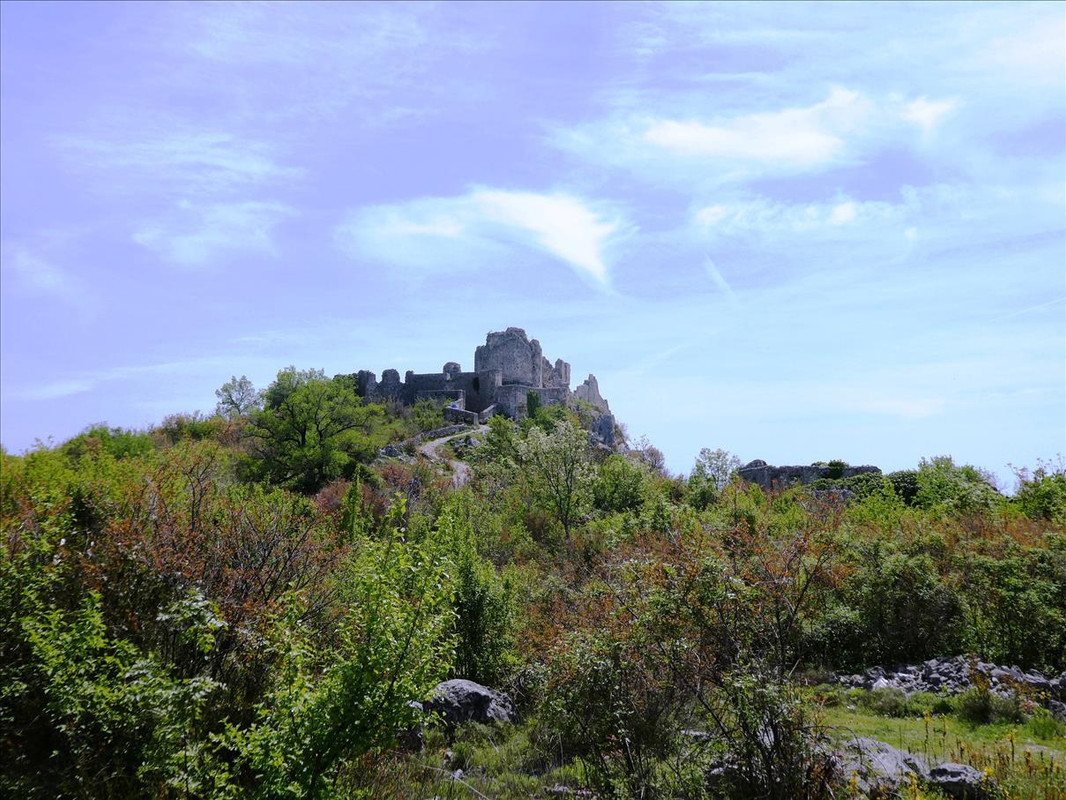  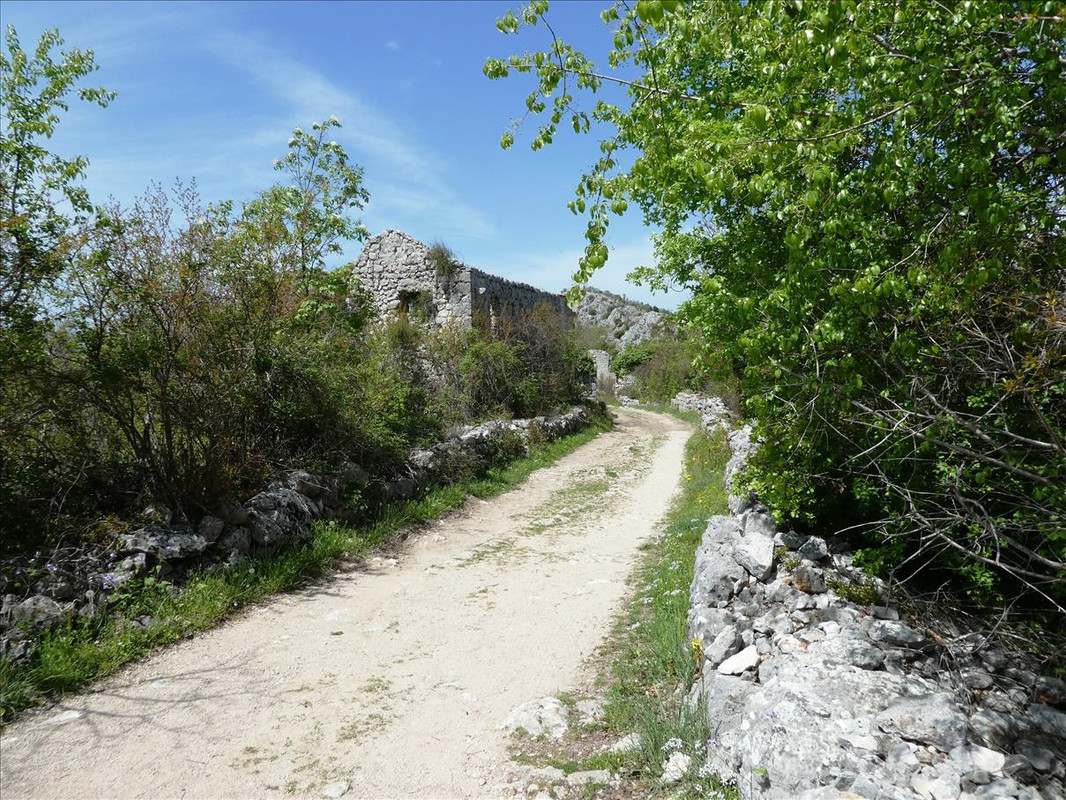 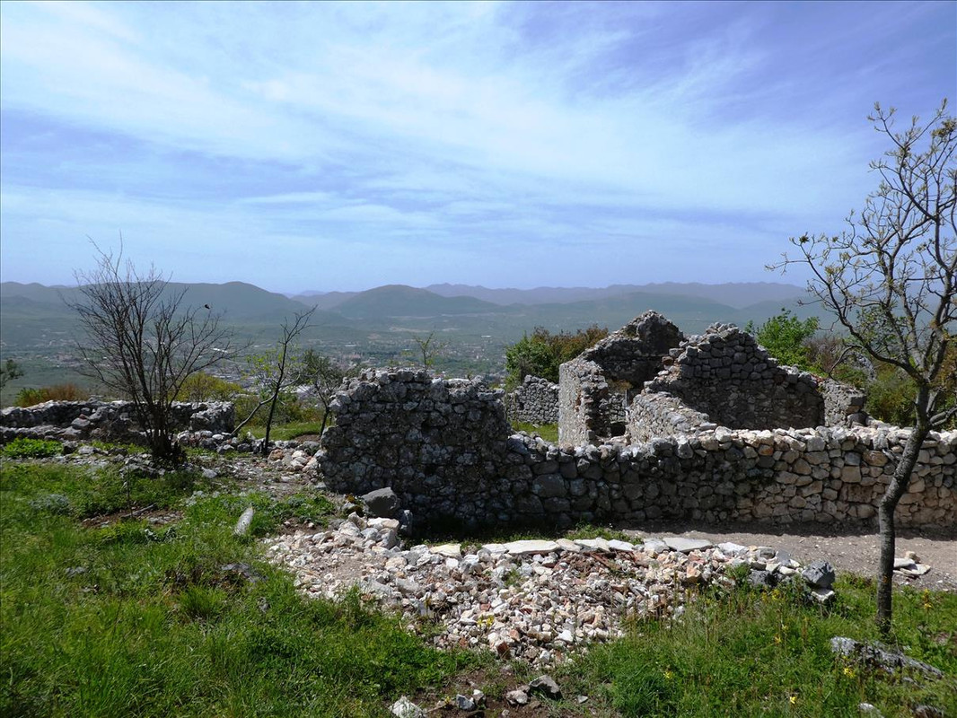 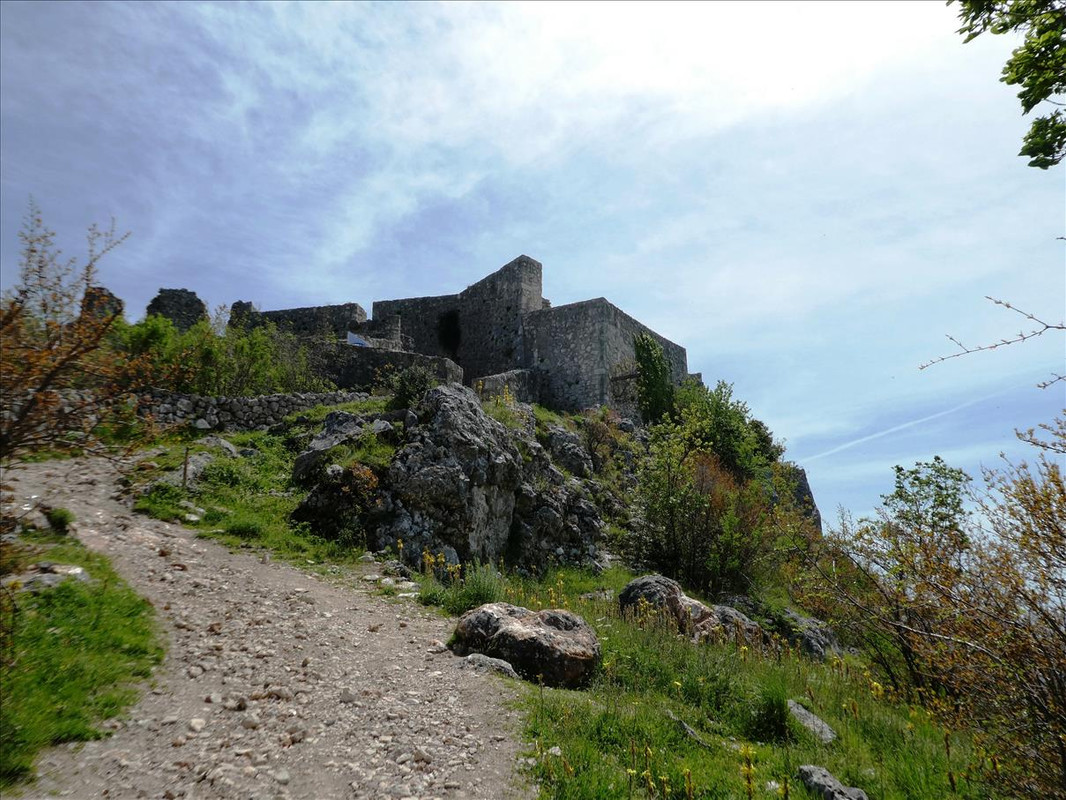 Notice how the scenery has changed in this area – 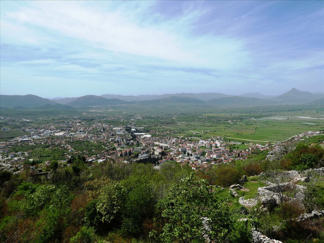 Coming in to the fortress proper –  Typical zig zag route for a castle/fortress etc to get to the main entrance - 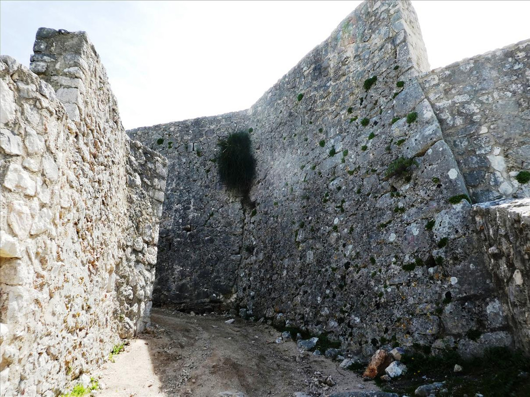 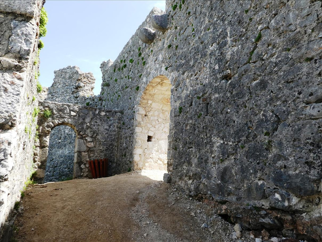  The old cistern – 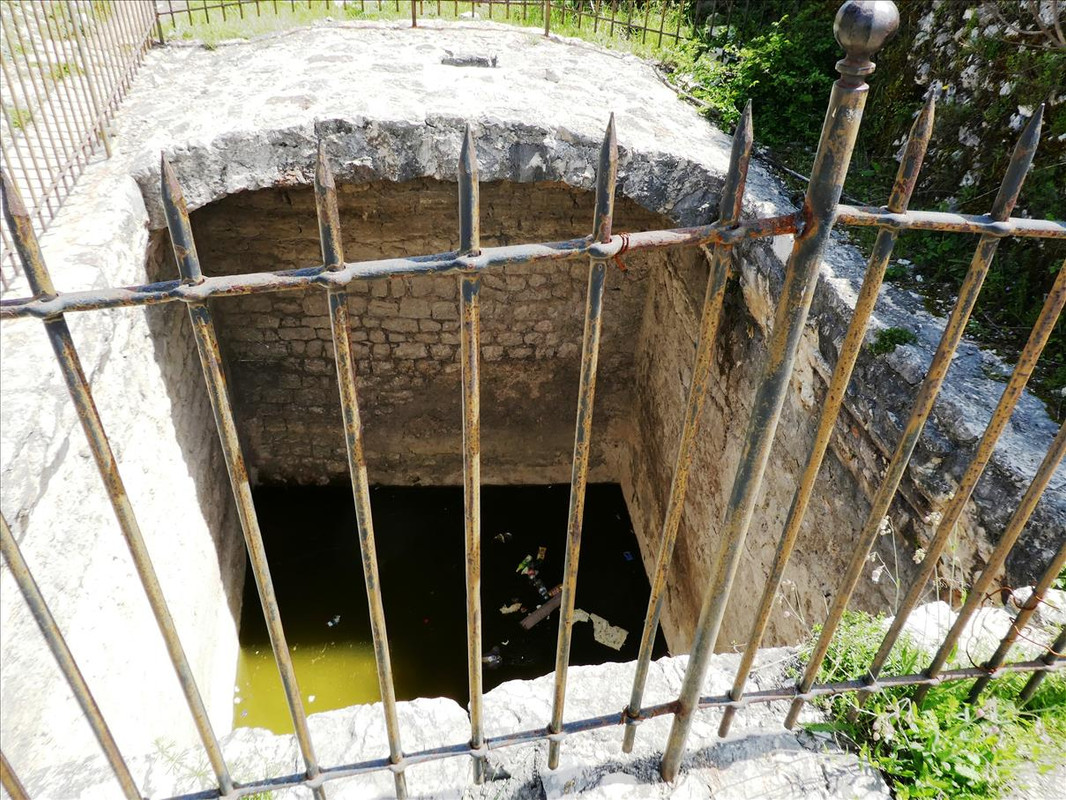 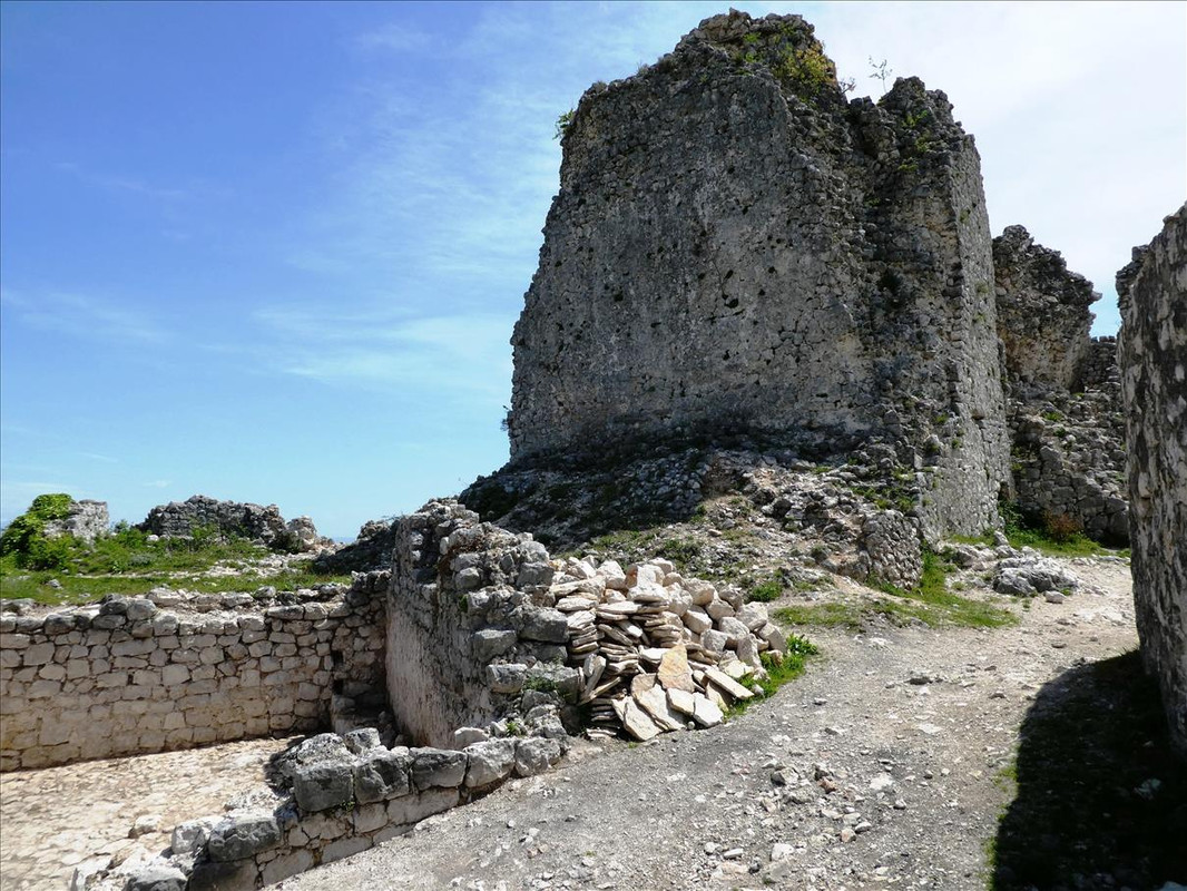 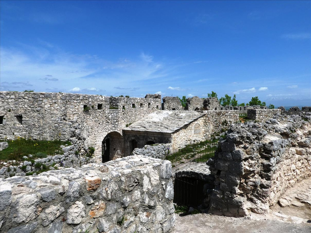 Looking down on where we walked through – 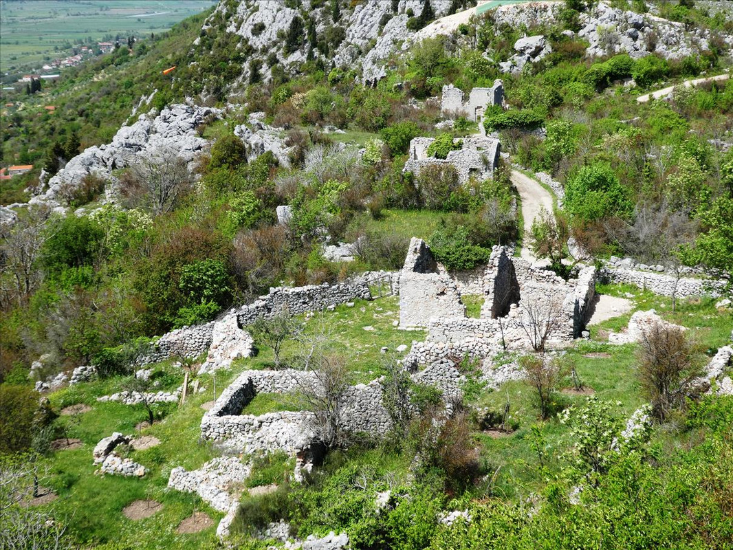 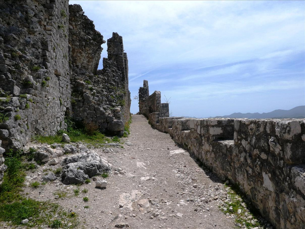  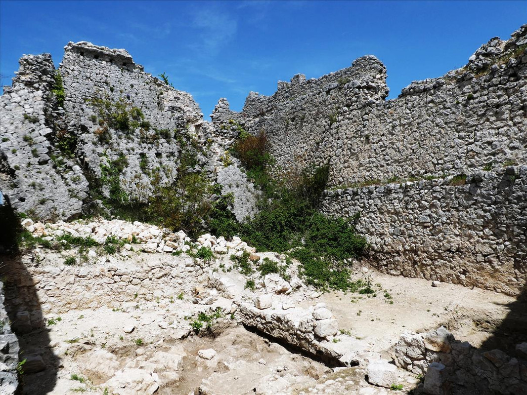 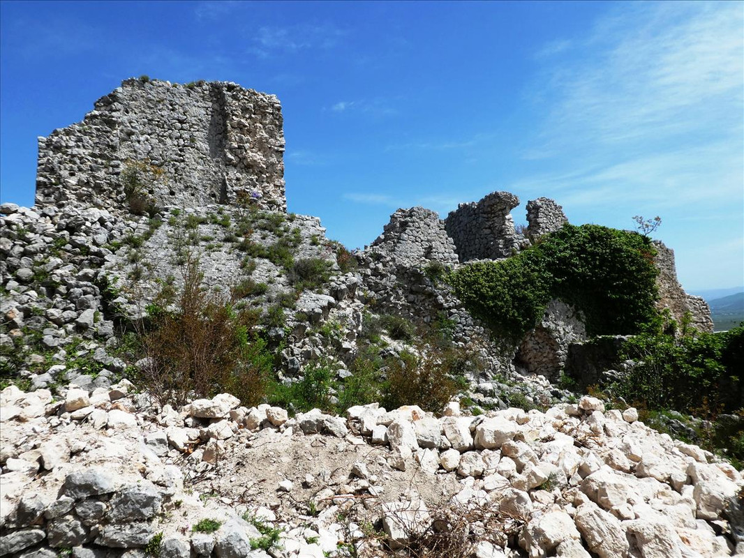  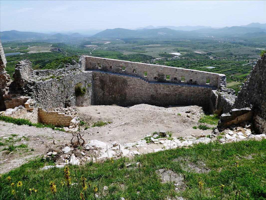 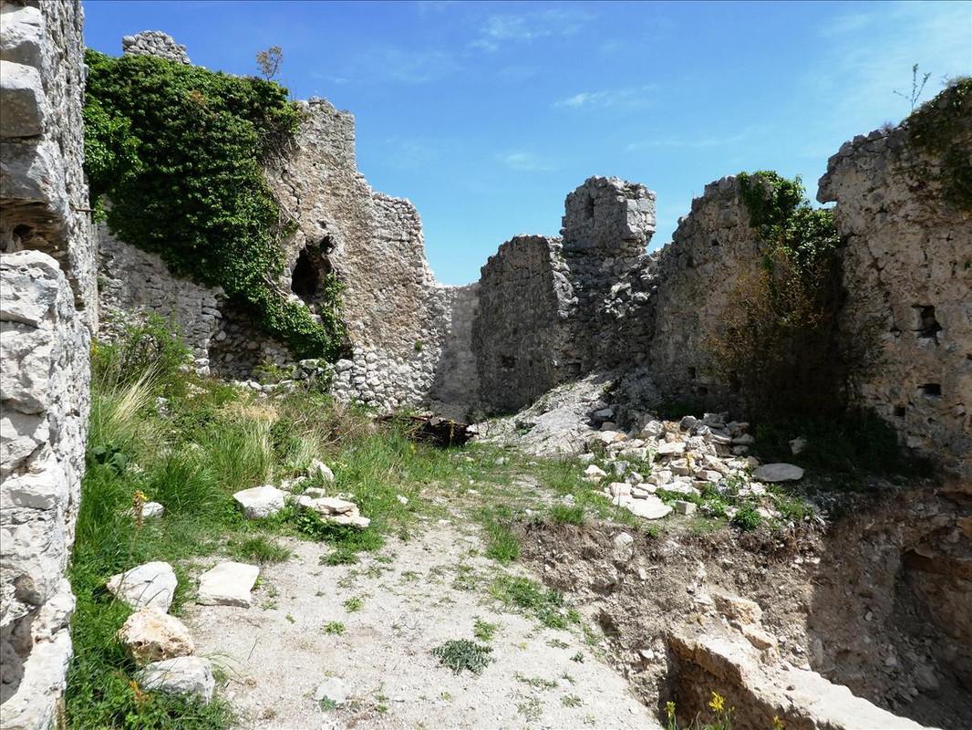 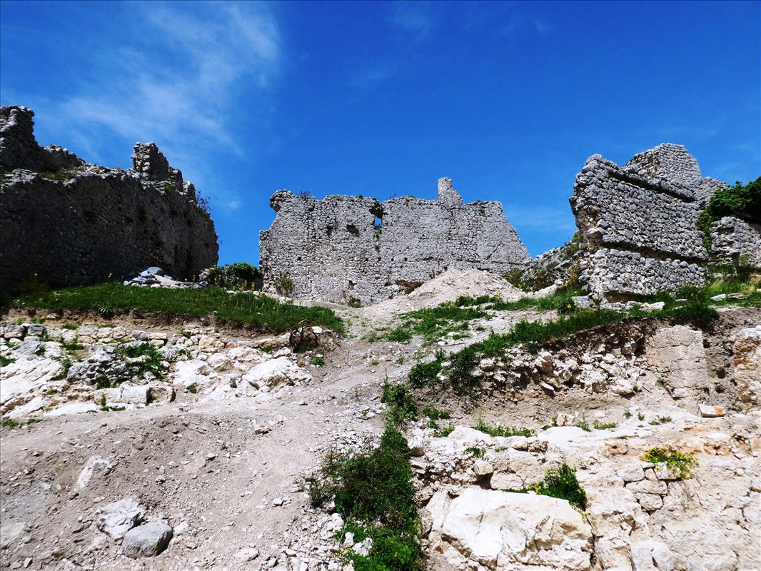 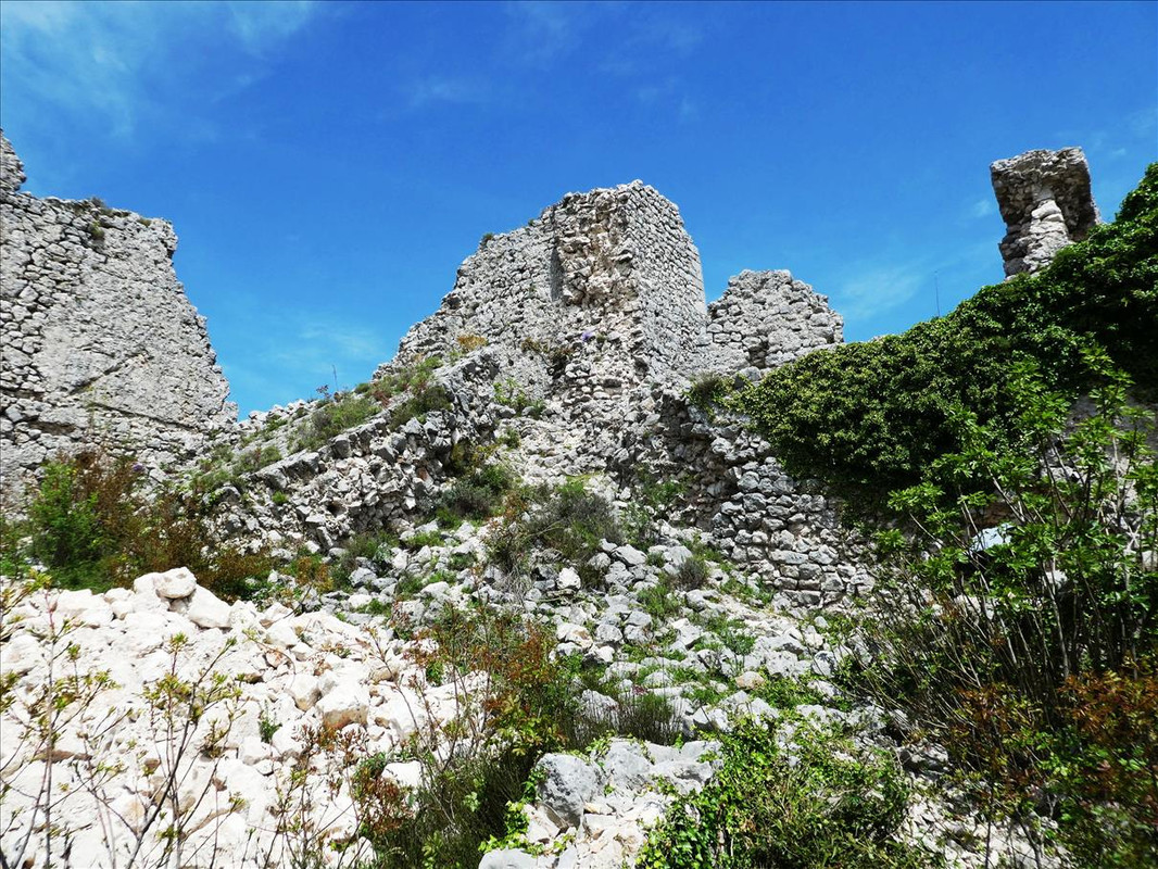 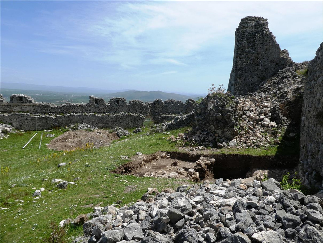 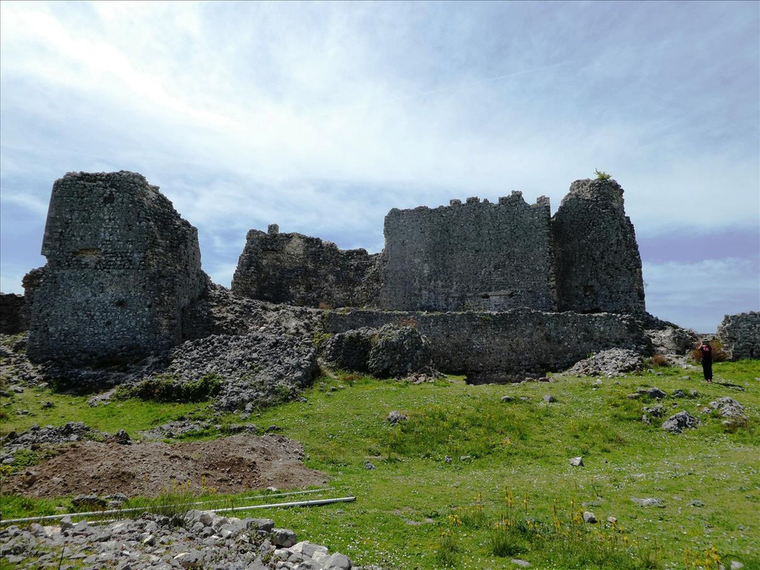 Good outlook over the surrounding countryside – 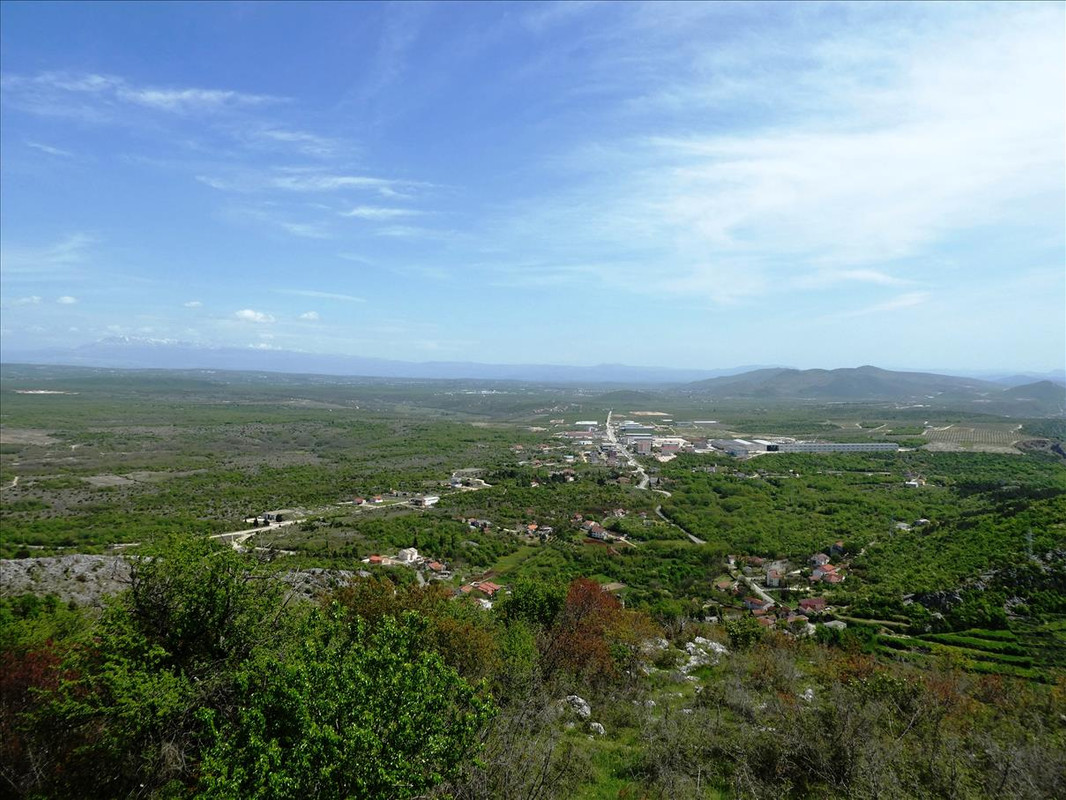  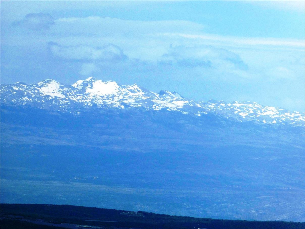 We plonked ourselves down on a convenient rock and took in the views whilst having a flask of coffee, cheese and onion sandwiches for me, salami for Mrs M, a packet of chilli flavoured crisps and a Granny Smith’s apple. Then we moved on. |
|
|
|
Post by Netsuke on May 7, 2021 12:12:44 GMT 2
I was there with the waterfalls, imagining the surroundings and I could smell the water. It reminds me of a series of waterfalls I visited several years ago. There is nothing qu.items thrilling or tingling as hearing the tinkle of water in the distance, you know it is there, you can hear it in places as you make your way there.
Thank you Mark for these many images, they bring back memories. The colour of the water is beautiful. Looking forward to seeing more of your trip.
|
|
|
|
Post by OnlyMark on May 7, 2021 14:22:56 GMT 2
Coming soon.
|
|
|
|
Post by Voy on May 7, 2021 15:27:55 GMT 2
now THAT is a castle ! thank you !
|
|
|
|
Post by OnlyMark on May 8, 2021 10:51:42 GMT 2
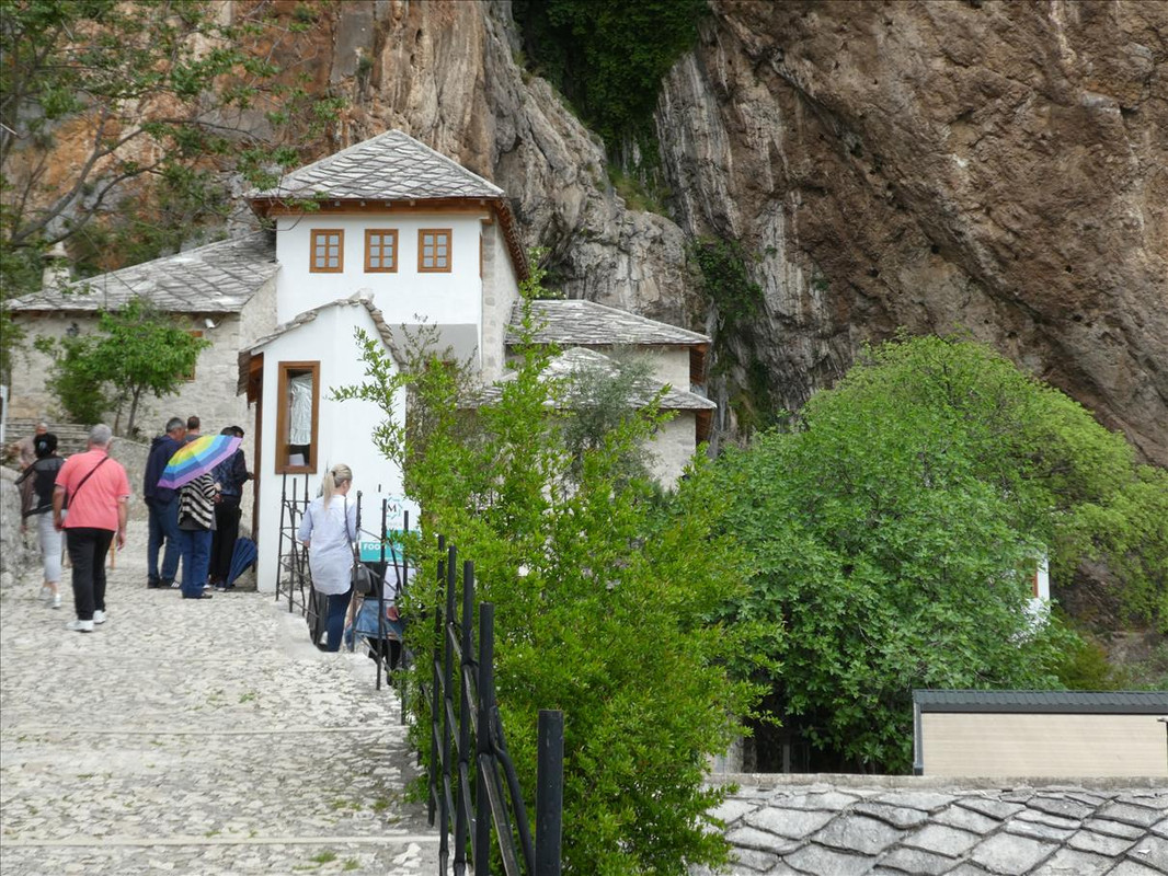
One of those strange days where it couldn’t decide if it wanted to be sunny or cloudy, or both at the same time. Nevertheless, as it wasn’t raining, but forecast to do so, we set off to a village called Počitelj. We knew it’d be a time of up and down steps as it’s built on a hill in the form of a natural amphitheatre, but I was somewhat upset to start having a twingy knee. The signs of older age and an abused body are catching up with me. As with a lot of places in the country, this village has a varied history. It’s believed a village has been here since about 1383, but the first recorded reference isn’t until 1444. The first relevant period to its history is between 1463 and 1471 when the area was ruled by the Hungarian King Matthias Corvinus It was during this time the village became strategically important due to its position in the valley of the River Neretva. In 1471 it was occupied by the Ottoman Empire and various public buildings were erected, such as the mosques, an imaret (soup kitchen), maktab/madrasa (schools), hamam (Turkish bath), han (caravanserai) and a clock tower (a tower with a clock). The Venetians invaded and destroyed a town called Gabela (from the Arabic word for ‘tax’) not far away along the same river around 1698 and Počitelj became strategically important again after a settled period. Note regarding the town of Gabela - up to the end of the 12th century it was called Drijevo and rapidly became a port for slave trading sanctioned by law (complicated, but blame Dubrovnik). “In the 14th century the Bosnian kings began to implement forceful measures against this "trade in human flesh on the Neretva" and under pressure from them in 1400 the Dubrovnik Senate banned the trade in human lives, and the transport of slaves in Ragusan ships in 1416 under the threat of six months imprisonment in the underground dungeons in Dubrovnik.” (Ragusa - "The Republic of Ragusa was an aristocratic maritime republic centered on the city of Dubrovnik.") For more info on slavery in the area peruse the following but the first page or so is worth reading. It’s amazing what new things can be found. I had heard a little of this subject in the past in the Dalmatian area from my mother in law, but never followed it through – www.persee.fr/doc/mefr_1123-9883_2000_num_112_2_9067Back to the village in hand - after the establishment of Austro-Hungarian rule in Bosnia and Herzegovina in 1878, Počitelj lost its strategic importance, started deteriorating and the population declined over the coming years. As a result of this the village remained quite intact resulting in a lot of what can be seen today, but...... “The entire historic urban site of Počitelj and surrounding area suffered extensive collateral damage during the 1992–1995 war in Bosnia and Herzegovina. It was heavily damaged by Croatian forces during the 1993 Bosnian War. Following the bombing, Počitelj's sixteenth-century master works of Islamic art and architecture were destroyed and a large part of the town's population was displaced.” We parked up at the bottom of the village close to a very nice cafe (the only one there) which afterwards, we relaxed and had a cold drink/coffee. That’s what we were going to head for first – 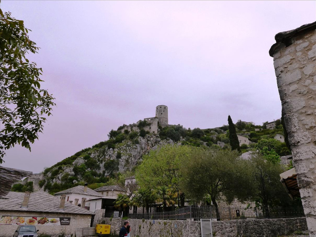 Some brief further info - 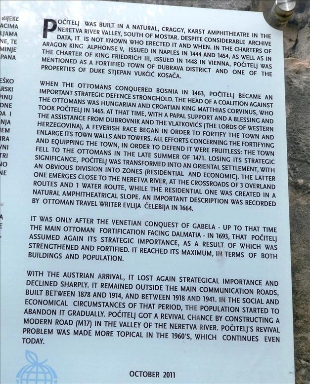 Then we started the walk up –  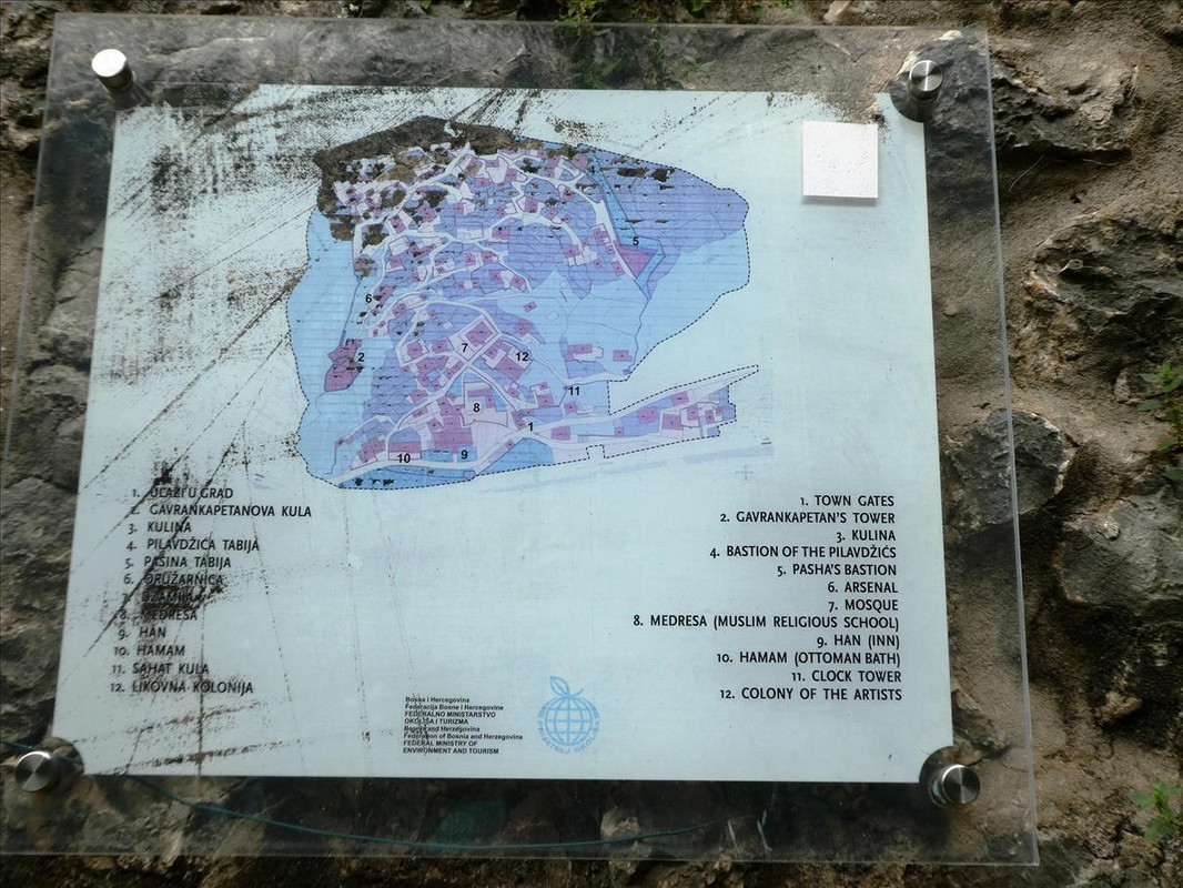  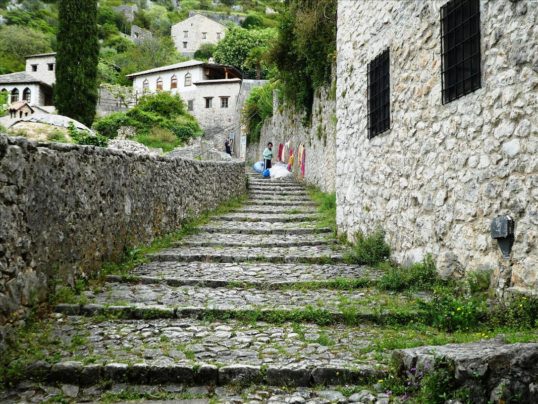 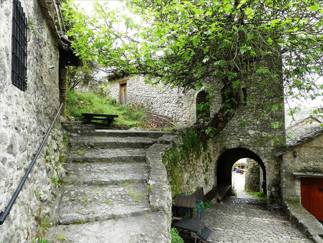 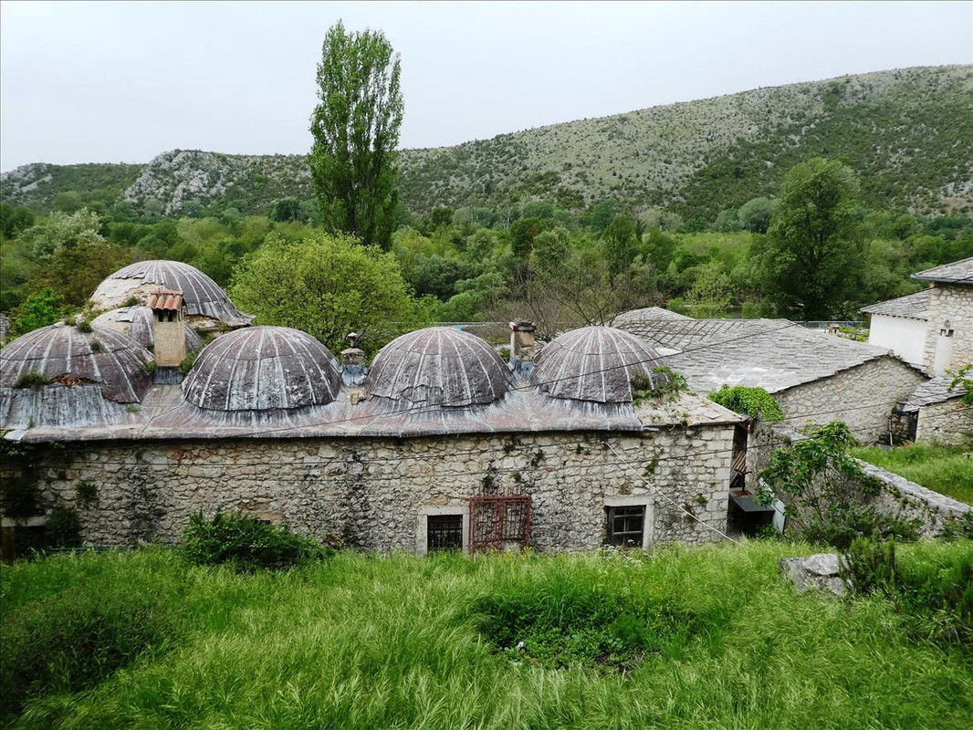 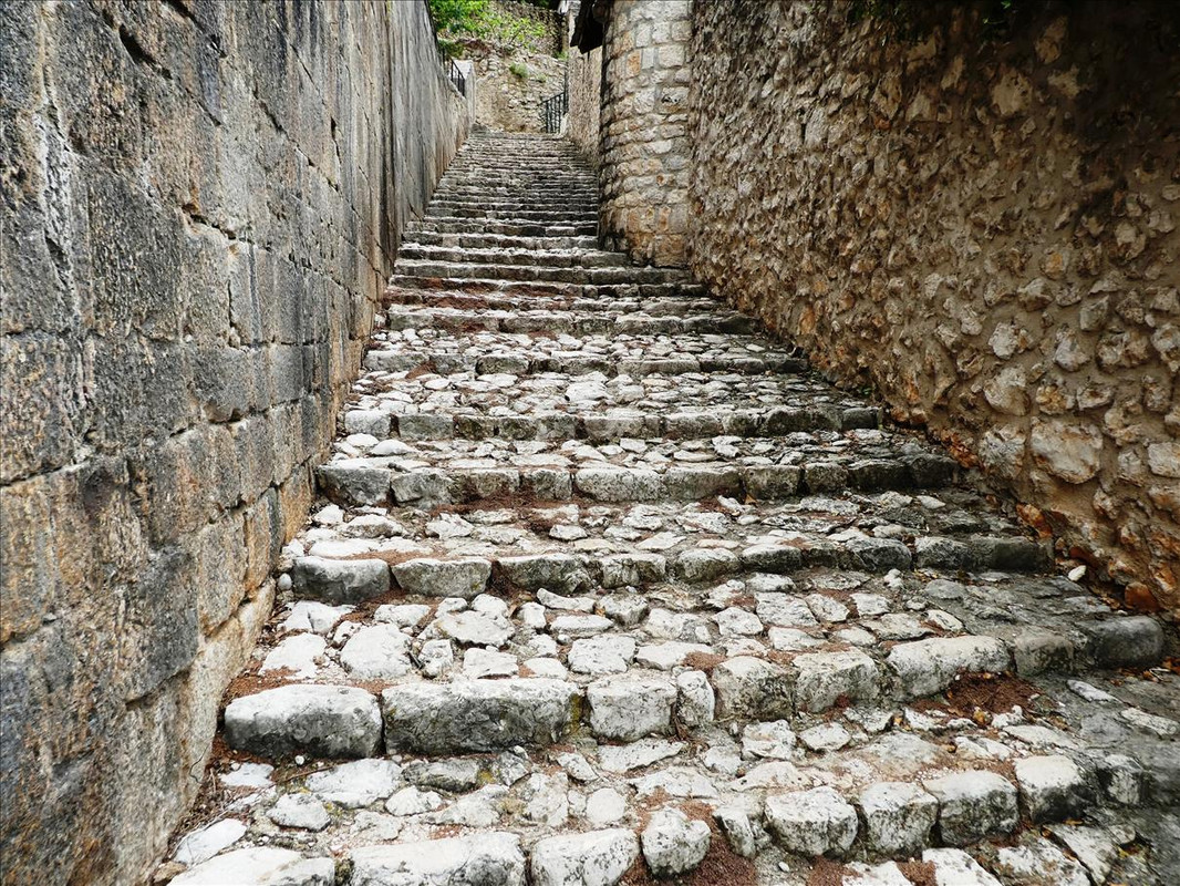 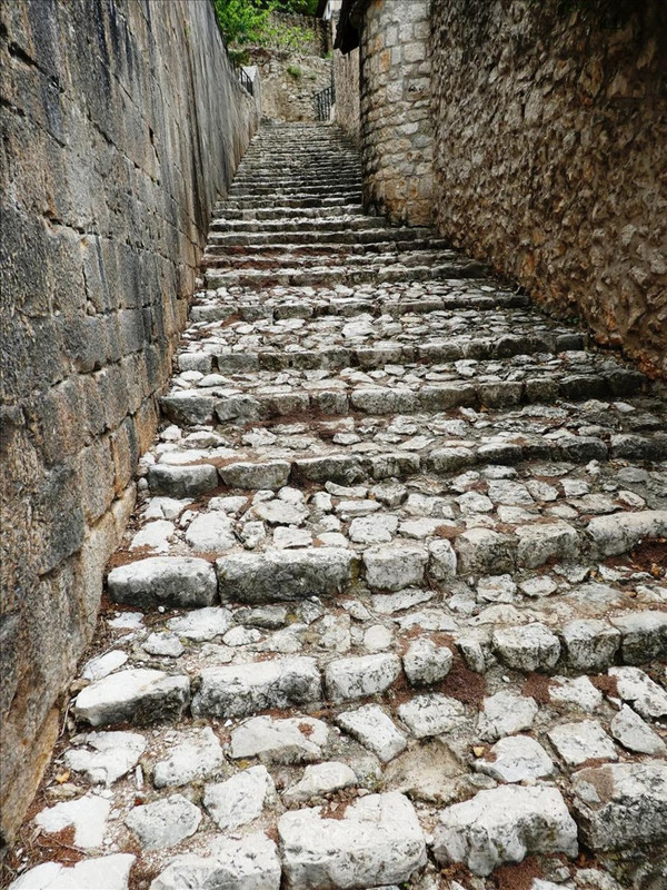 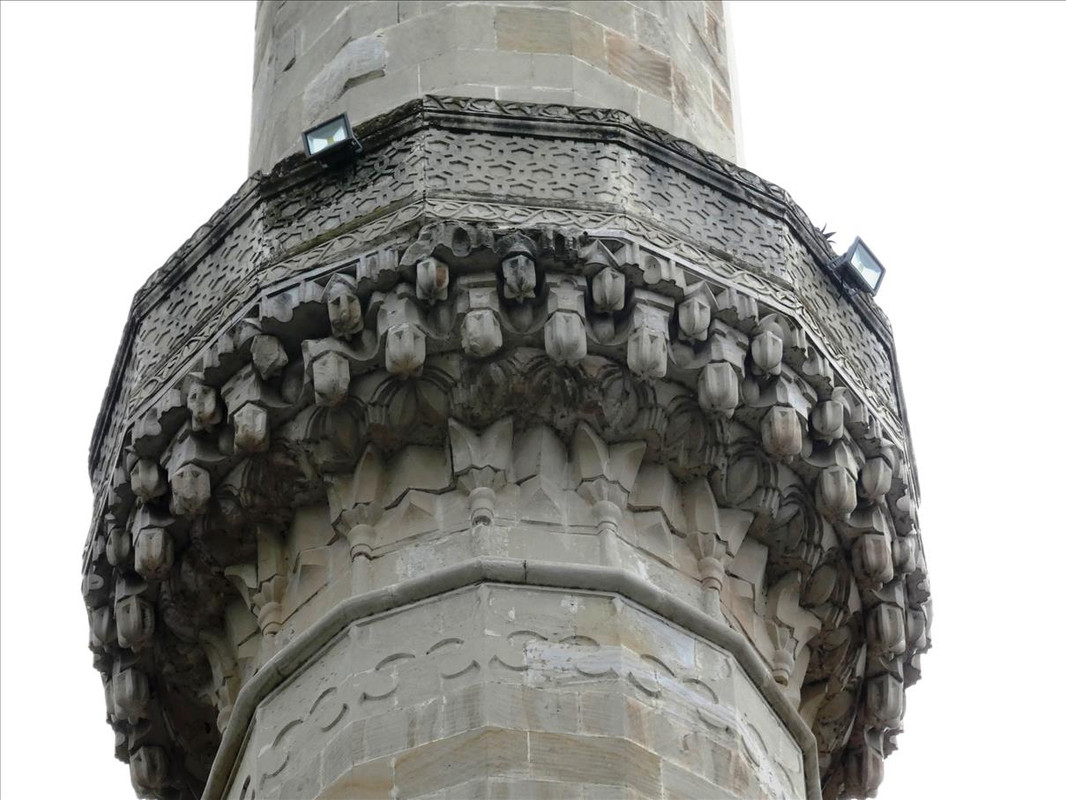 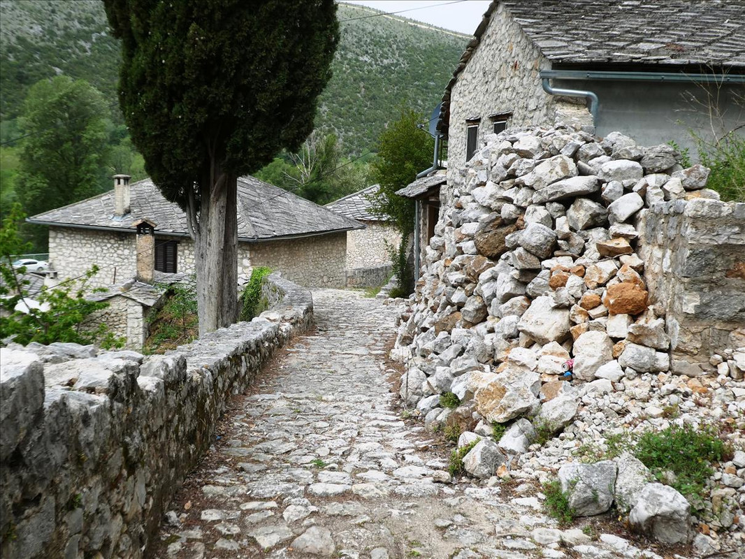 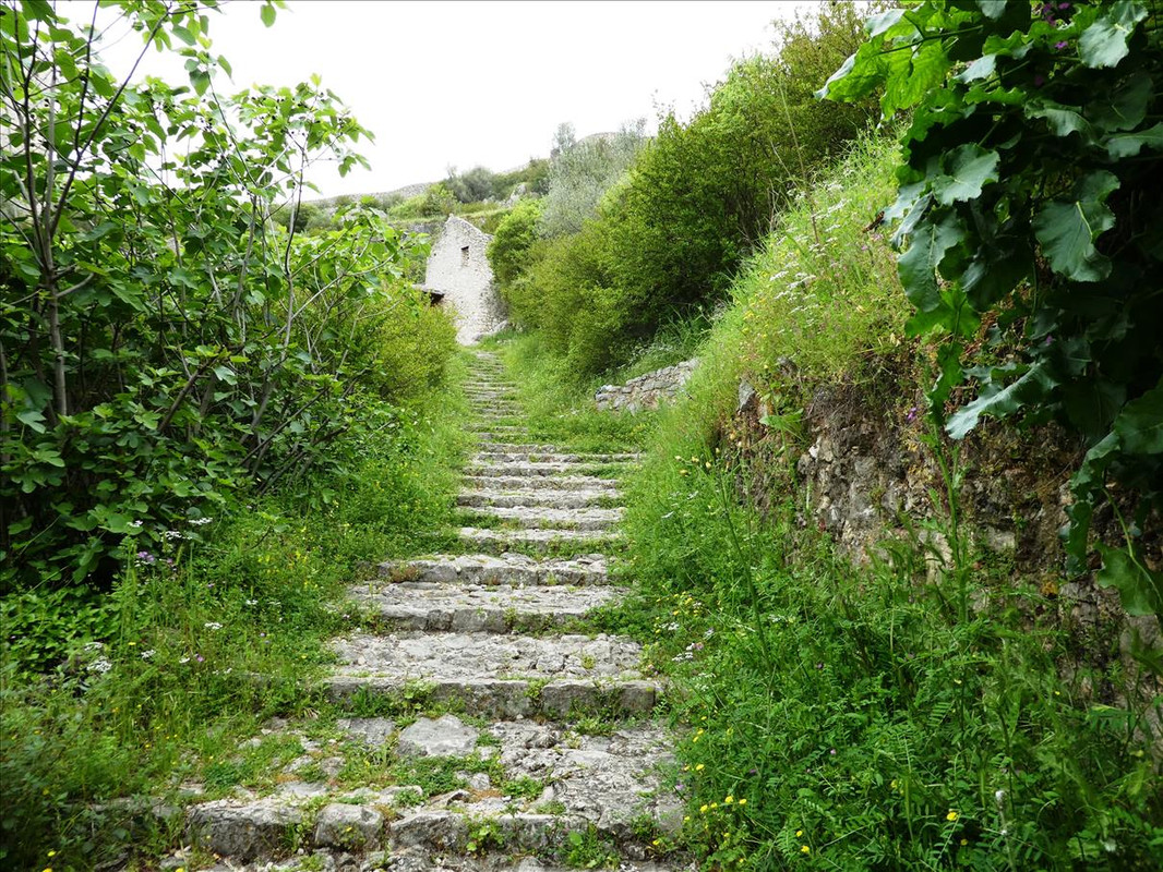 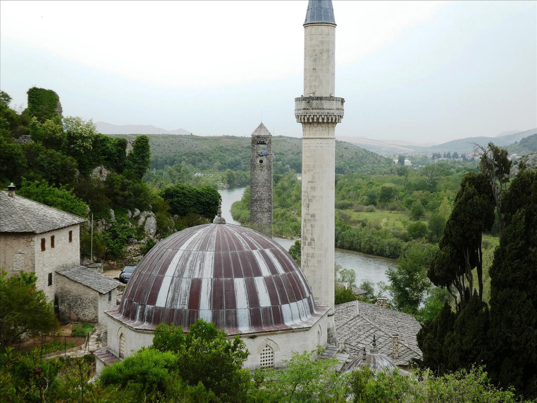 That’s the fortress across the other side of the amphitheatre shaped village which we’ll head for later – 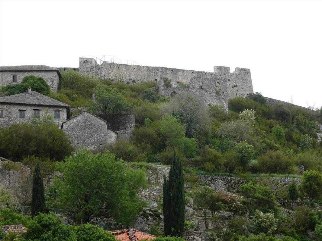 Still ascending to get to there first – 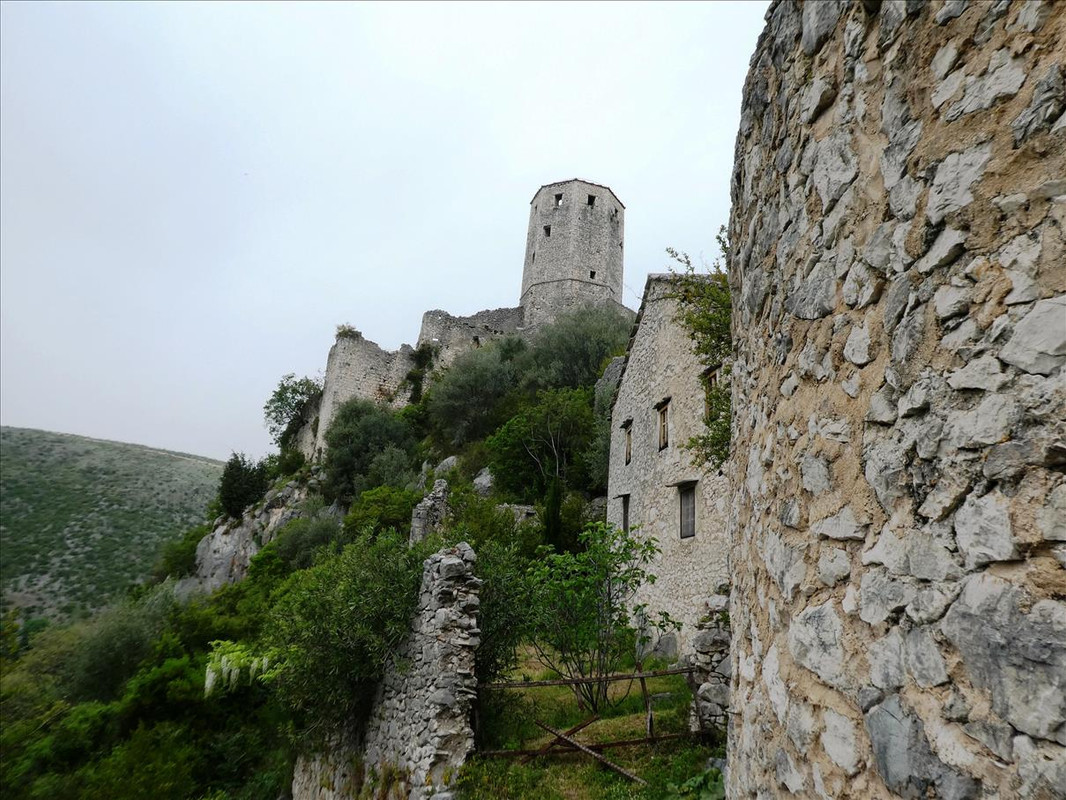 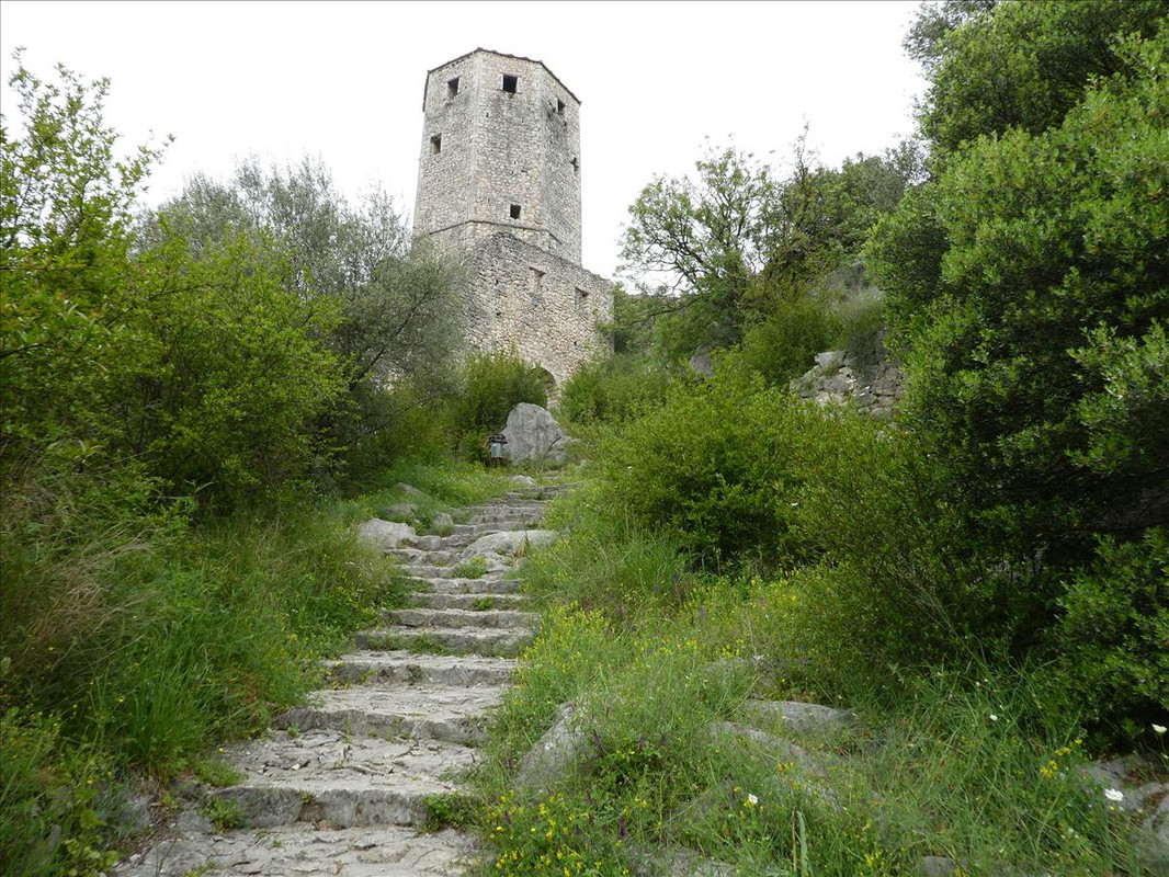  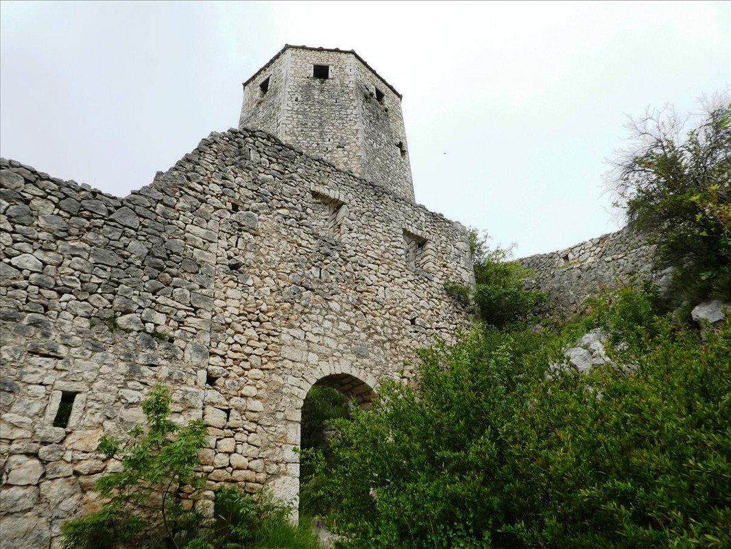 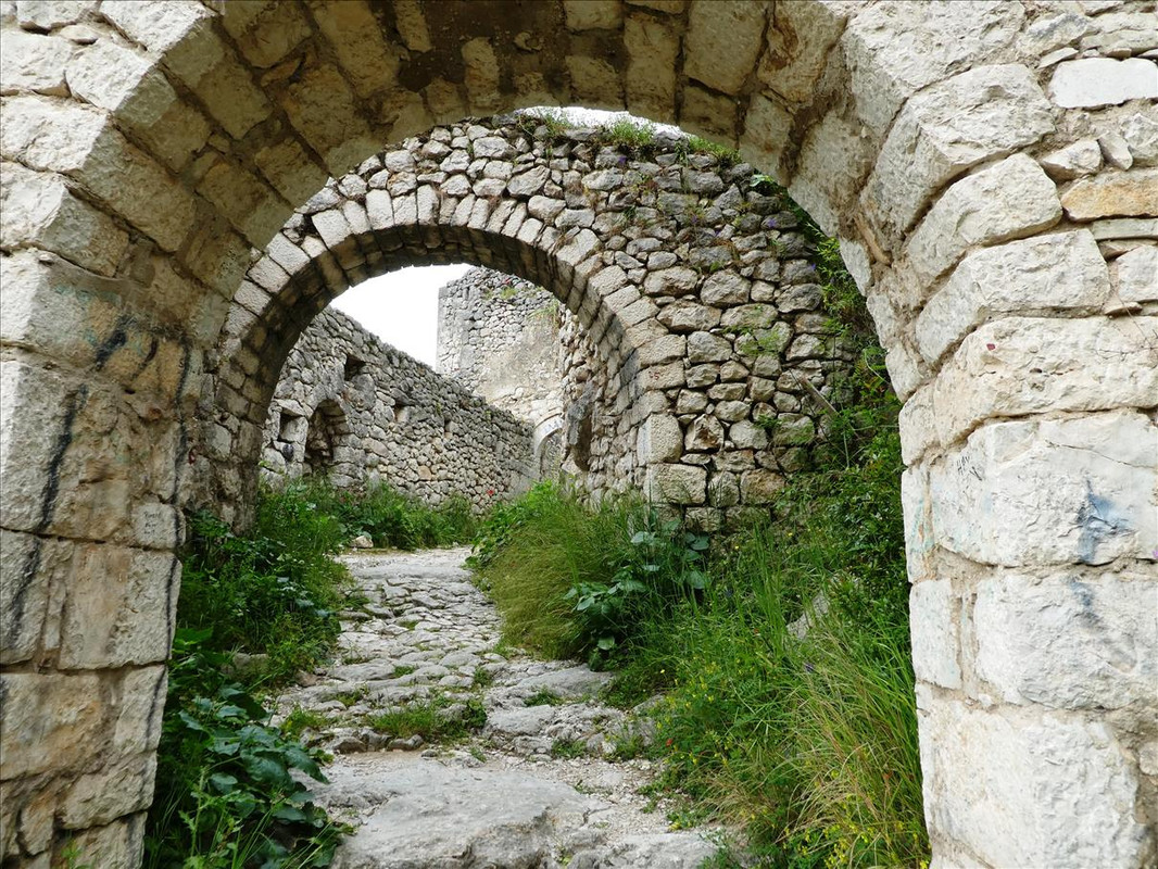 Ok, got there – 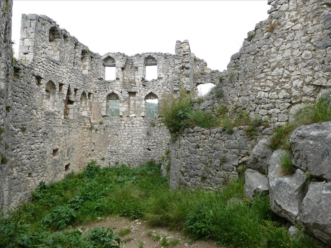 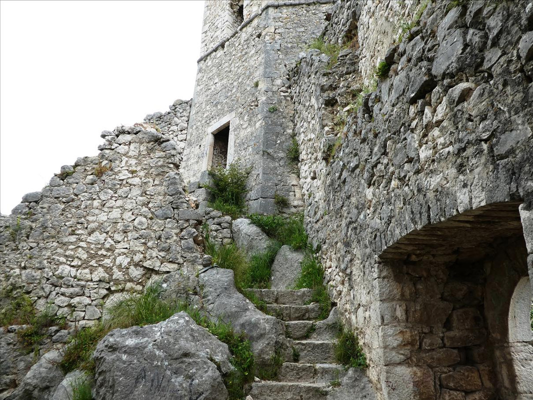 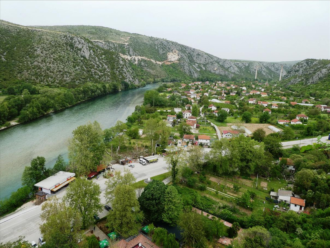  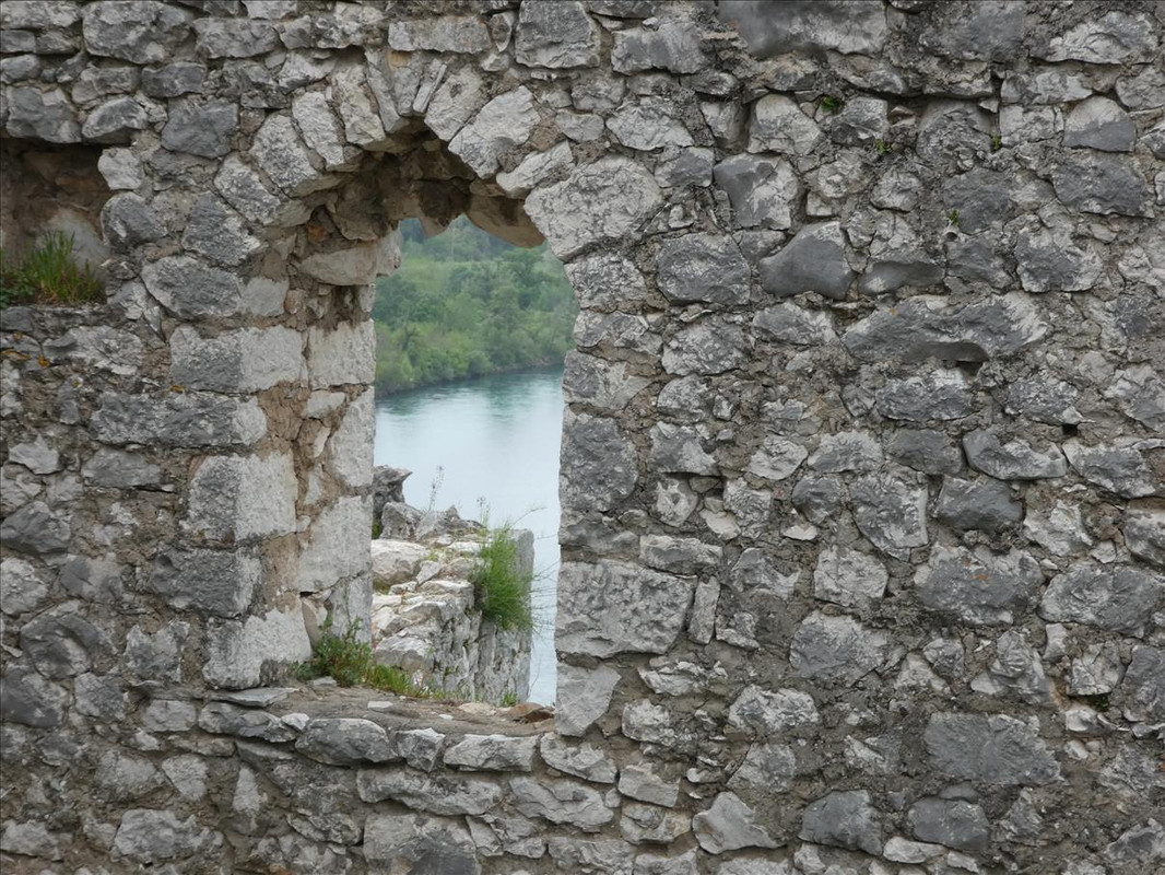 I went further inside but only to the first level. The steps you can see were designed to not allow easy access to invaders. That meant they were quite tight (for me anyway) and uneven steps. I was quite happy to not bother going any higher – 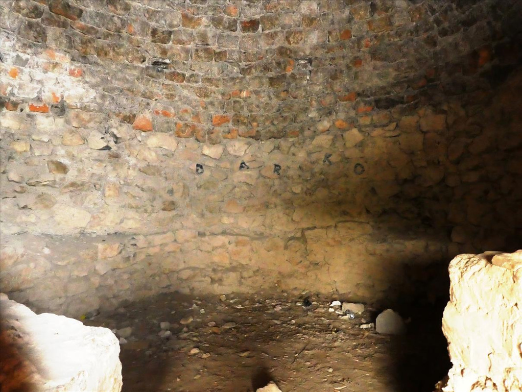 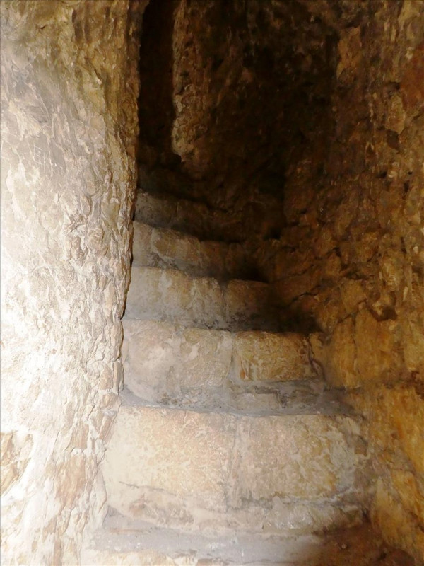 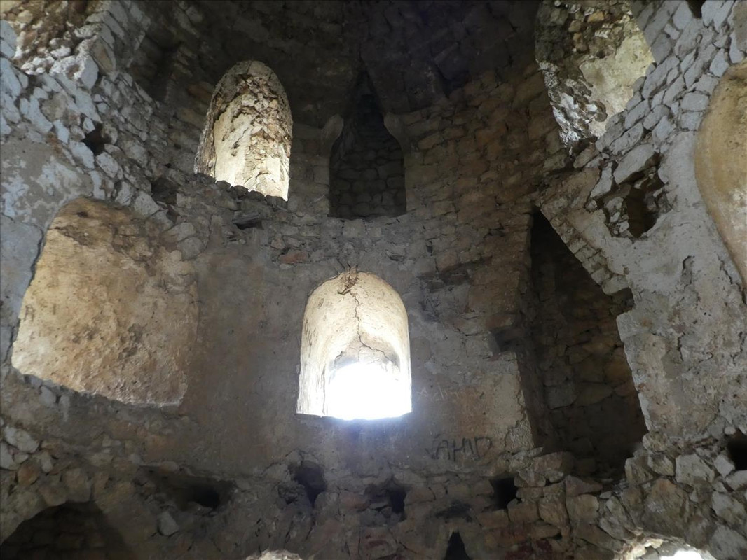 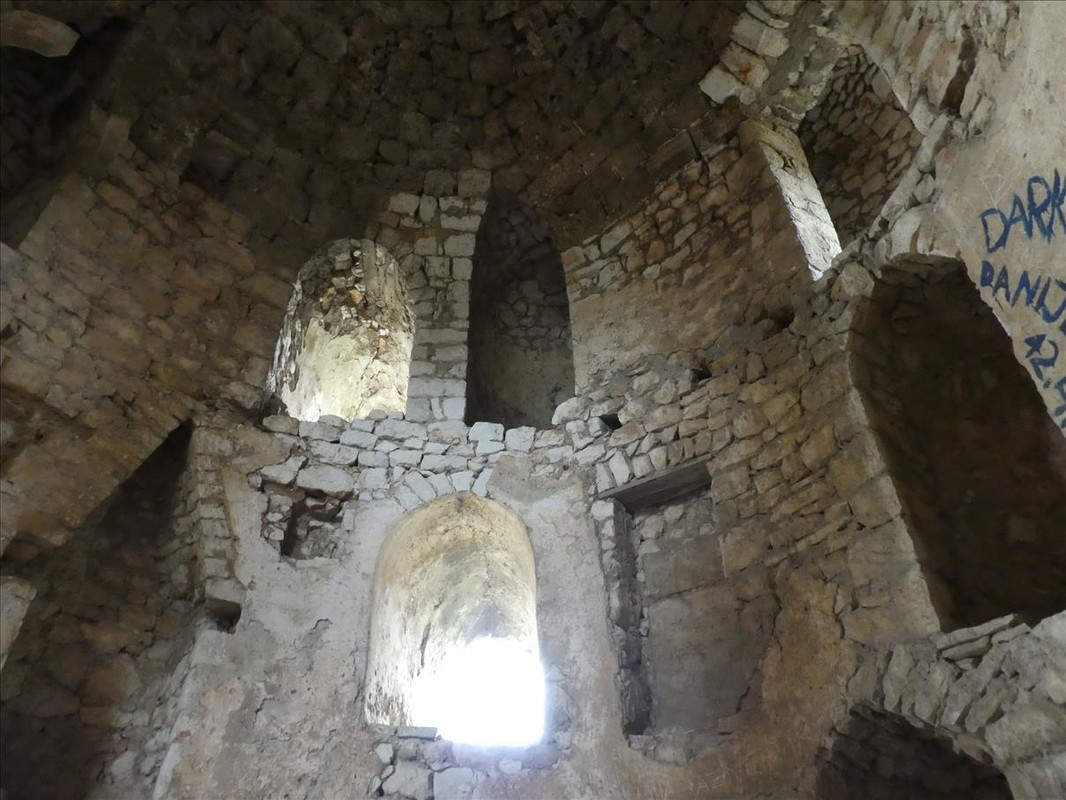 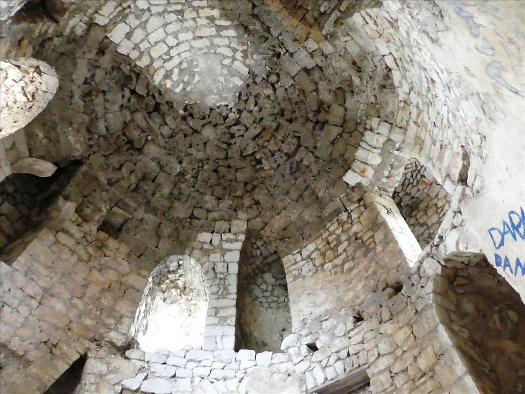 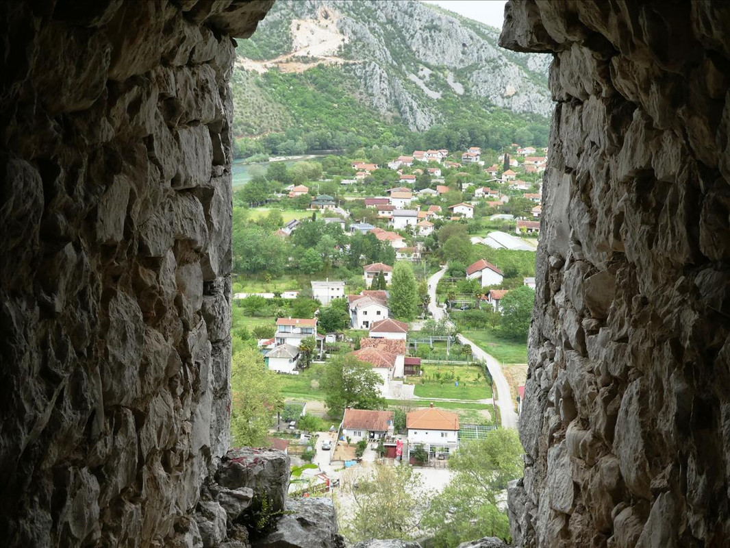 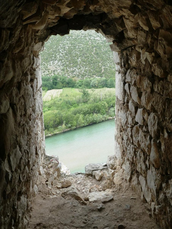  I climbed back down and we exited that part to make our way across the top of the village to the fortress. Of course, there’s no one straight path but it goes up and down – 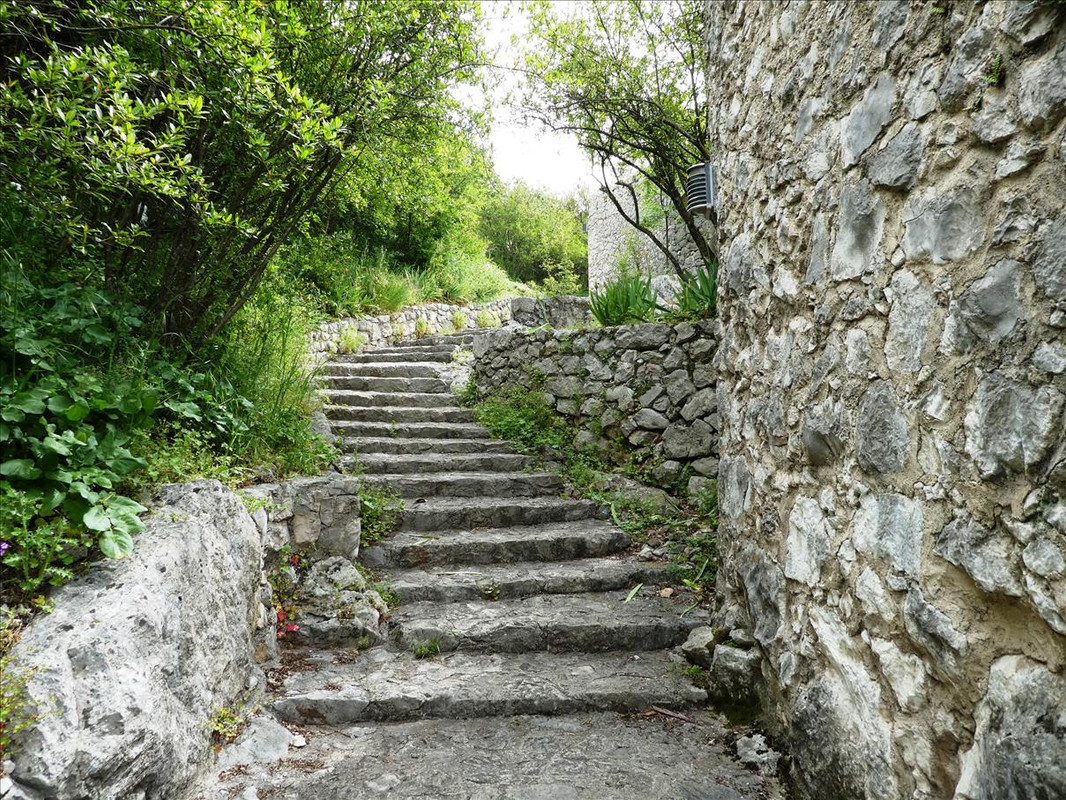 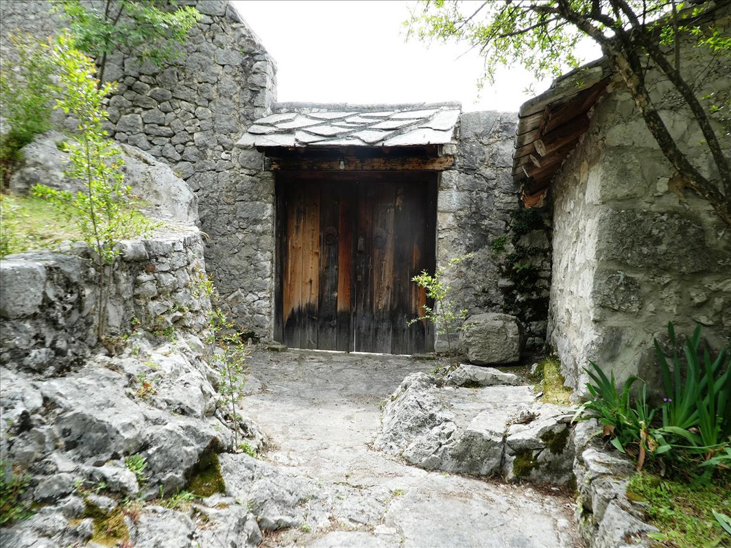 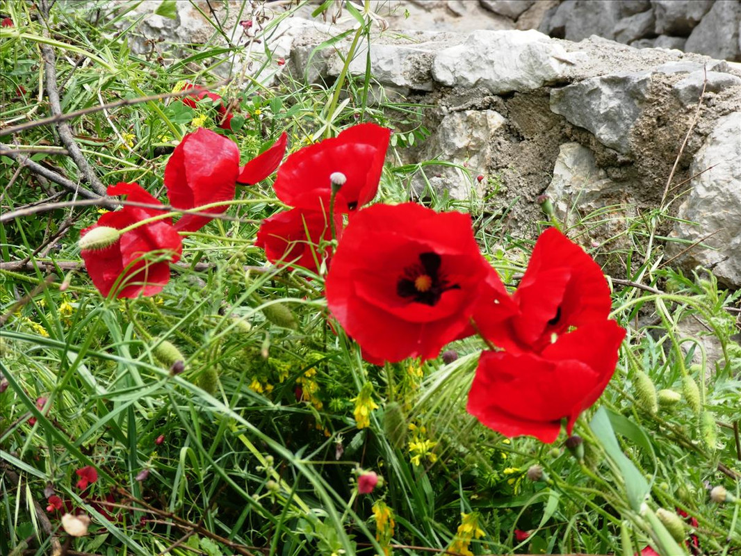 Getting closer - 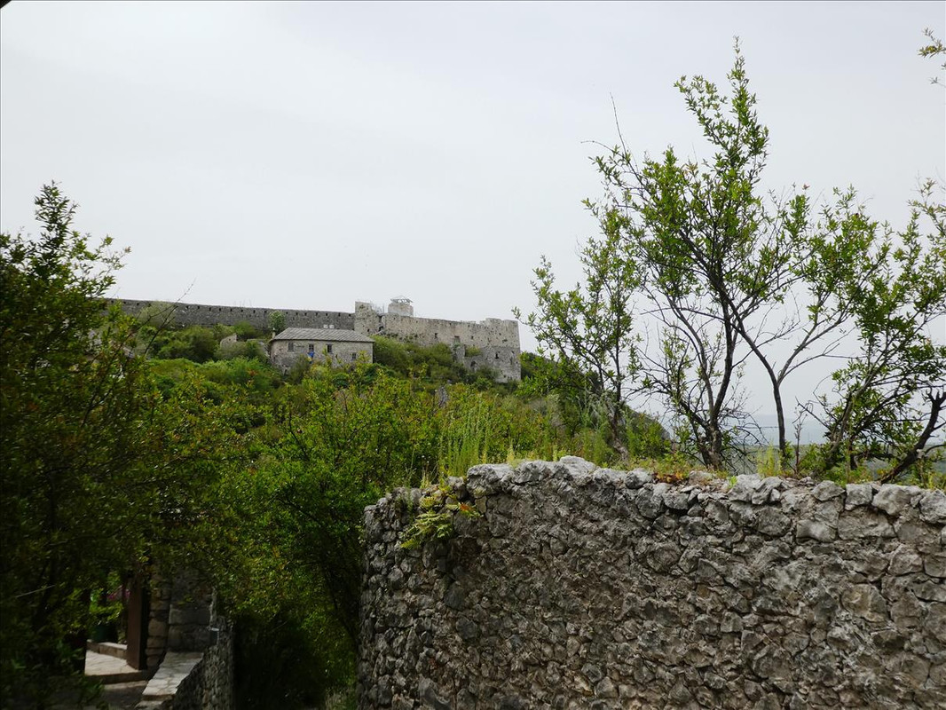 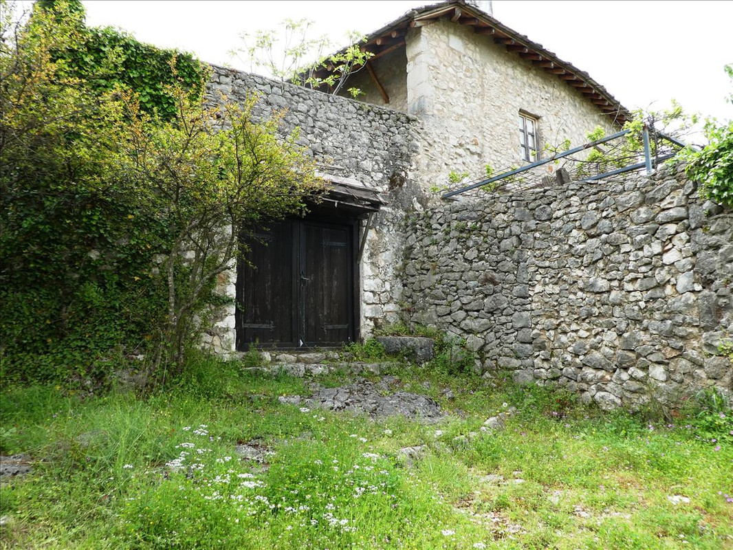 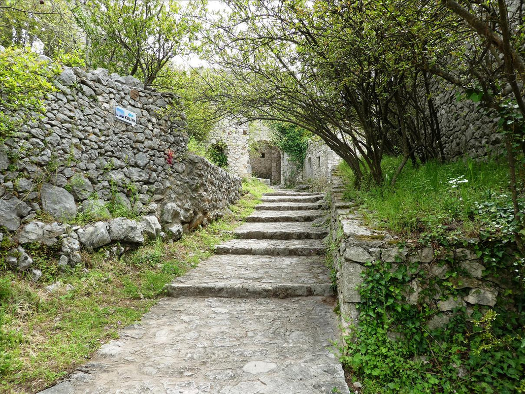 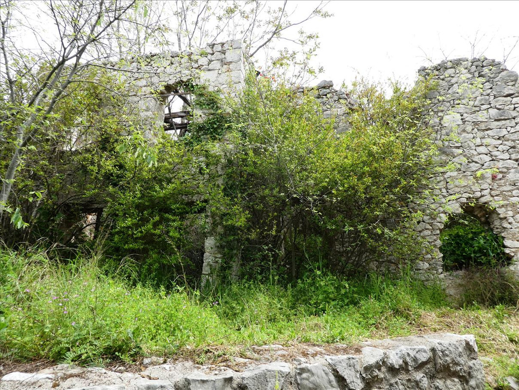  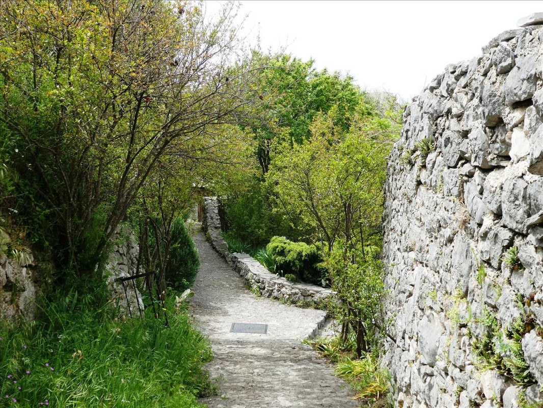 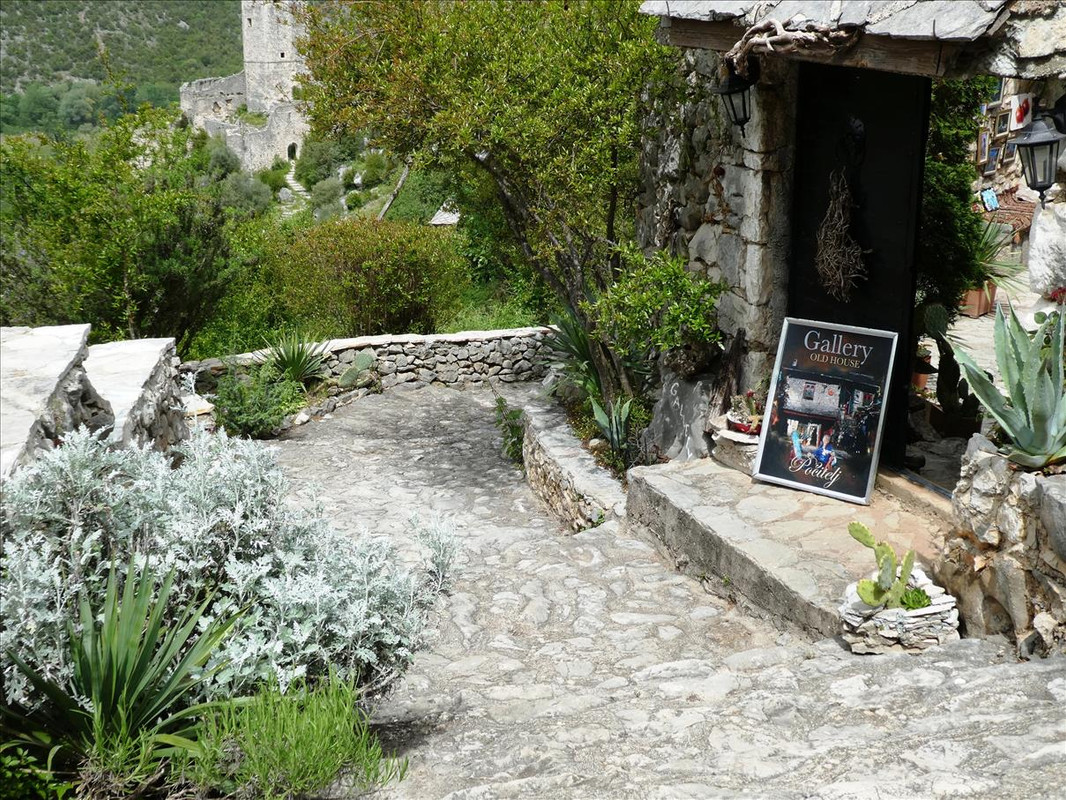  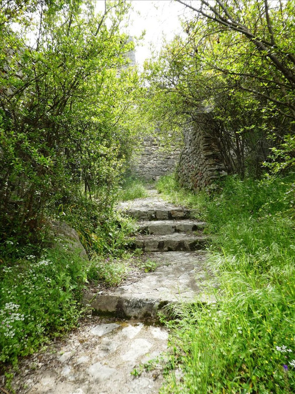 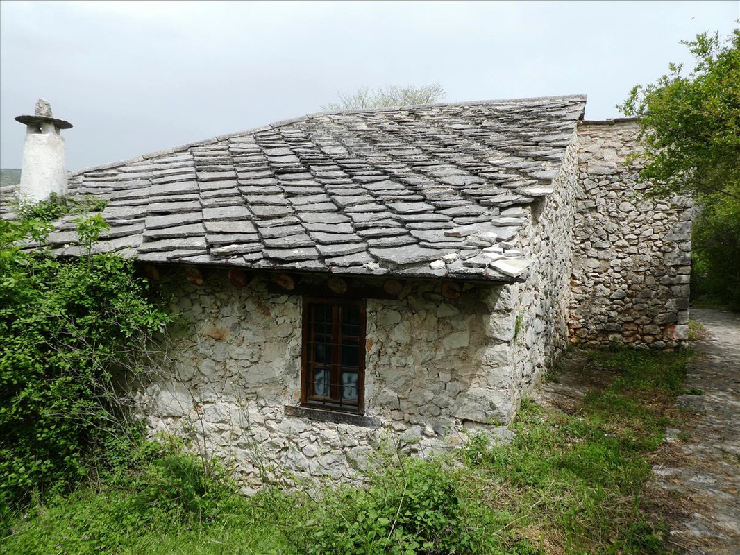 Looking back to where we’ve come from - 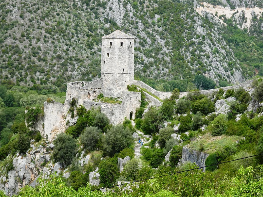 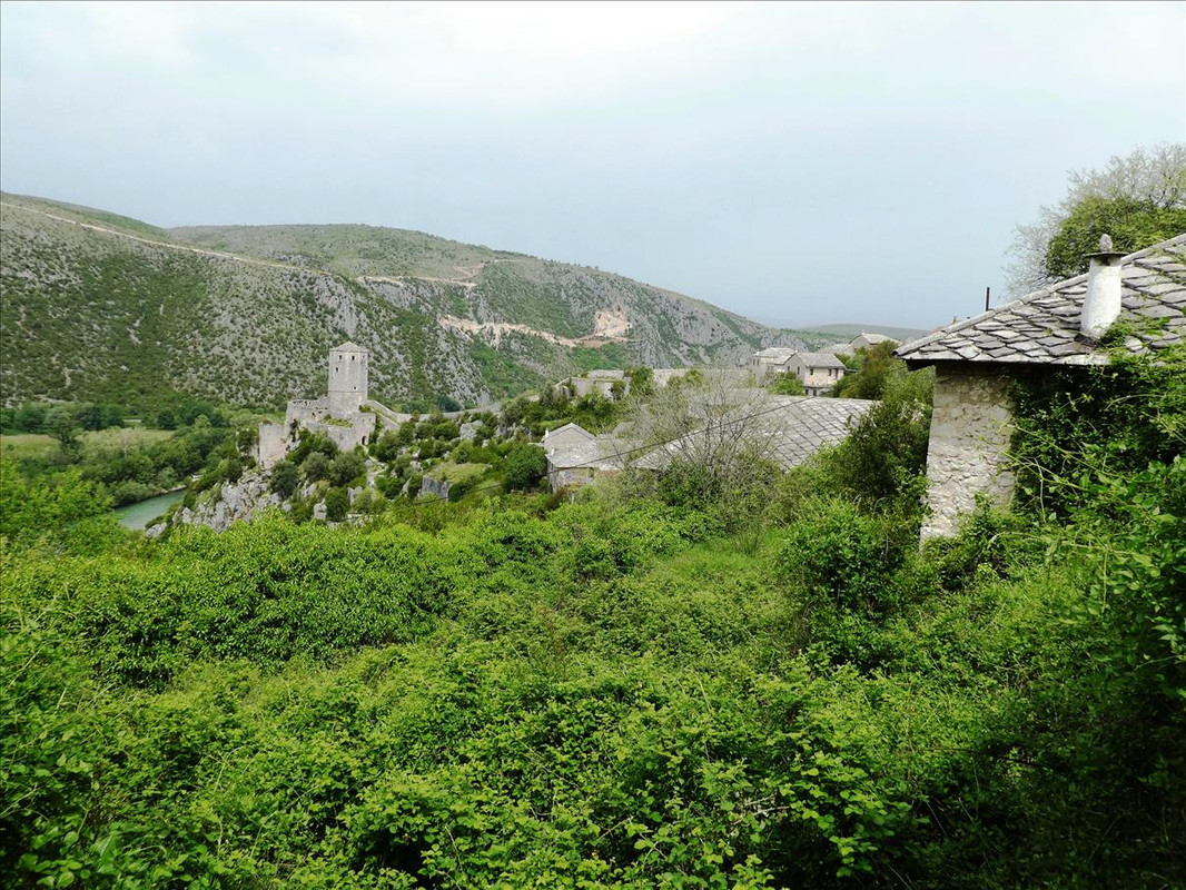 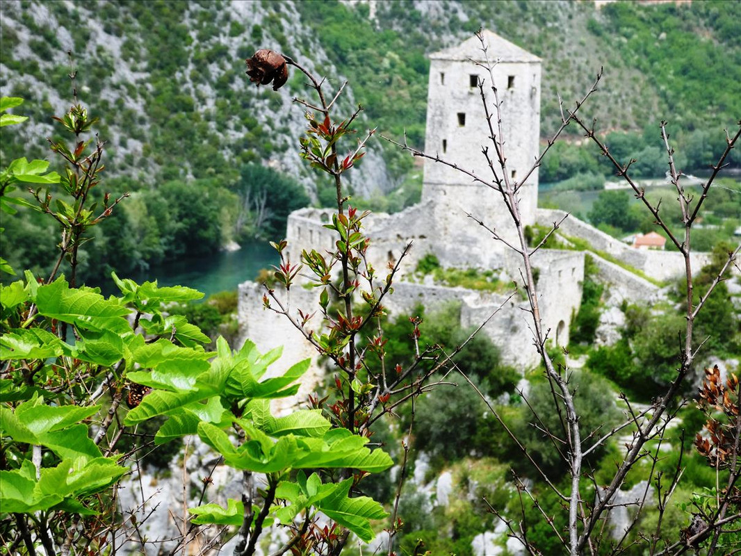 And.... we’re there. Bugger. Closed. Bugger – 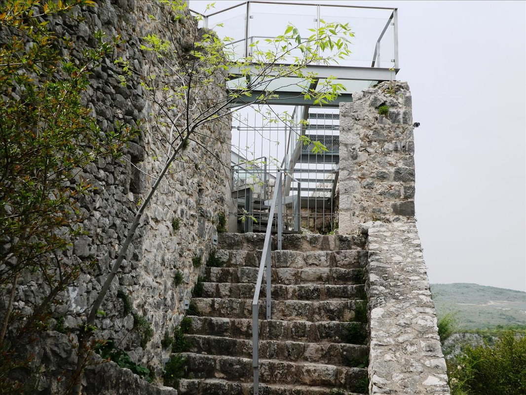 Sorry, can’t do anything about it, but we had a good idea – go back to the cafe near the clock tower. So we made our meandering and scenic way back down –  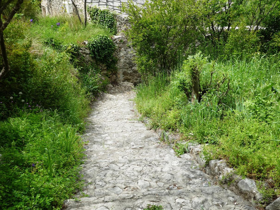 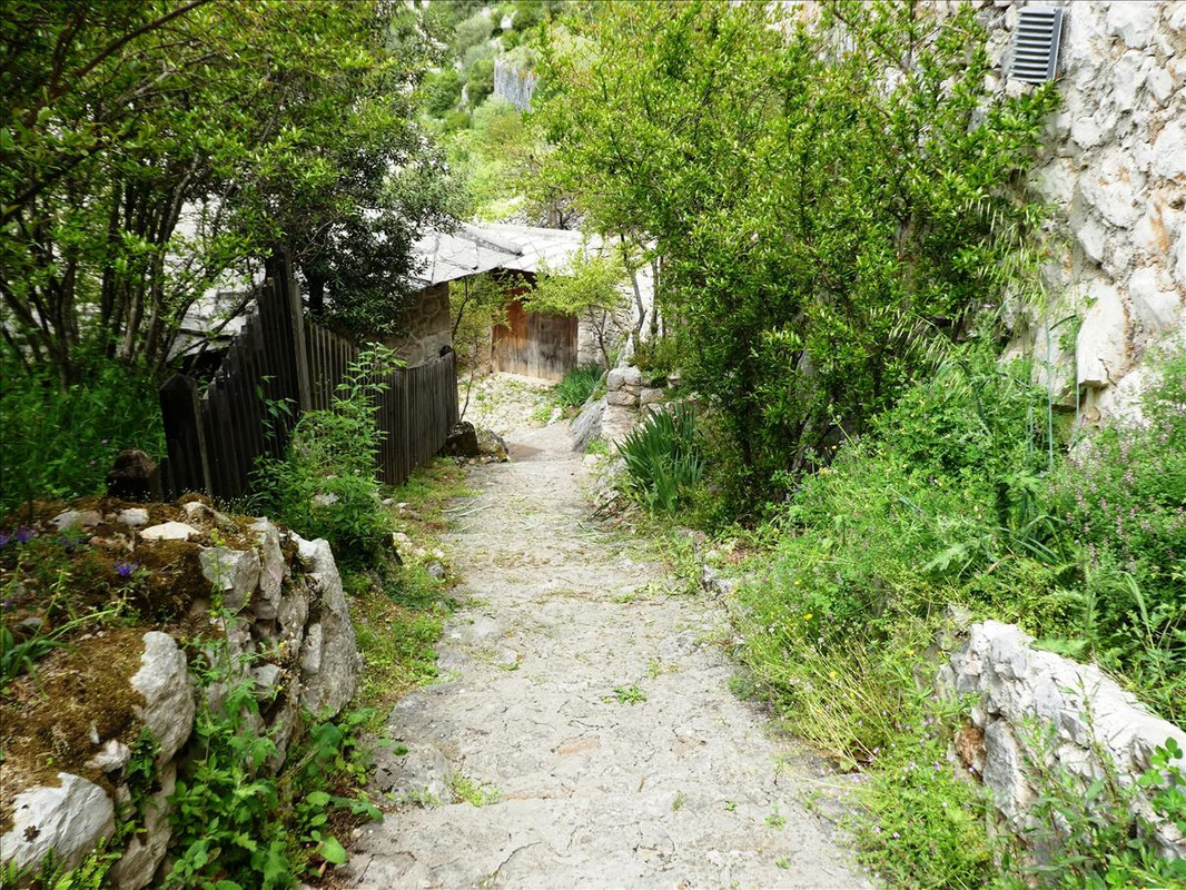  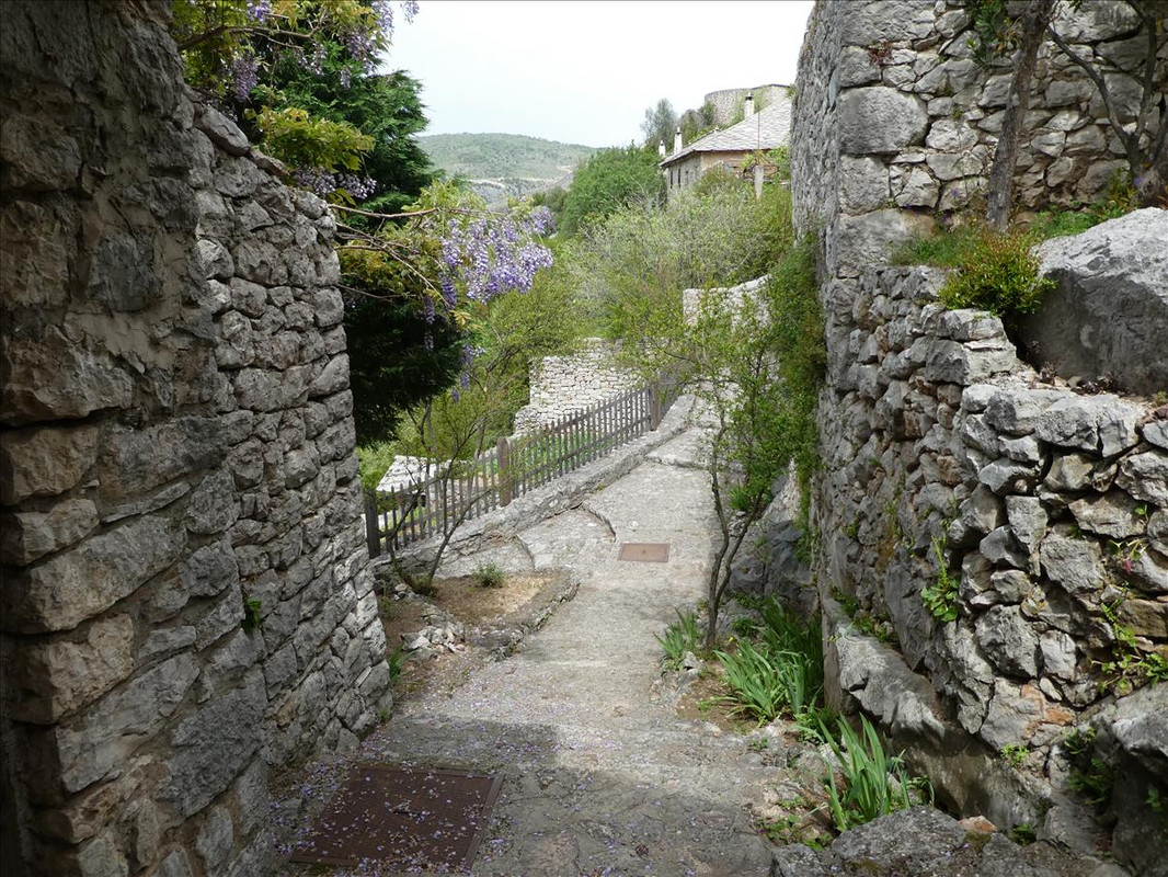 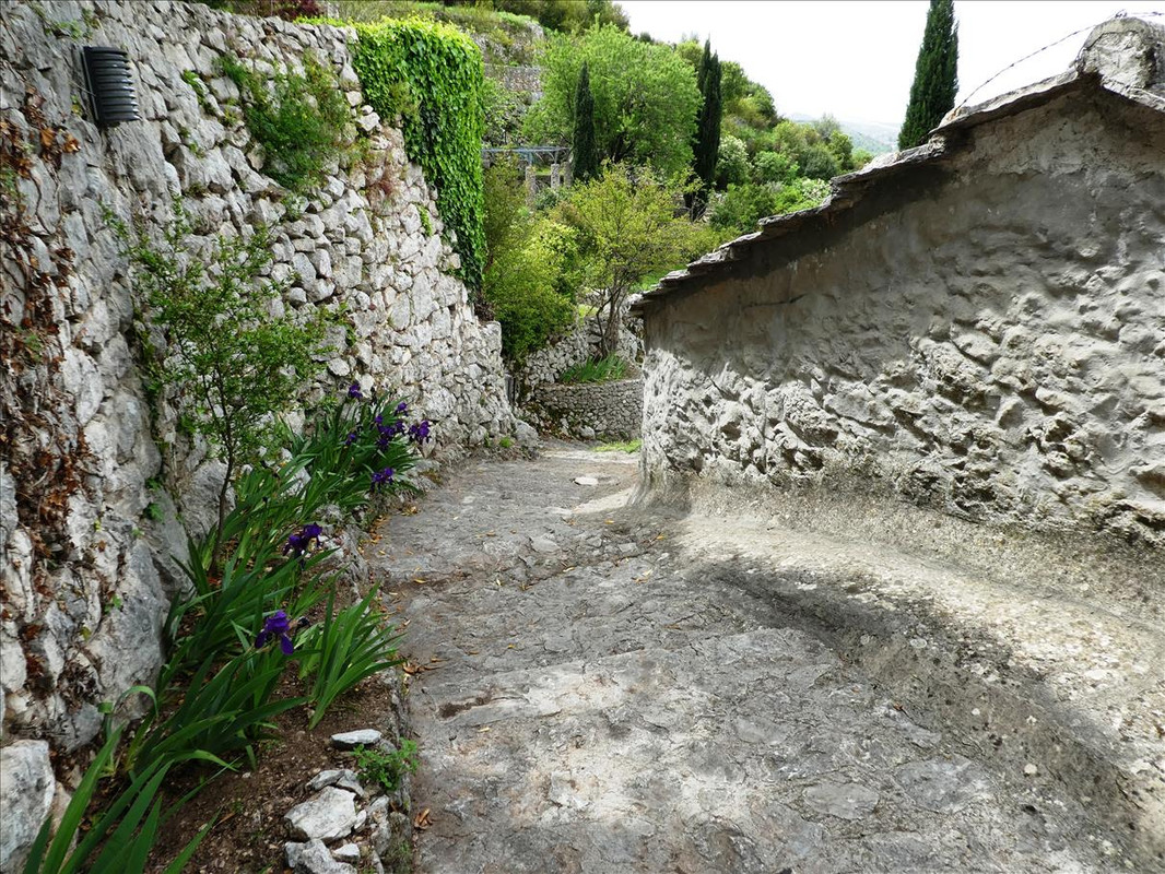   We had a bit of a rest and moved on. |
|
|
|
Post by sophie on May 8, 2021 16:43:14 GMT 2
Again, gorgeous scenery. Thanks. And again, no other people in the pictures.. is this unusual?
|
|
|
|
Post by OnlyMark on May 8, 2021 17:32:53 GMT 2
Not in covid times when there are virtually no tourists here. Quite usual from what I've seen. There's more and more in Sarajevo but not so in the outlying districts. These areas we went have tourists coming from the coast, from Croatia as it is quite near, but they would all need a PCR test to enter the country, which is another one they probably have to have and felt not to be worth it for now.
|
|
|
|
Post by sophie on May 8, 2021 17:51:09 GMT 2
Thanks.. I was beginning to wonder if this area is an area I would enjoy exploring once travel resumes when I go to visit my family. The former Yugoslavia is one of the three (the other being Denmark and Albania)European countries I haven’t been to. These days I try to avoid the heavily touristed areas of the world so the lack of people in pictures interests.. obviously didn’t think it through!!
|
|
|
|
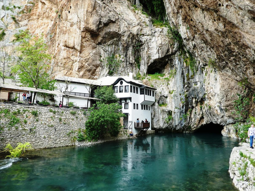
Post by OnlyMark on May 9, 2021 12:52:02 GMT 2
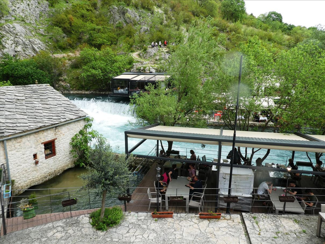
We’d obviously had quite a while looking through the village and we decided to stop for lunch before we took anything else in. It would have been easy enough to call in any of the towns and get a restaurant meal. Most had seating outside anyway so the restrictions for eating inside due to covid hardly mattered. The area is famous regarding eating for trout and as we both enjoyed that we stopped at a hotel/motel/old water mill and restaurant on one of the other rivers. This one – best jump to 1:38 until 1:56 and then 2:17 to the end. Not my video – We sat on the island to have our meal. Very pleasant. Mrs M is sitting patiently by herself waiting for me – 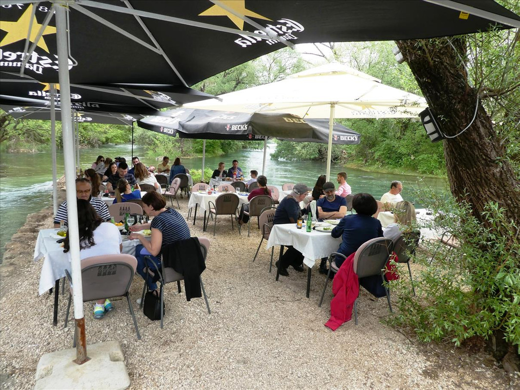 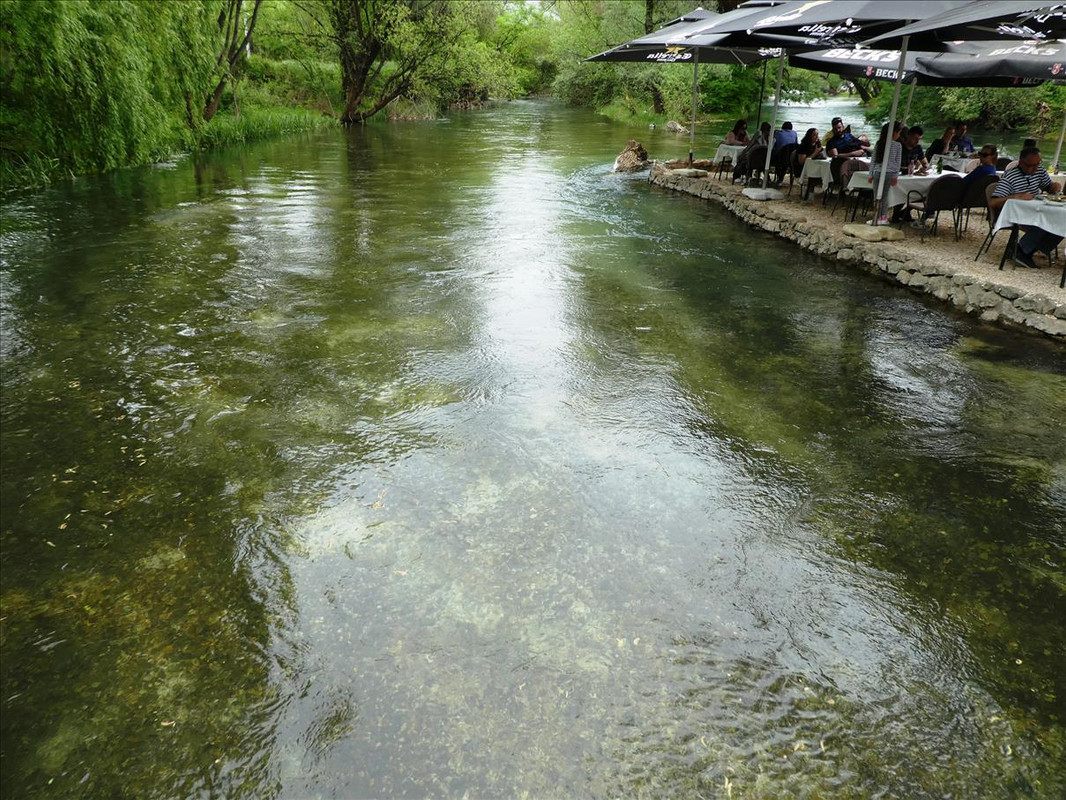 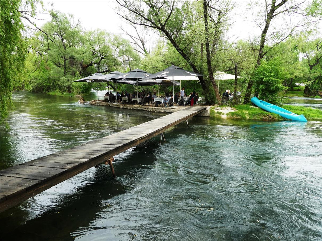 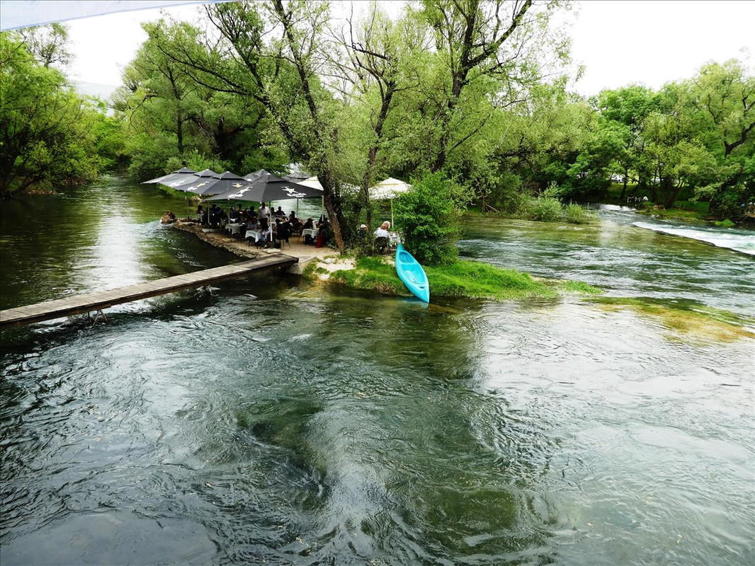 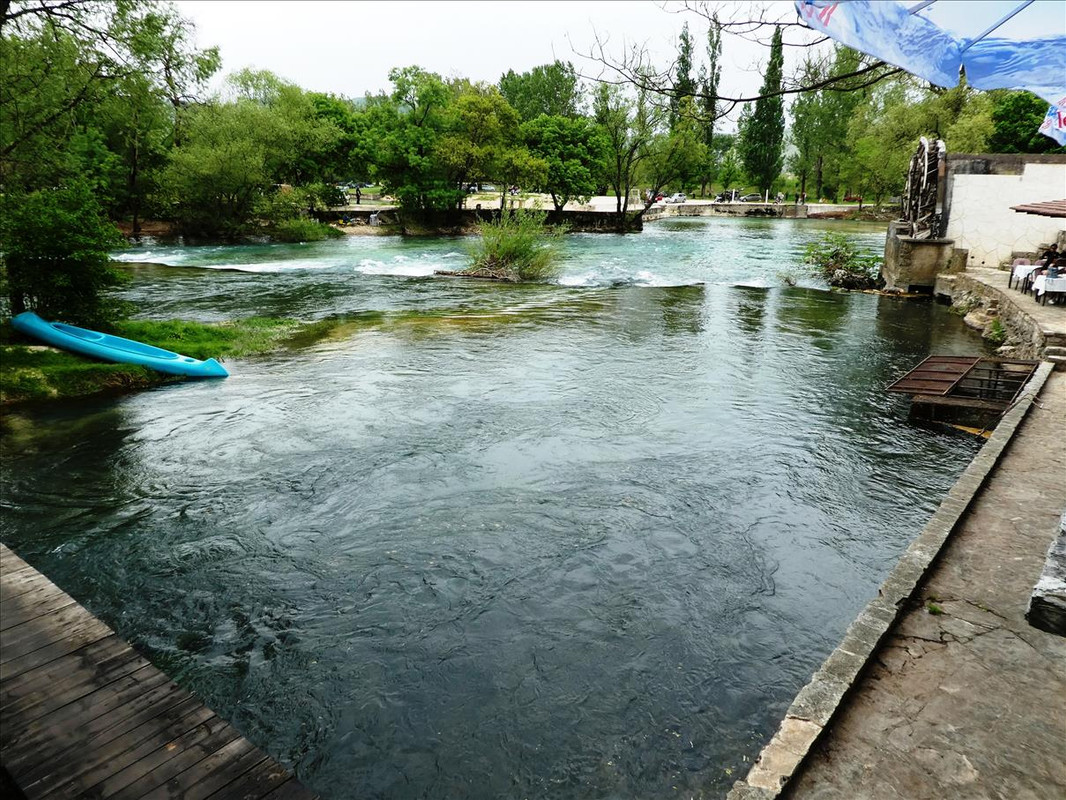 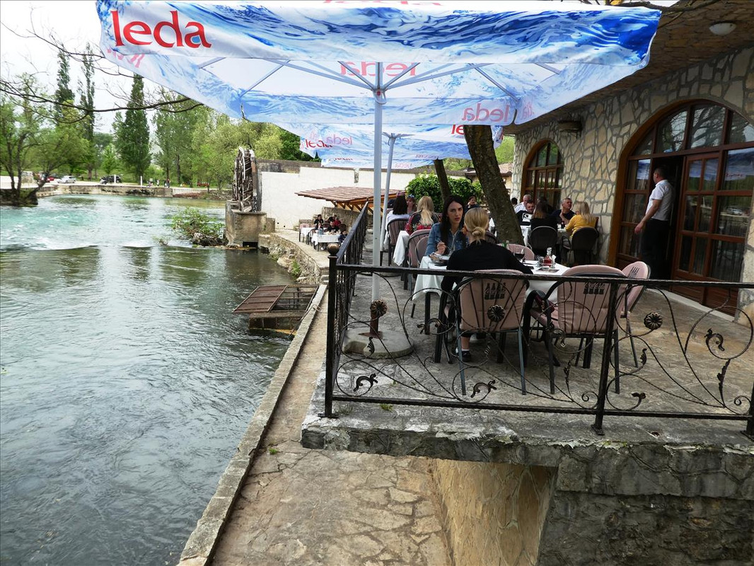 Yes, tasted good. Even the green leafy thing. Seasoned just right. Cost equivalent to about five euros - 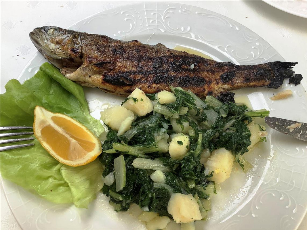 |
|
|
|
Post by OnlyMark on May 9, 2021 12:53:30 GMT 2
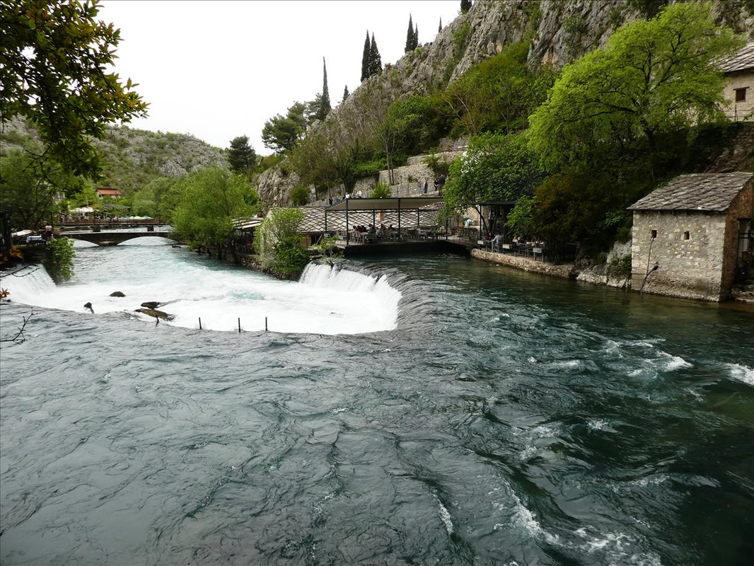
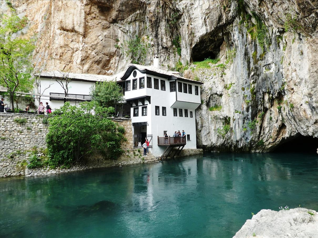
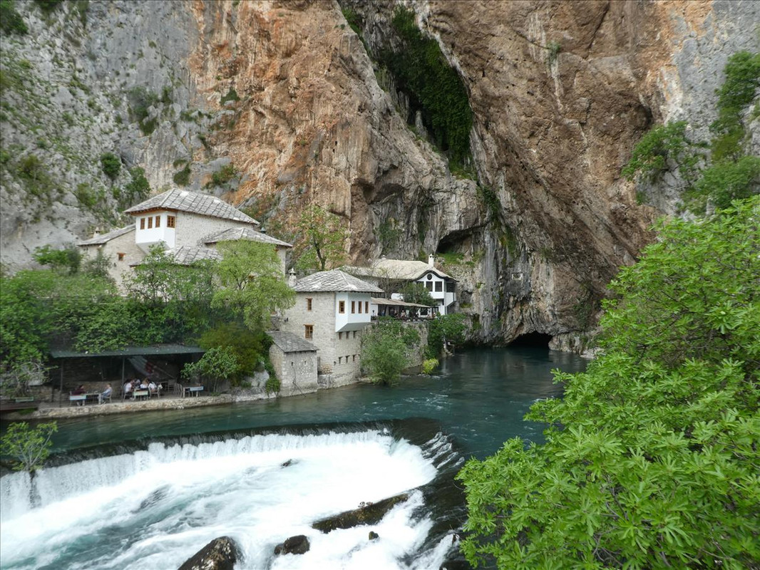
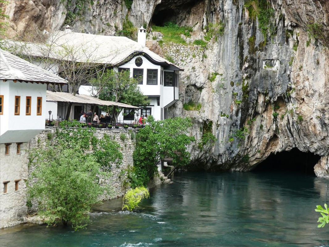
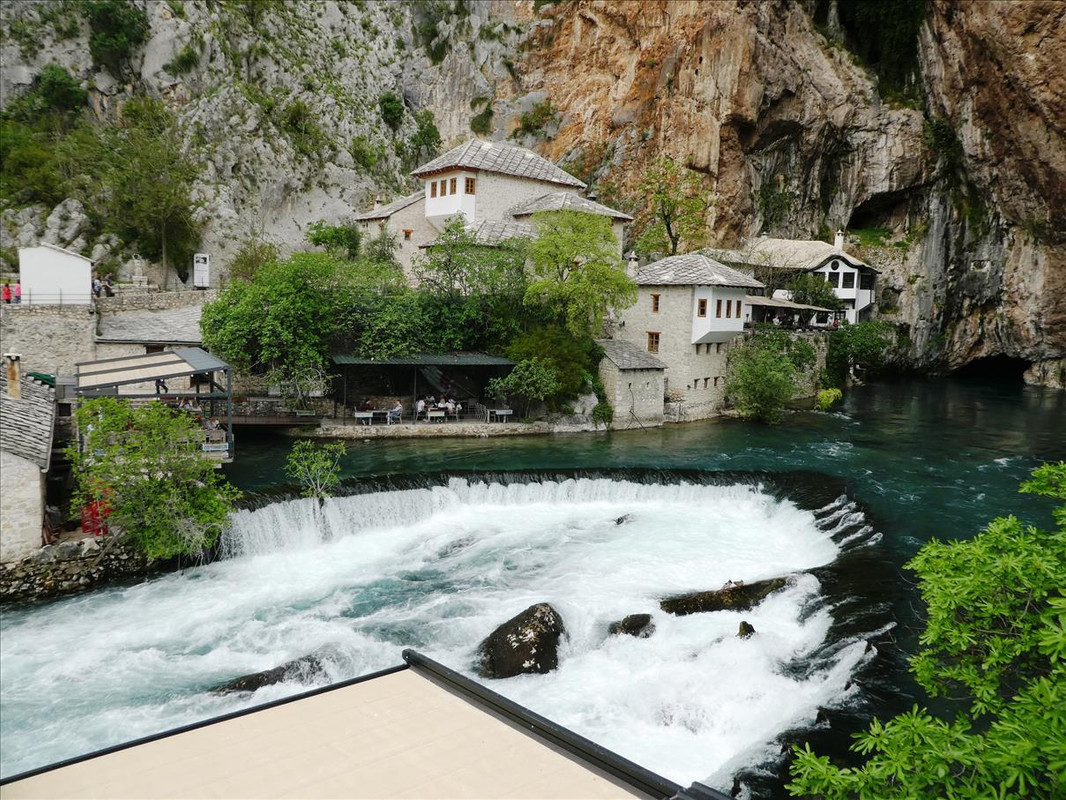
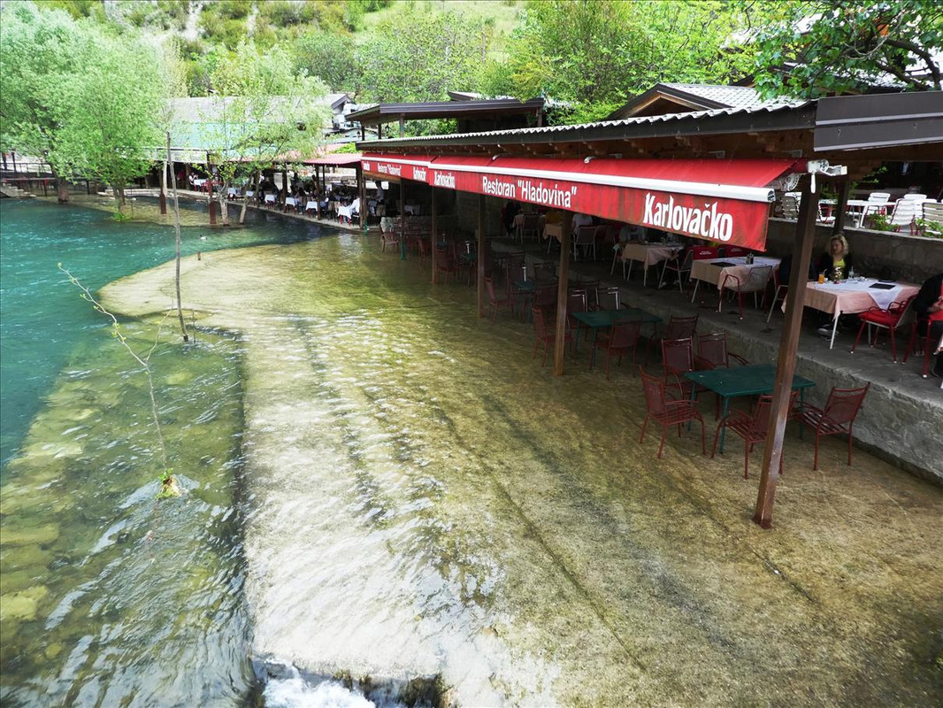
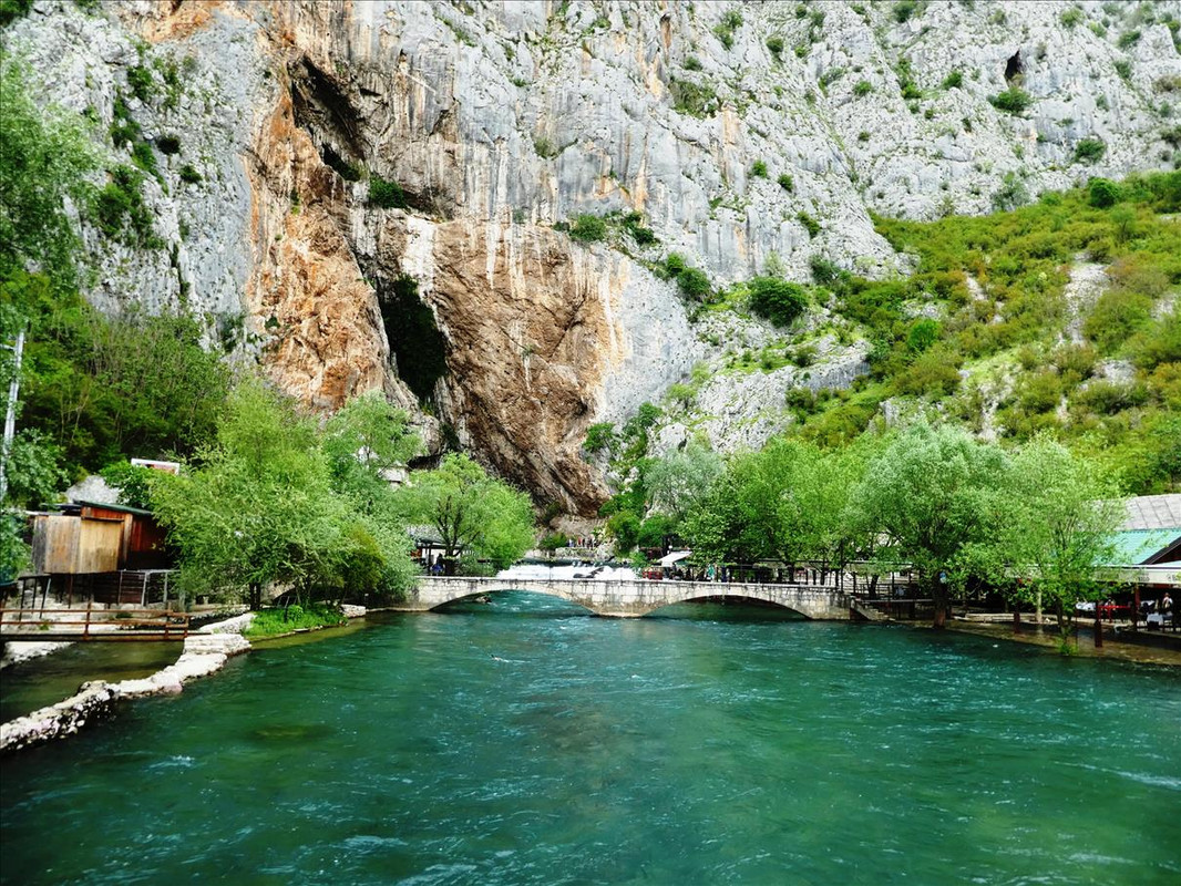
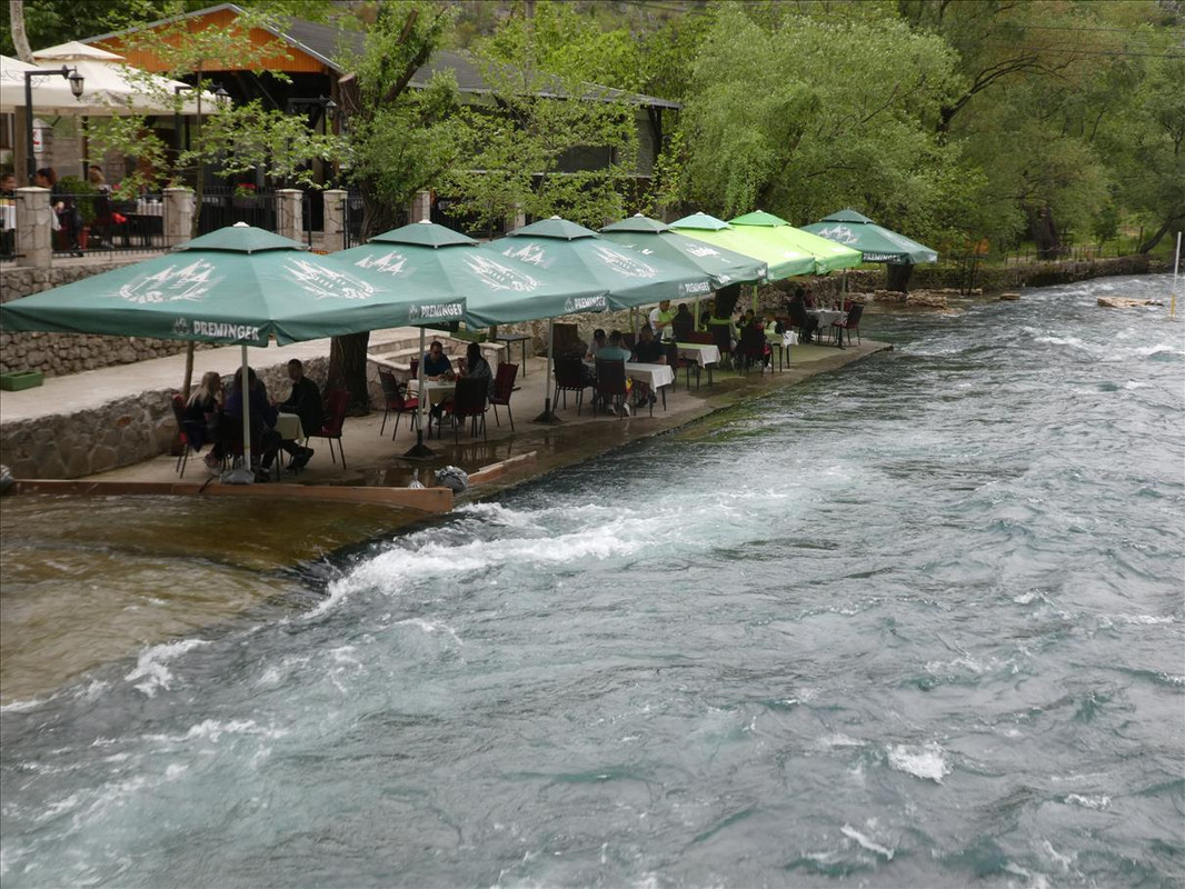
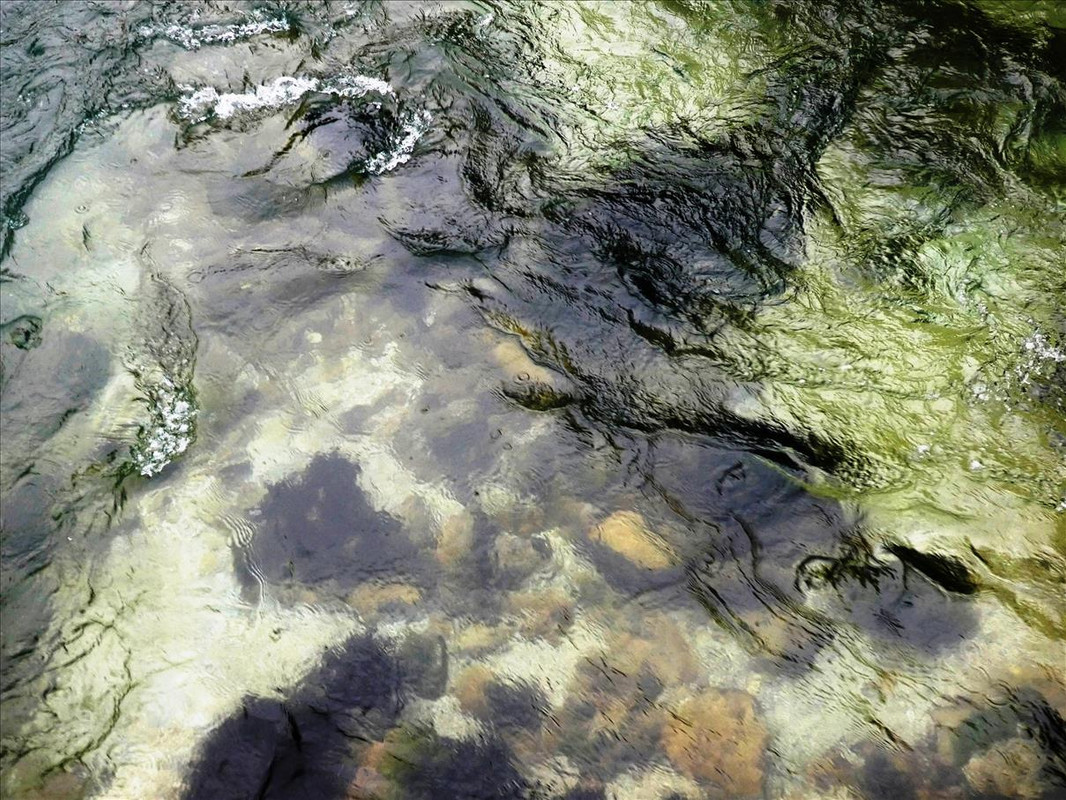
Even though we’ve had lunch, I’ll take you to another lunch spot where we could have had a bite to eat. As the last post was quite short I’ll add this also in here for today. It’s called Koćuša waterfall and is in the village of Veljaci (in the municipality of Ljubuški), on the river Mlada. But it is on the same river as the first post, Kravice waterfall, which is on the river Trebižat. The problem is that even though the river is just 51km long, these are the names it goes by in different places – “Because the Trebižat River disappears and reappears various times and places, the people used to call it different names. At least nine names are regularly used, and few other are known to be used as well - overall some thirteen names are known to be used at different point in times and/or by different communities along its course, at various locations and for different sections: the Vrljika (from its original wellspring at Proložac to Kamenost (Podbablje)), the Matica (from Kamenmost in Croatia to Drinovci in Bosnia and Herzegovina), the Tihaljina (from wellspring at Peć Mlini to Mladi), the Mlade (from Mlade to Perila), the Stari (Old) Prokop & the (New) Prokop or the Kanal (from Perila to Jegetina), and the Trebižat (from Jegetina, through Ljubuško Polje, till confluence with the Neretva in village Struge near Čapljina); also at various places the river is called Brina, Culuša, Ričina, Suvaja (at Posušje), & Rika.” Talking about making life complicated...... www.sarajevotimes.com/waterfall-kocusa-one-beautiful-attractions-bih-still-unknown/We stopped for a walk round and a quick after lunch coffee but we didn’t stop too long as it was threatening rain and we wanted to get to our last place of the trip before that came down. You can see there is absolutely nobody there at all. The lack of tourists is really killing that section of the economy in the country. The restaurant we had lunch at was busy because it isn’t a tourist place as such, it is frequented mainly by locals, who still naturally go out for lunch. I’d certainly stop here in better times though. The waterfall is only about 5m high but is about 50m long, so not as spectacular as the other one, but definitely scenic – 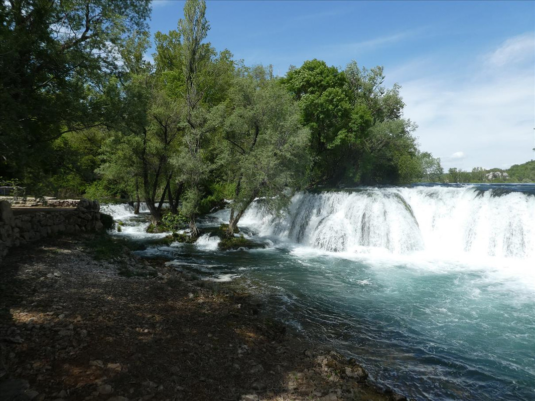 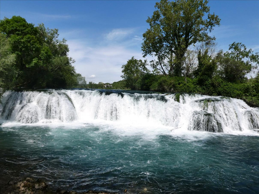 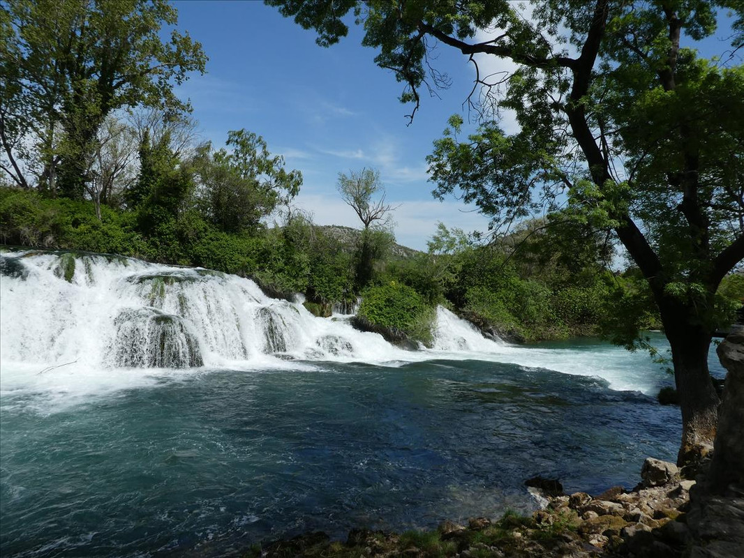 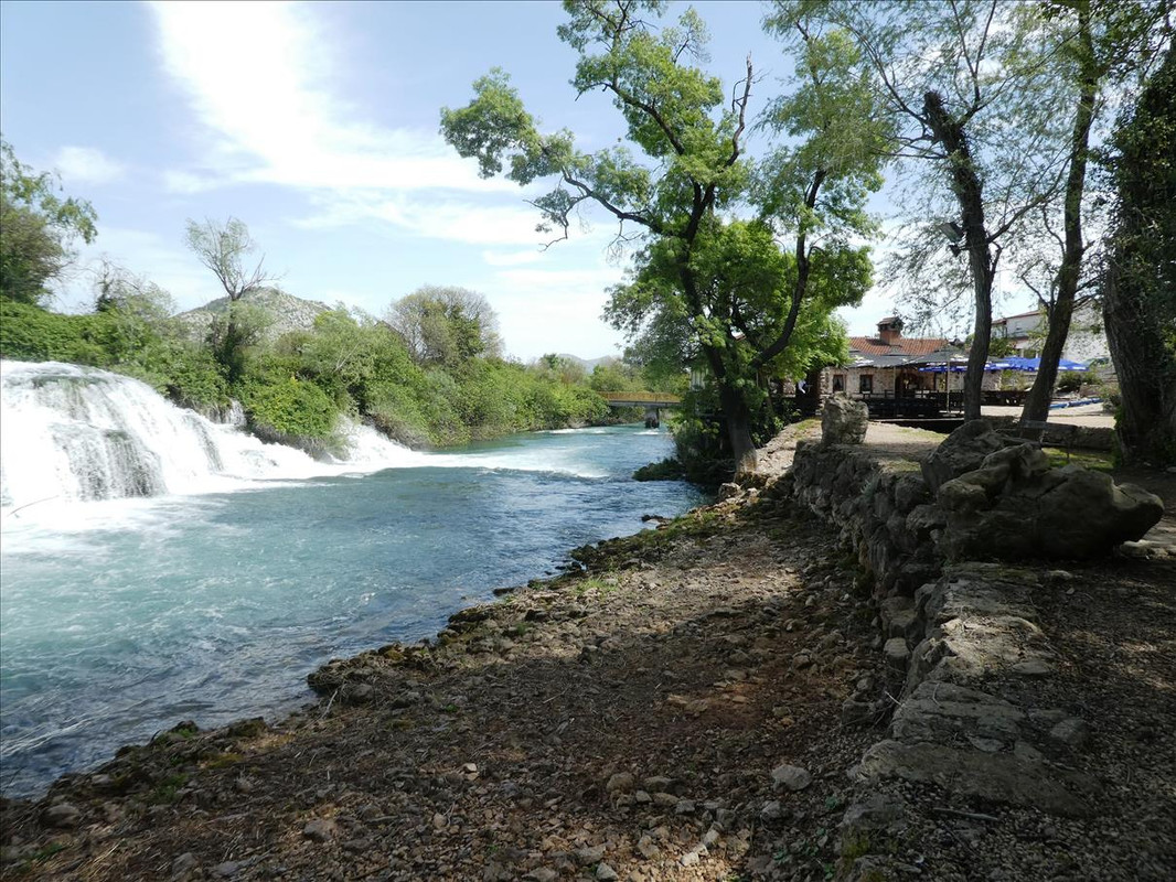  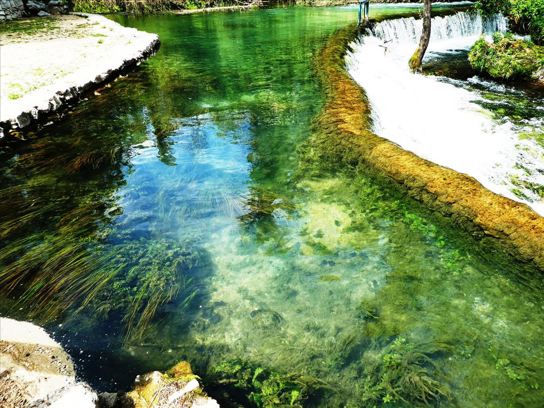 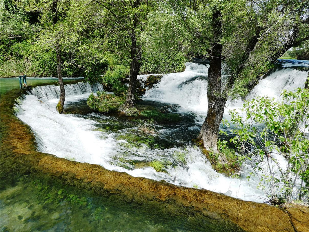 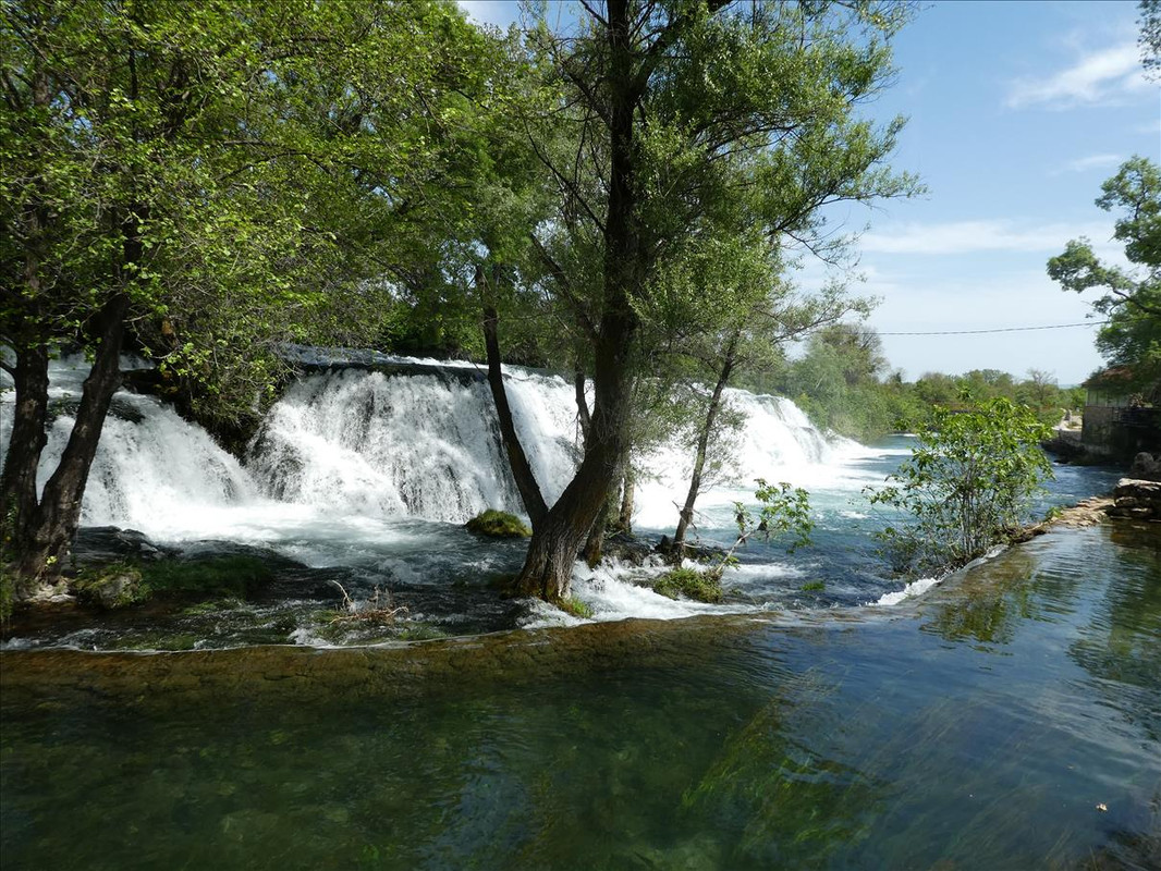 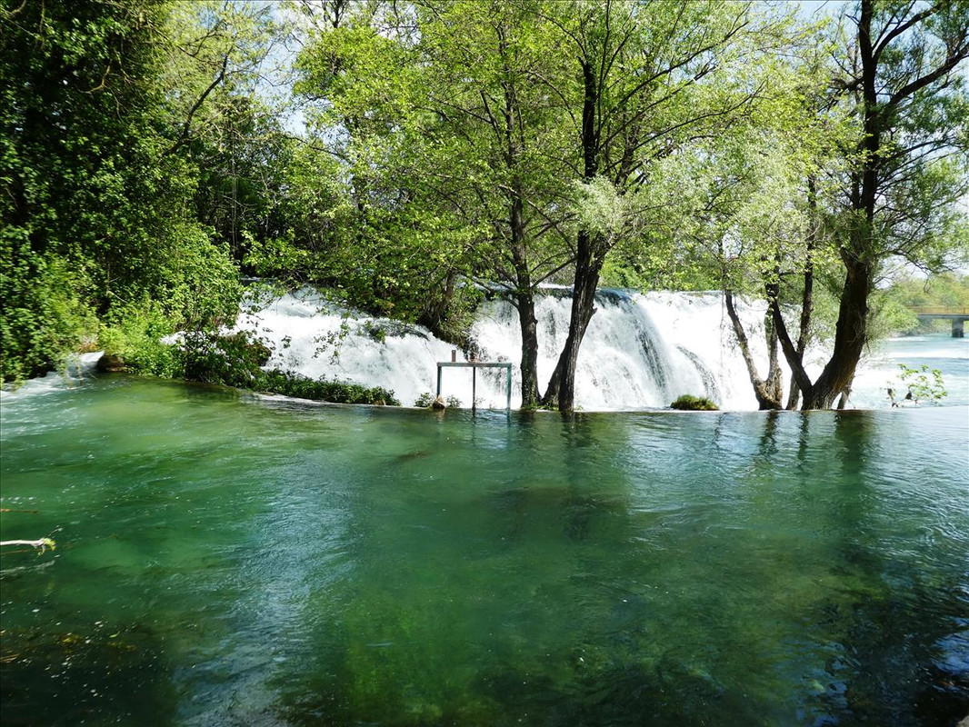 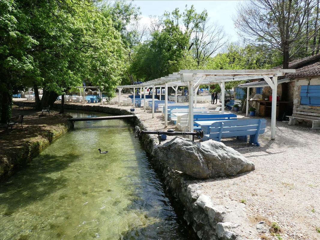 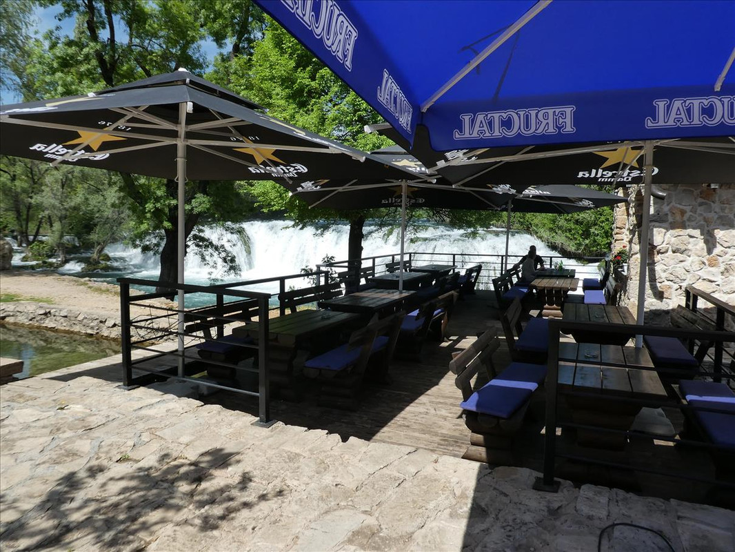 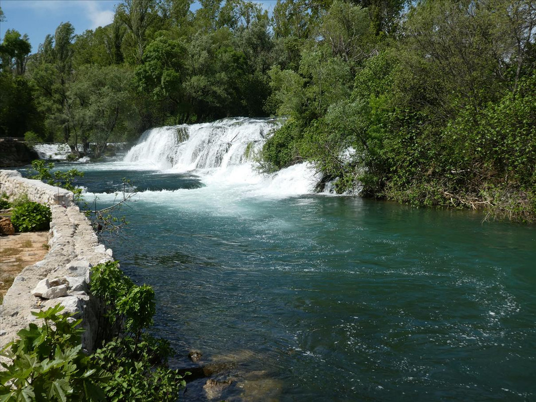 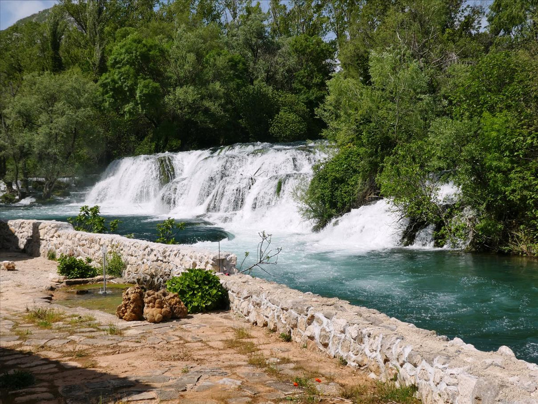 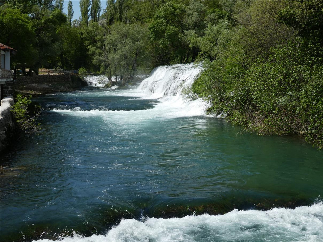 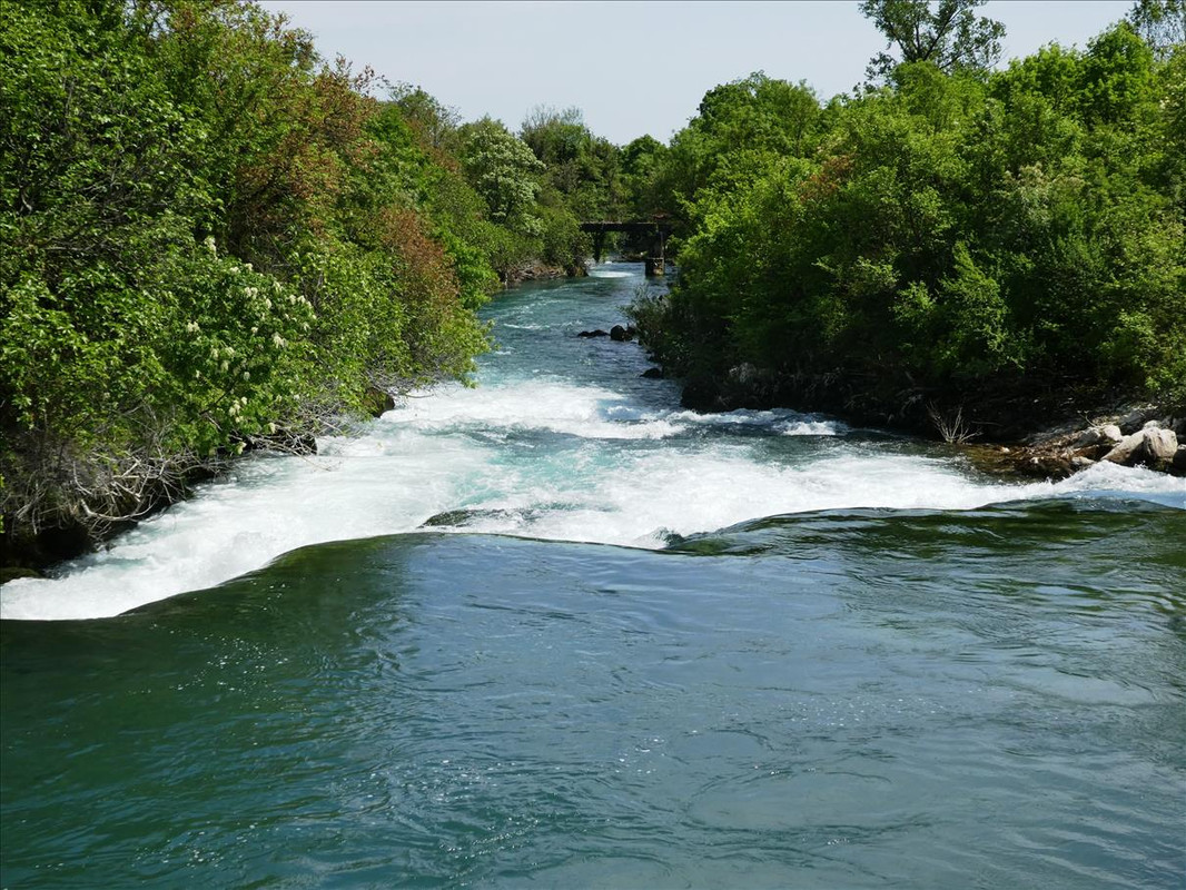 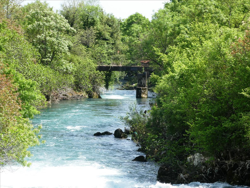 |
|
|
|
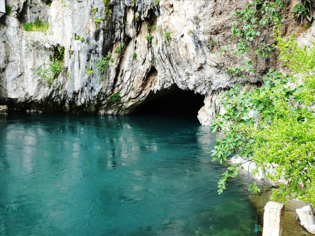
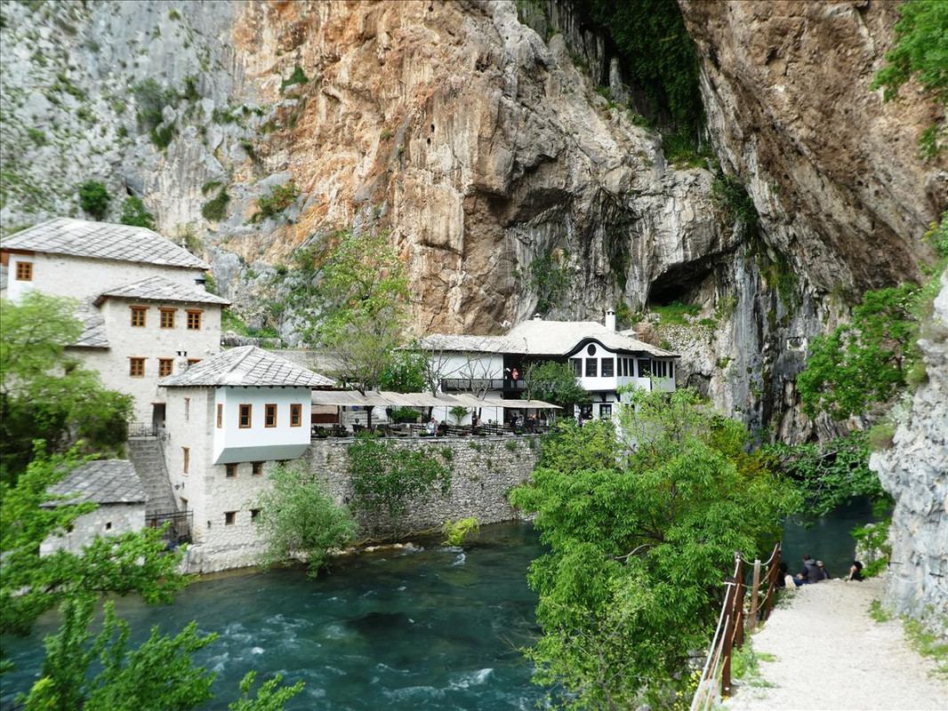
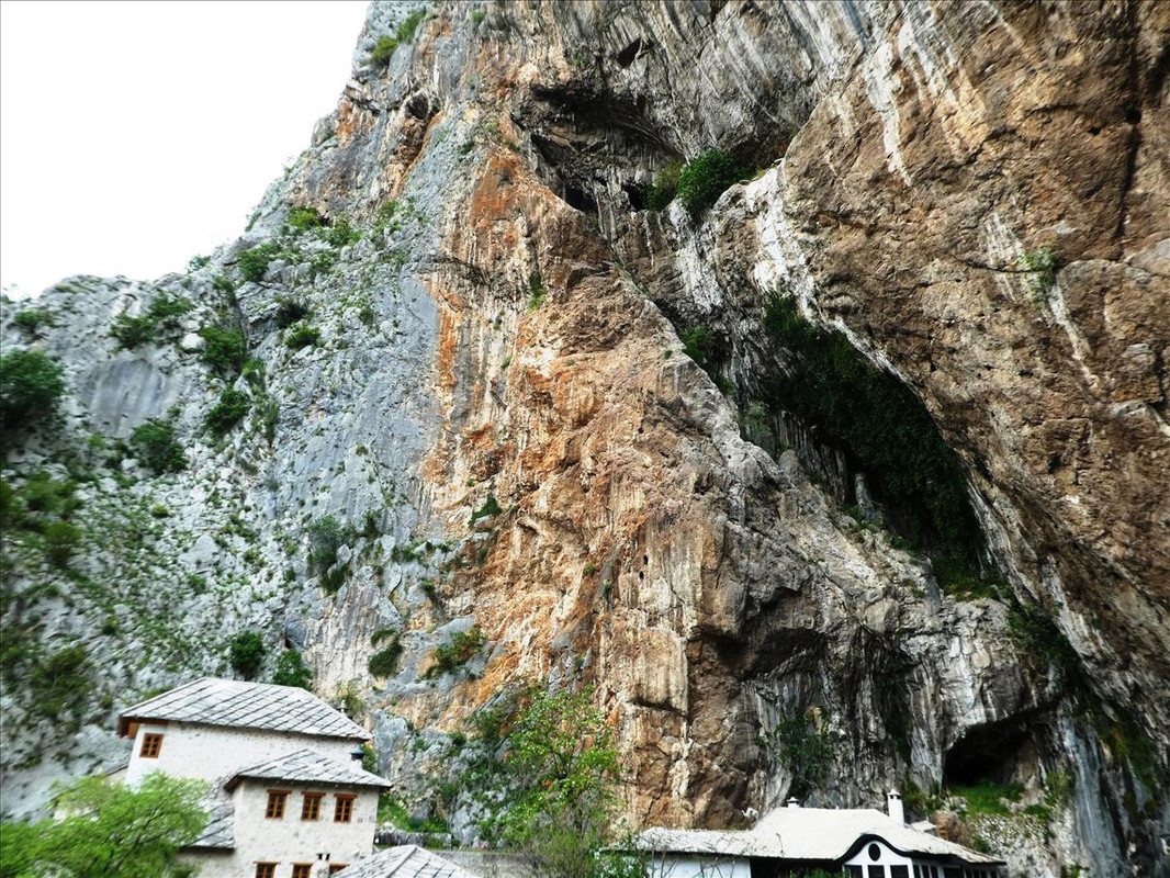
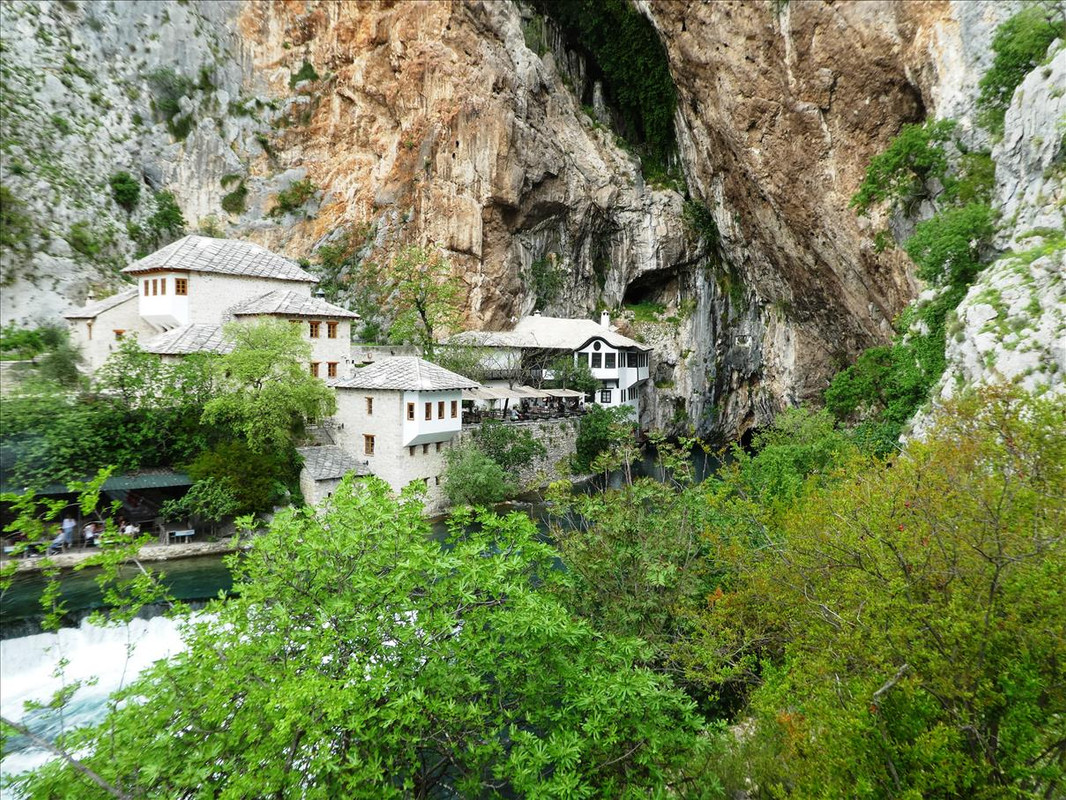
Post by OnlyMark on May 9, 2021 12:54:08 GMT 2
|
|
|
|
Post by Baz Faz on May 9, 2021 19:44:39 GMT 2
Like Sophie I was wondering about the lack of people. It is not just the lack of tourists but the houses don't seem inhabited.
|
|
|
|
Post by OnlyMark on May 9, 2021 21:20:25 GMT 2
With the village, many if not most went elsewhere during the Bosnian war and few have drifted back.
|
|
|
|
Post by Voy on May 9, 2021 23:34:02 GMT 2
Is this last, long but short waterfall area swimmable in summer? it looks heavenly
|
|
|
|
Post by OnlyMark on May 10, 2021 7:21:55 GMT 2
Yes it is.
|
|
|
|
Post by OnlyMark on May 10, 2021 7:24:09 GMT 2
|
|
|
|
Post by Baz Faz on May 10, 2021 12:16:04 GMT 2
Atmospheric photos as always.
I am struck by those houses nestling directly by the cliffs. The first house Mrs Faz and I owned in France was on a hillside. The lower part had been terraced for vines. Up behind our house it was wooded. At one end was a cliff that had been used as a quarry. One day part of the cliff broke off and boulders came crashing down and obliterated a cottage our neighbour was working on. One boulder the size of a small car stopped at his feet. Naturally his face was ashen when he came to tell us.
When we sold the property we mmade sure there were no cliffs above the new house.
|
|