

Post by OnlyMark on Jan 4, 2017 18:22:26 GMT 2
If you happen to speak Kololo you know that Mosi-oa-Tunya means "The smoke that thunders". If you don't then you may better know the place as Victoria Falls.
The falls form the border between Zambia and Zimbabwe as per the location on the following map –
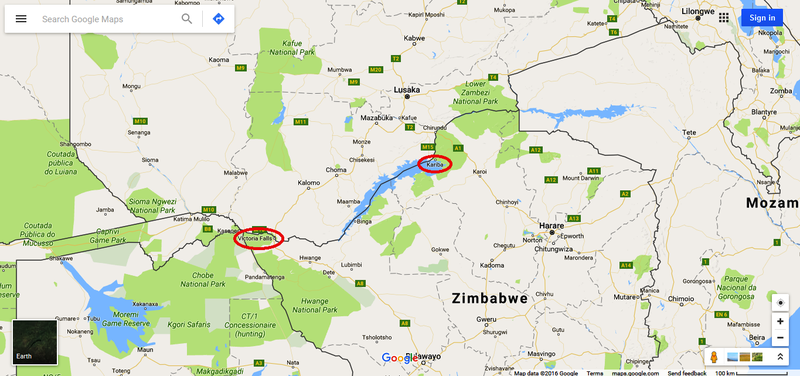
Not too far away you can also slip into Botswana or Namibia and the town itself on the Zambian side, called Livingstone, was at one time the capital of what was then Northern Rhodesia, now Zambia, until 1935 when due to the development of the copper industry further north, the capital of the country shifted to Lusaka. But that is a different story.
The town on the Zimbabwe side is unoriginally also called Victoria Falls.
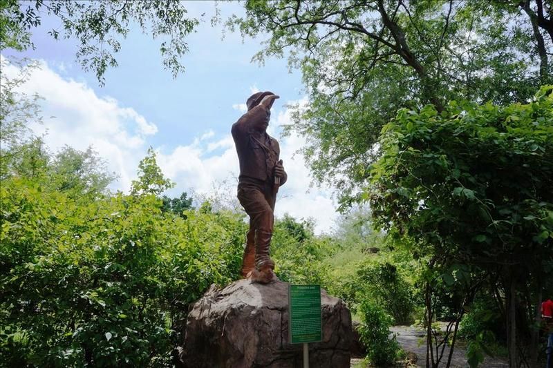
Few of you will not have heard of David Livingstone, the Scottish missionary and explorer, who is reputed to have been the first European to view the falls and due to his diaries and logs, we know it was on the 16th November 1855. He named the falls after Queen Victoria.
Before we go on I'd just mention that if you ever have the opportunity to visit here you'd be best finding accommodation on the Zimbabwe side as it is far better value and there are better facilities and standards than on the Zambian side. It is easy enough at this point to cross the border between the two towns and can view the falls from both ends/sides.
I've stayed on both sides and it is more enjoyable with a bigger and better choice of restaurants and places to stay in Victoria Falls town rather than Livingstone.
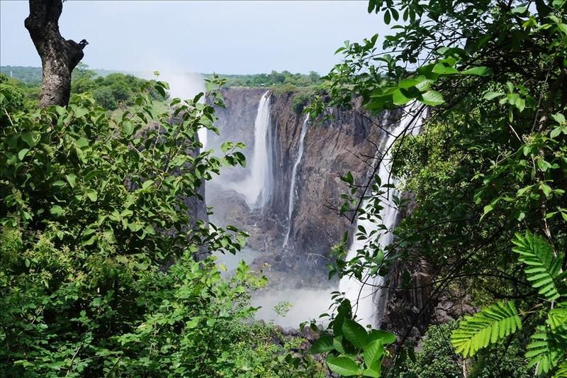
The falls themselves cannot claim the title of being the highest or widest but as these things go someone had to find what it is the best at, and if you combine the width and the height you end up with the largest sheet of falling water of any falls.
To put it in perspective, Niagara Falls is only half as high and Horseshoe Falls is well under half as wide.
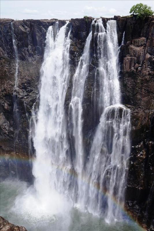
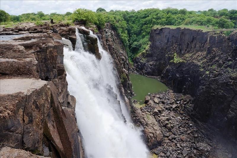
The figures are 1,708 metres wide and 108 metres high. In common language, it is 'big'. No matter how many photos you see (and you'll see some) it's not until you are there that you appreciate how large it is. I only had time to visit the Zambian side this time, so in fact my photos only show a bit less than half of it.
When it is in full flow the spray can reach 500m high and visible from 50km away – hence 'the smoke that thunders'. You can feel the vibrations through your feet as you get closer to it.
To appreciate the full power of the place you have to visit near the end of April when it is in full flood – but visibility can be a little restrictive due to the spray. The opposite time to visit is at the end of the dry season, so late November/early December(ish) before any early rains get chance to fill it up. At that time the flow rate is only about a tenth of the most flow time. You can then get the idea of what makes up the falls without the disadvantage of the reduced visibility. My photos are from about now when it's starting to 'fill up a bit' as I couldn't get down any earlier. Plus my daughters are over for the holidays and it was good to take them.
This is the guy who started it all off. Mr Livingstone. If it wasn't for him then nobody would be bungee jumping off the bridge today –
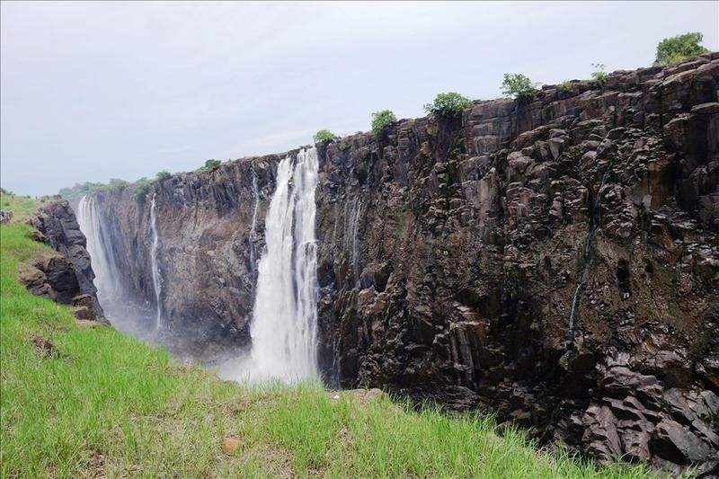
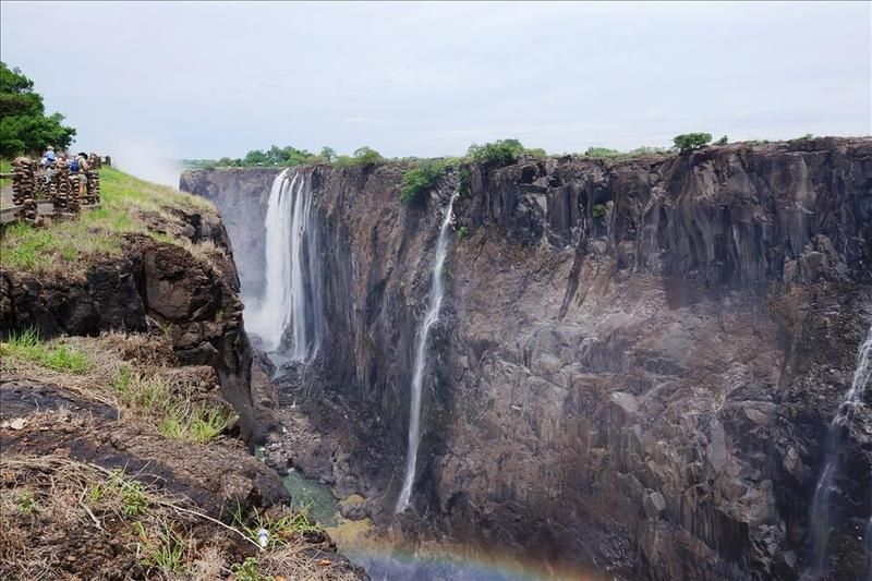
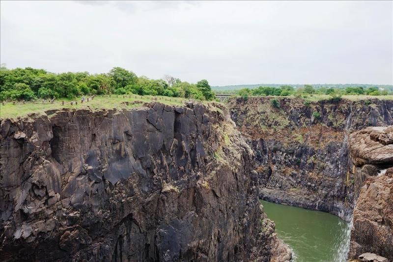
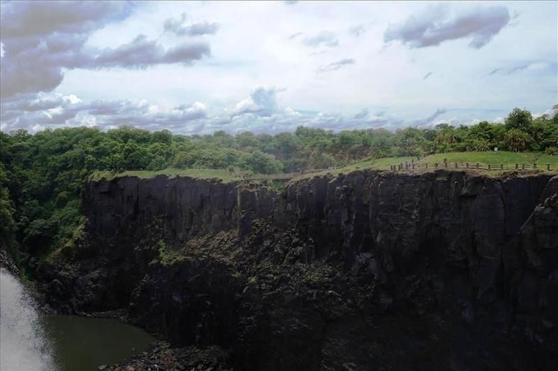
We'll start by having a walk along the left side for a while. There are some falls where the water drops off a cliff and then spreads out along the river below it. Not so here. The water, after dropping the 100m or so, is then corralled into a small opening and cuts a zig zag path through the rock.
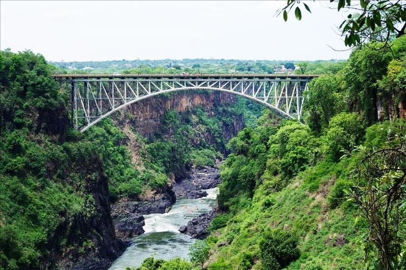
The bridge was constructed in England by the Cleveland Bridge & Engineering Company, before being shipped to the Mozambique port of Beira and then transported on the newly constructed railway to the Victoria Falls. It took just 14 months to construct and was completed in 1905. The story is that as they were about to connect the two ends up, the middle overlapped by one and a quarter inches. As it was the end of the day they all went home. The next morning it lined up perfectly and they hastily riveted it together.
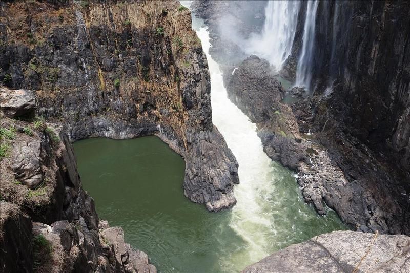
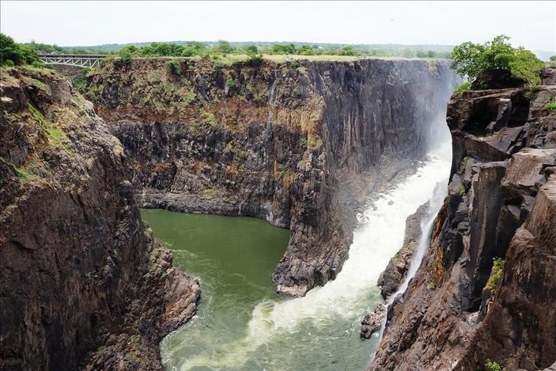
It connects the two countries and if you look closely you can see in the middle the bungee jumping station plus in the river, the white water rafters just starting off. Clearly seen is the gorge all the water has to flow through –
As regards bungee jumping, when I took groups there I was given the opportunity, because of bringing them business, to get a free jump. The only proviso was I had to do it naked.
Nope. Didn't do it, before you ask.
Having my tackle plummeting through the air, possibly into a river populated by crocodiles...... not appealing.
Further up the left hand side (and keep an eye on the right side for later) is a bridge connecting a headland. During times of high spray it is not unknown for tourists to take shampoo and soap and have a shower there.
Nope, didn't do that either –
Just looking back over my right shoulder to the Zambian end –
Continuing on –
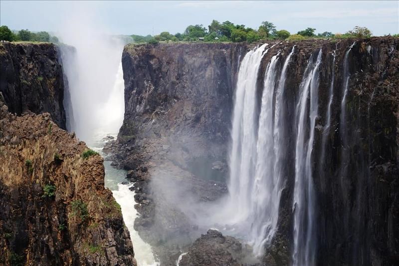
This is where the two sides meet and flow off to the left –

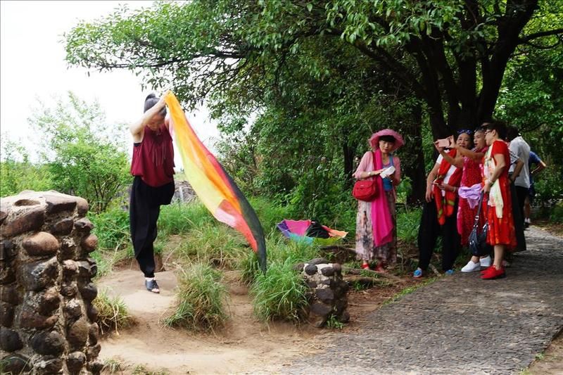
They all took turns striking a pose to have their photos taken with the falls in the background –
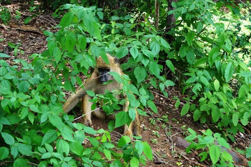
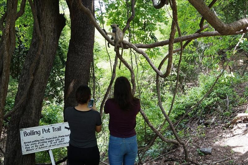
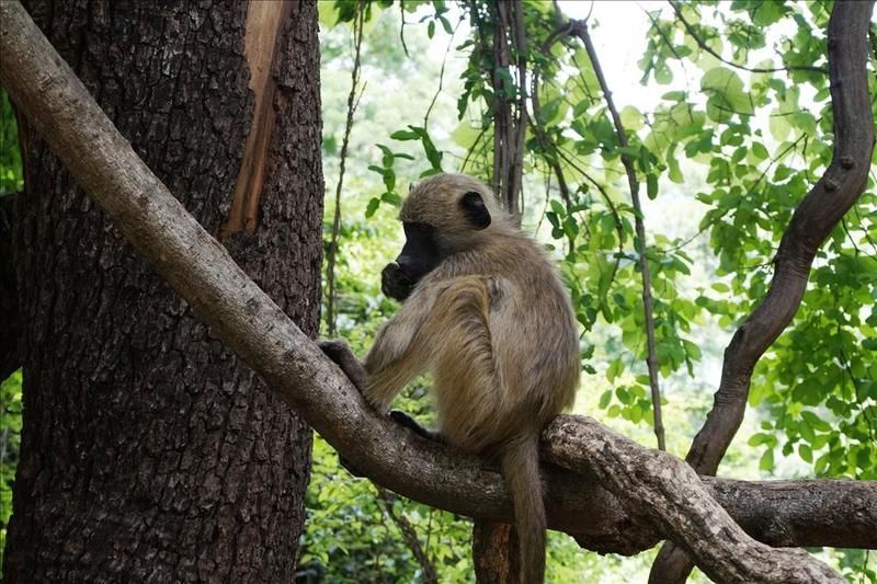
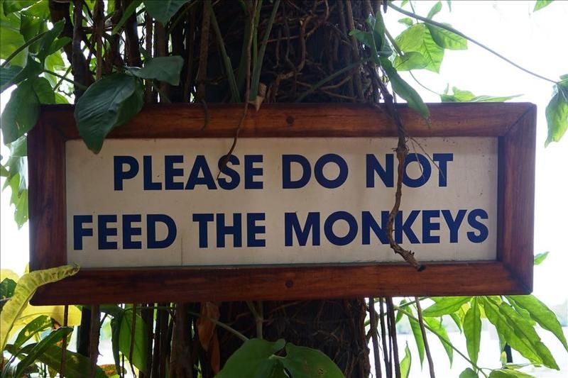
Beware of the wildlife. They are not averse to snatching your camera away and hassling you for food –
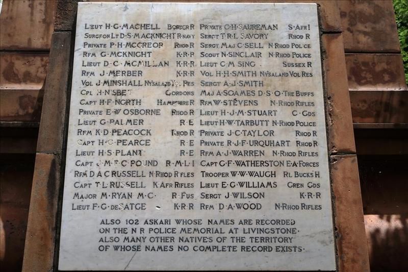
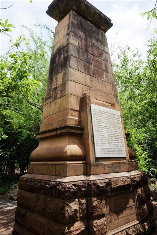
There is also a memorial to the fallen of WWI –
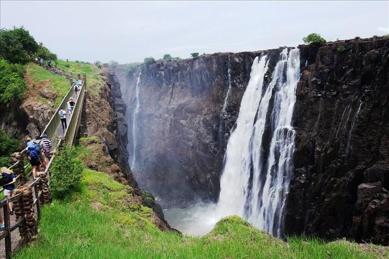
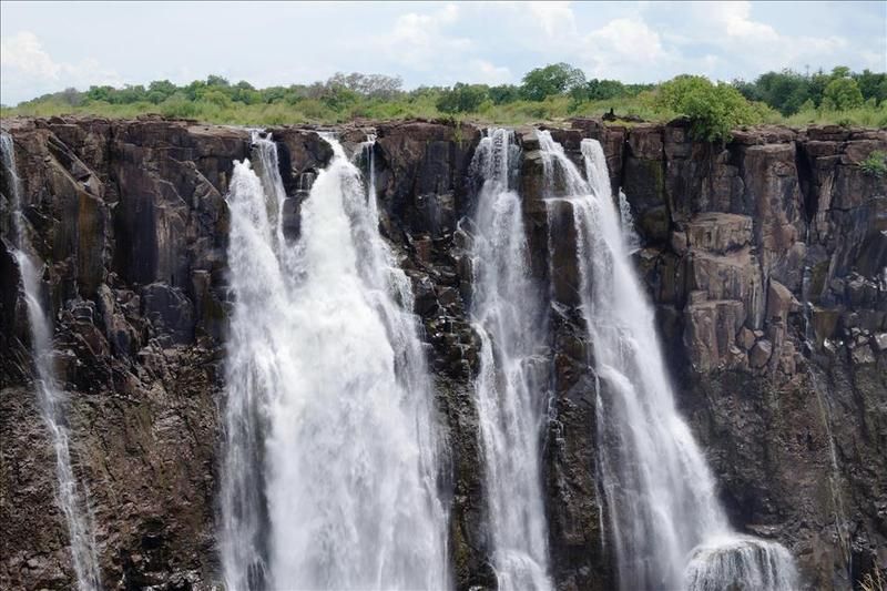
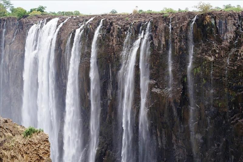
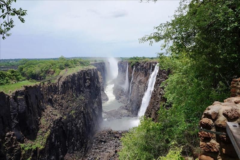
Ahh, that's a bit better view. Two thirds of the length of the falls, the railway bridge far left and the foot bridge closer left –
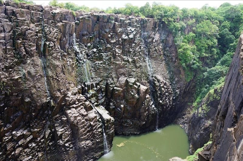
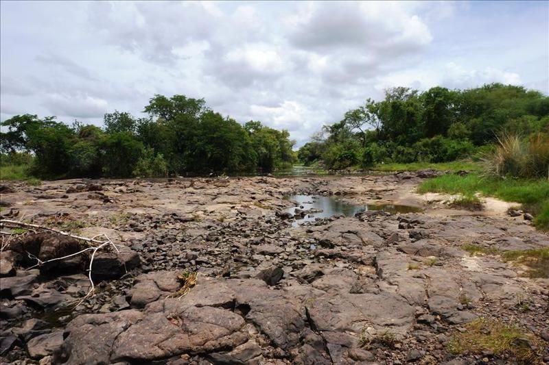
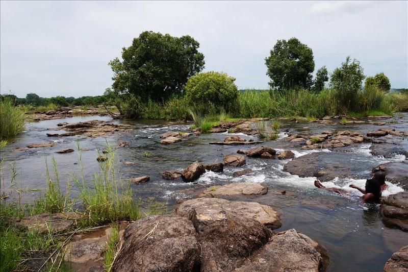
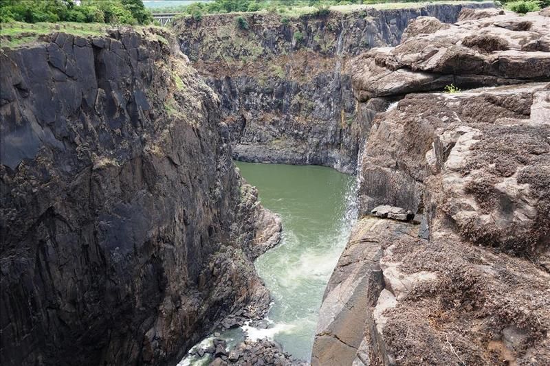
As is my want, I like to go somewhere a bit off the tourist track. So, without permission, I had a walk over on the right hand side to the right hand edge of the falls. Seen as mentioned from the other side.
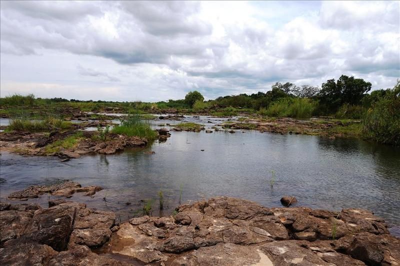
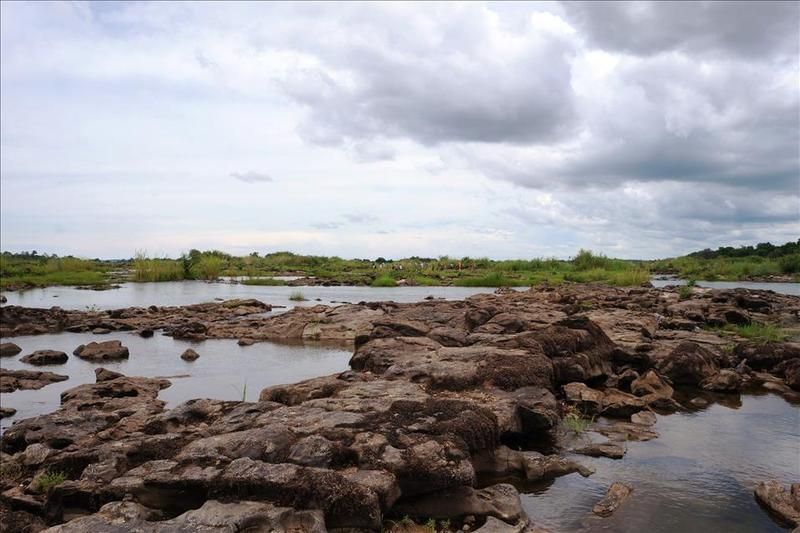
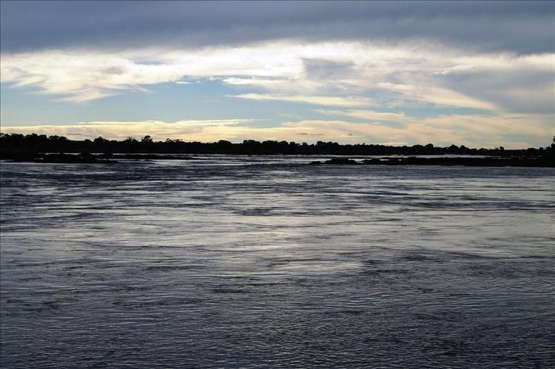
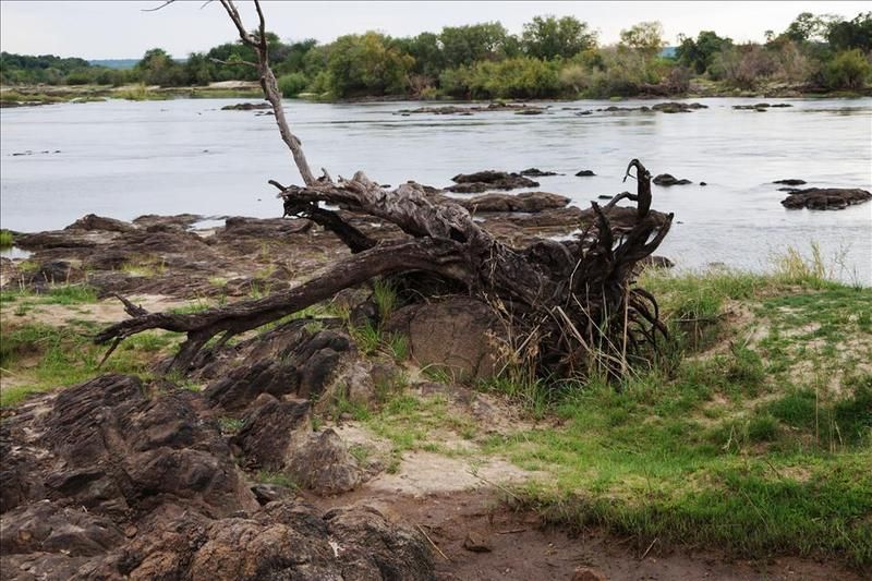
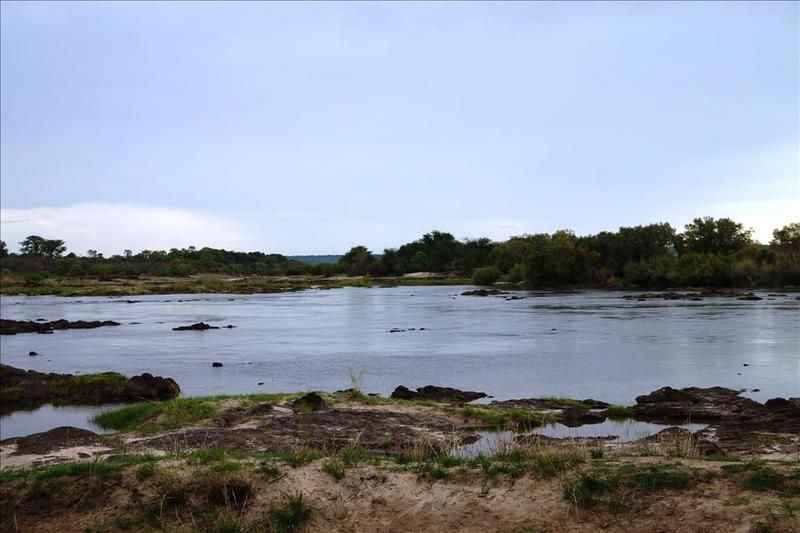
I confess it is not so unusual a thing to do at low water. I'm far from the first and others were there when I was. So upstream at this point there is little water and at times a bit of a wade and a scramble –
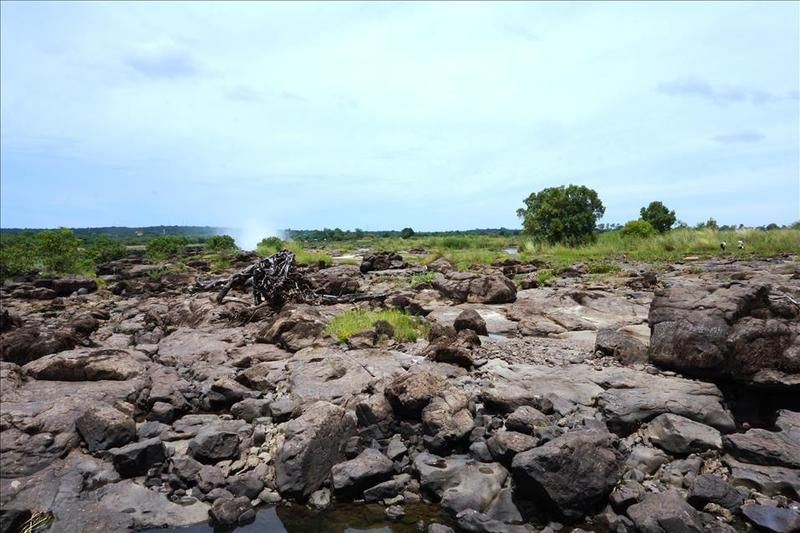
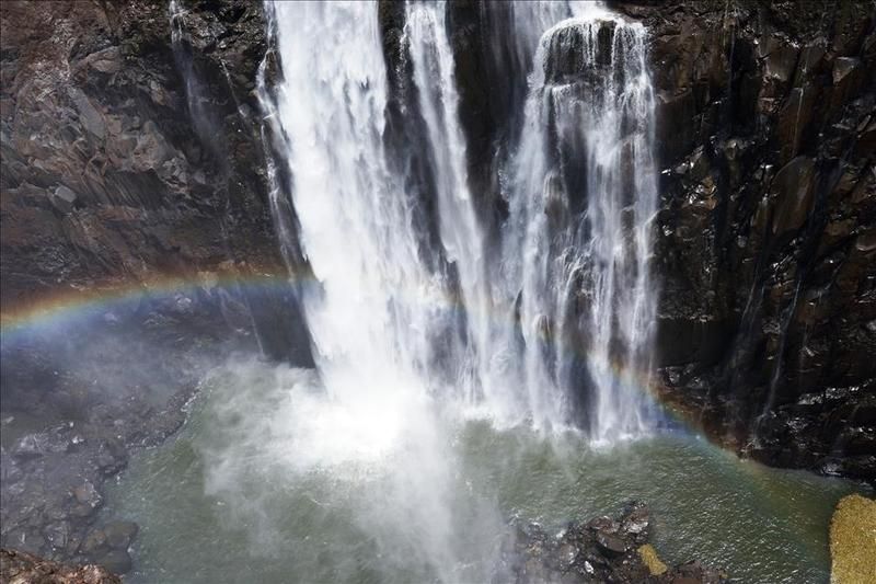
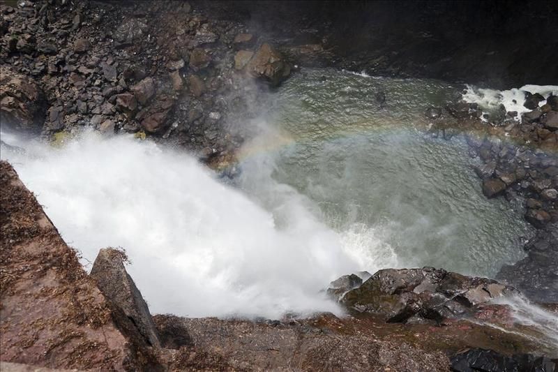
A closer view of the edge seen from the other side initially –
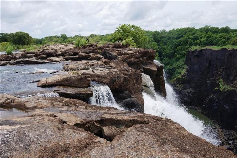

When I go again, which no doubt I will, I'll move further along but for now, that is as far as I got.
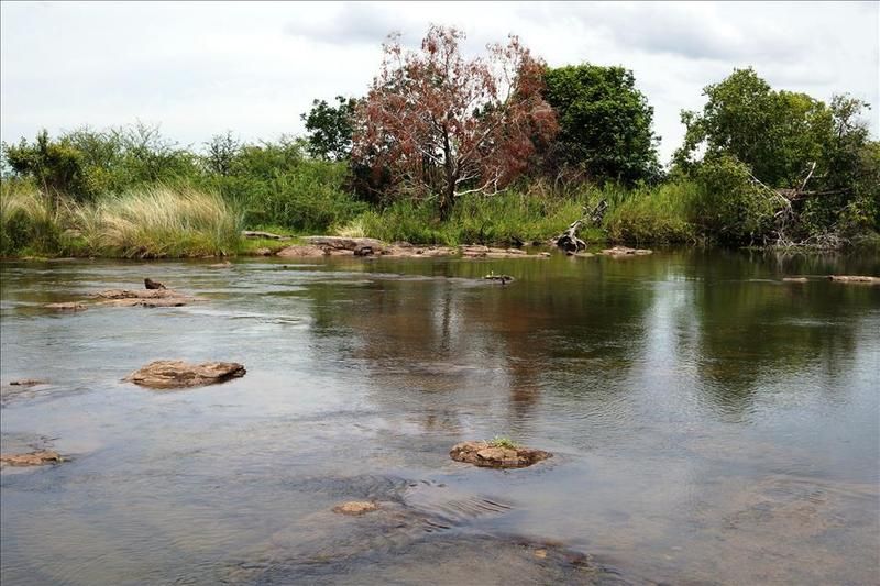
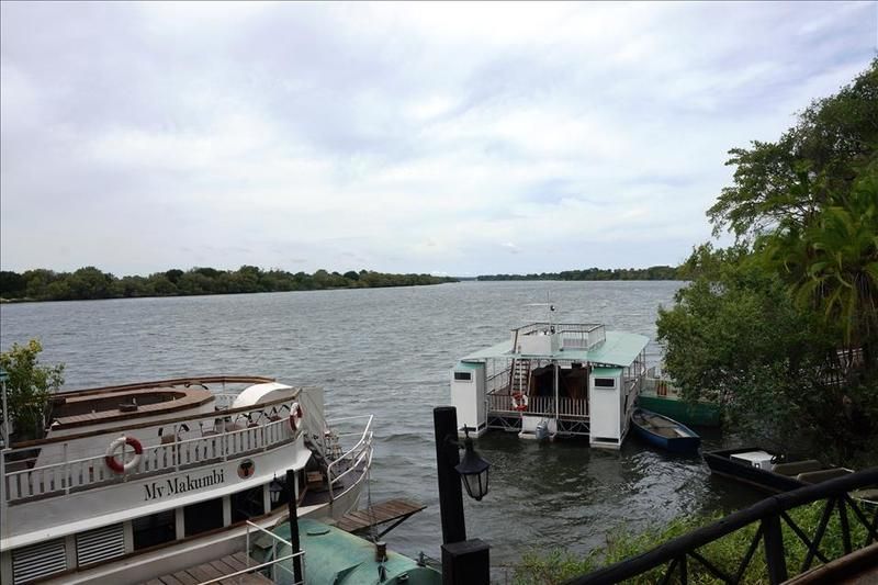
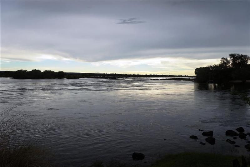
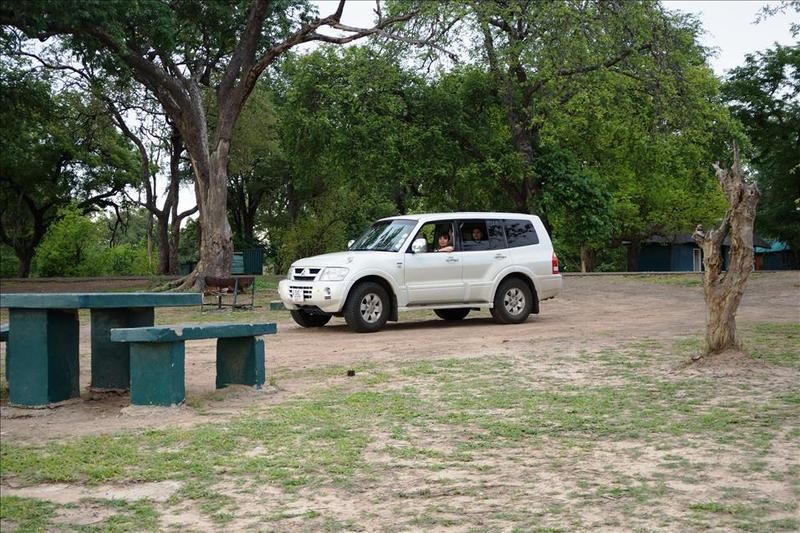
In order to recover from our adventures we nipped to a relaxed lodge on the banks of the river for a late lunch –
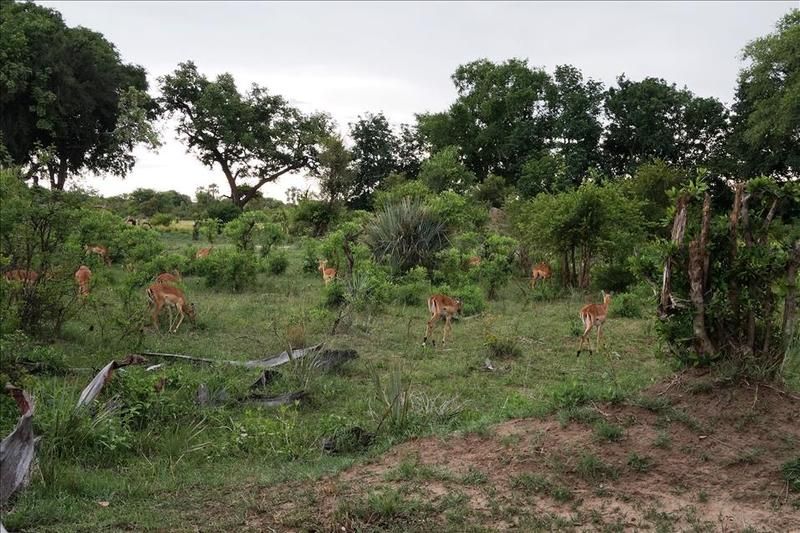
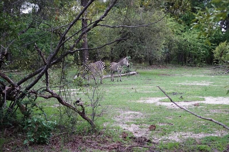
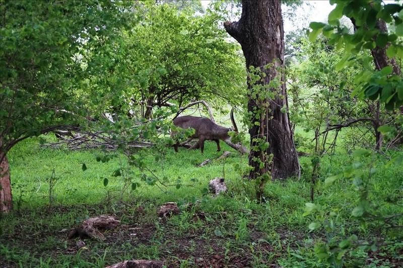
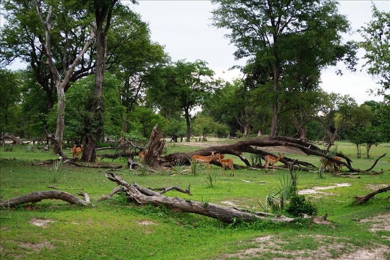
Saw some game –
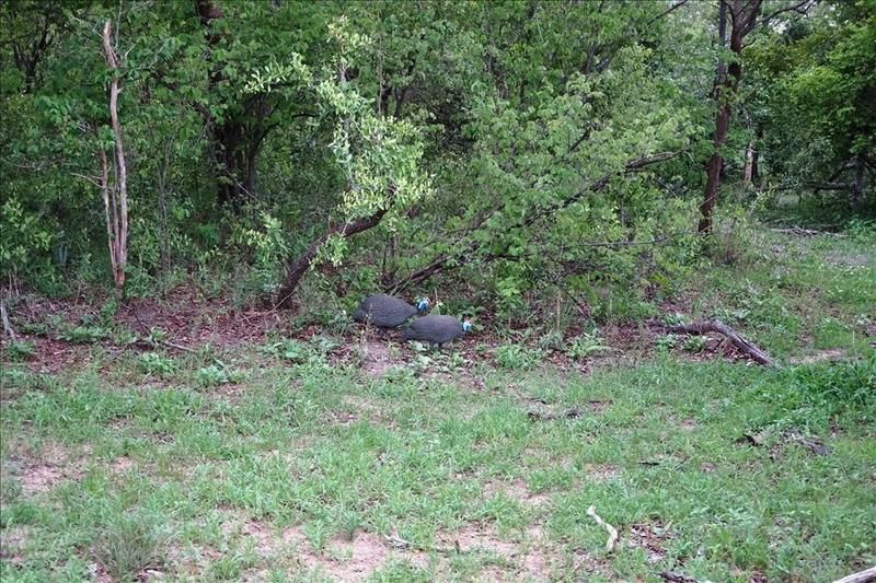
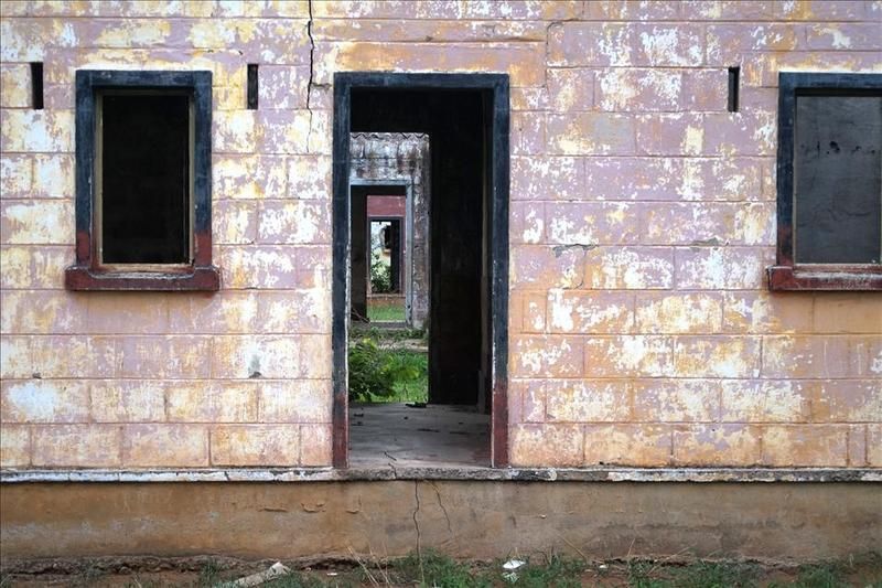
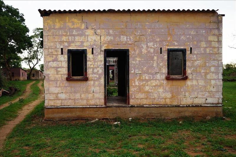
Talking of game, near the falls is a small game park. There are no predators but it makes for a gentle and easy drive round for a couple of hours for those times up until going back to the hotel for a shower and getting ready for dinner. We saw the usual stuff. The daughters liked it to see these in the wild rather than in zoo or pictures. If you can make them out. There were also buildings from the era when people did actually live here –
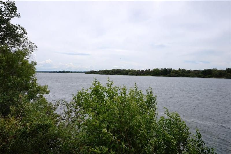
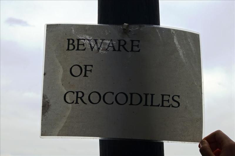
It was running along the banks of the river upstream from the falls and made for a pleasant spot. There were signs saying not to get close to the water because of the hippos and crocs. As usual I seem to have ignored them (I really will get into trouble one day) but I had good guards and spotters –
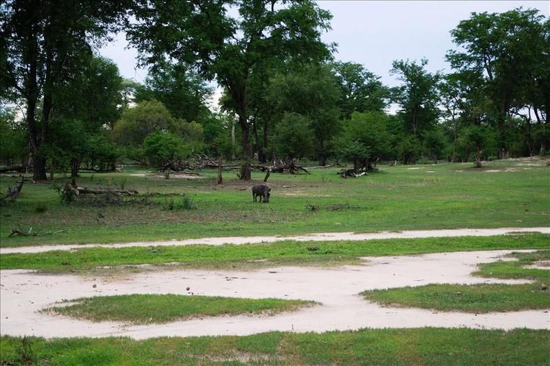
Pumba!!!
More another time.
The falls form the border between Zambia and Zimbabwe as per the location on the following map –
Not too far away you can also slip into Botswana or Namibia and the town itself on the Zambian side, called Livingstone, was at one time the capital of what was then Northern Rhodesia, now Zambia, until 1935 when due to the development of the copper industry further north, the capital of the country shifted to Lusaka. But that is a different story.
The town on the Zimbabwe side is unoriginally also called Victoria Falls.
Few of you will not have heard of David Livingstone, the Scottish missionary and explorer, who is reputed to have been the first European to view the falls and due to his diaries and logs, we know it was on the 16th November 1855. He named the falls after Queen Victoria.
Before we go on I'd just mention that if you ever have the opportunity to visit here you'd be best finding accommodation on the Zimbabwe side as it is far better value and there are better facilities and standards than on the Zambian side. It is easy enough at this point to cross the border between the two towns and can view the falls from both ends/sides.
I've stayed on both sides and it is more enjoyable with a bigger and better choice of restaurants and places to stay in Victoria Falls town rather than Livingstone.
The falls themselves cannot claim the title of being the highest or widest but as these things go someone had to find what it is the best at, and if you combine the width and the height you end up with the largest sheet of falling water of any falls.
To put it in perspective, Niagara Falls is only half as high and Horseshoe Falls is well under half as wide.
The figures are 1,708 metres wide and 108 metres high. In common language, it is 'big'. No matter how many photos you see (and you'll see some) it's not until you are there that you appreciate how large it is. I only had time to visit the Zambian side this time, so in fact my photos only show a bit less than half of it.
When it is in full flow the spray can reach 500m high and visible from 50km away – hence 'the smoke that thunders'. You can feel the vibrations through your feet as you get closer to it.
To appreciate the full power of the place you have to visit near the end of April when it is in full flood – but visibility can be a little restrictive due to the spray. The opposite time to visit is at the end of the dry season, so late November/early December(ish) before any early rains get chance to fill it up. At that time the flow rate is only about a tenth of the most flow time. You can then get the idea of what makes up the falls without the disadvantage of the reduced visibility. My photos are from about now when it's starting to 'fill up a bit' as I couldn't get down any earlier. Plus my daughters are over for the holidays and it was good to take them.
This is the guy who started it all off. Mr Livingstone. If it wasn't for him then nobody would be bungee jumping off the bridge today –
We'll start by having a walk along the left side for a while. There are some falls where the water drops off a cliff and then spreads out along the river below it. Not so here. The water, after dropping the 100m or so, is then corralled into a small opening and cuts a zig zag path through the rock.
The bridge was constructed in England by the Cleveland Bridge & Engineering Company, before being shipped to the Mozambique port of Beira and then transported on the newly constructed railway to the Victoria Falls. It took just 14 months to construct and was completed in 1905. The story is that as they were about to connect the two ends up, the middle overlapped by one and a quarter inches. As it was the end of the day they all went home. The next morning it lined up perfectly and they hastily riveted it together.
It connects the two countries and if you look closely you can see in the middle the bungee jumping station plus in the river, the white water rafters just starting off. Clearly seen is the gorge all the water has to flow through –
As regards bungee jumping, when I took groups there I was given the opportunity, because of bringing them business, to get a free jump. The only proviso was I had to do it naked.
Nope. Didn't do it, before you ask.
Having my tackle plummeting through the air, possibly into a river populated by crocodiles...... not appealing.
Further up the left hand side (and keep an eye on the right side for later) is a bridge connecting a headland. During times of high spray it is not unknown for tourists to take shampoo and soap and have a shower there.
Nope, didn't do that either –
Just looking back over my right shoulder to the Zambian end –
Continuing on –
This is where the two sides meet and flow off to the left –
They all took turns striking a pose to have their photos taken with the falls in the background –
Beware of the wildlife. They are not averse to snatching your camera away and hassling you for food –
There is also a memorial to the fallen of WWI –
Ahh, that's a bit better view. Two thirds of the length of the falls, the railway bridge far left and the foot bridge closer left –
As is my want, I like to go somewhere a bit off the tourist track. So, without permission, I had a walk over on the right hand side to the right hand edge of the falls. Seen as mentioned from the other side.
I confess it is not so unusual a thing to do at low water. I'm far from the first and others were there when I was. So upstream at this point there is little water and at times a bit of a wade and a scramble –
A closer view of the edge seen from the other side initially –
When I go again, which no doubt I will, I'll move further along but for now, that is as far as I got.
In order to recover from our adventures we nipped to a relaxed lodge on the banks of the river for a late lunch –
Saw some game –
Talking of game, near the falls is a small game park. There are no predators but it makes for a gentle and easy drive round for a couple of hours for those times up until going back to the hotel for a shower and getting ready for dinner. We saw the usual stuff. The daughters liked it to see these in the wild rather than in zoo or pictures. If you can make them out. There were also buildings from the era when people did actually live here –
It was running along the banks of the river upstream from the falls and made for a pleasant spot. There were signs saying not to get close to the water because of the hippos and crocs. As usual I seem to have ignored them (I really will get into trouble one day) but I had good guards and spotters –
Pumba!!!
More another time.


